File:Clear_Creek_Management_Area.jpg
维基百科,自由的 encyclopedia
此为最大尺寸。
Clear_Creek_Management_Area.jpg (226 × 167像素,文件大小:32 KB,MIME类型:image/jpeg)
摘要
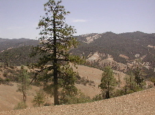
| 描述Clear Creek Management Area.jpg |
English: The Diablo Range in the vicinity of San Benito Mountain, California, USA |
| 来源 | From [1]. Image located at [2]. BLM image. |
| 作者 | United States Bureau of Land Management |
许可协议
| Public domainPublic domainfalsefalse |
| This image is a work of a Bureau of Land Management* employee, taken or made as part of that person's official duties. As a work of the U.S. federal government, the image is in the public domain in the United States. *or predecessor organization |
原始上传日志
The original description page was here. All following user names refer to en.wikipedia.
- 2006-01-29 02:48 Scott Burley 226×168× (34556 bytes) From [http://www.ca.blm.gov/hollister/index.html]. Image located at [http://www.ca.blm.gov/images/hollister_images/a_ccma.jpg]. BLM image.
说明
添加一行文字以描述该文件所表现的内容
此文件中描述的项目
描绘内容
image/jpeg
数据大小 简体中文(已转写)
32,913 字节
167 像素
226 像素
文件历史
点击某个日期/时间查看对应时刻的文件。
| 日期/时间 | 缩略图 | 大小 | 用户 | 备注 | |
|---|---|---|---|---|---|
| 当前 | 2019年5月19日 (日) 20:30 | | 226 × 167(32 KB) | SelfieCity | Cropped 1 % vertically using CropTool with precise mode. Removing black line across the bottom of the image |
| 2008年10月24日 (五) 12:39 |  | 226 × 168(34 KB) | BotMultichill | {{BotMoveToCommons|en.wikipedia}} {{Information |Description={{en|From [http://www.ca.blm.gov/hollister/index.html]. Image located at [http://www.ca.blm.gov/images/hollister_images/a_ccma.jpg]. BLM image. [[:en:nl:Afbeelding:Clear Creek Management Ar |
文件用途
以下页面使用本文件:
全域文件用途
以下其他wiki使用此文件:
- arz.wikipedia.org上的用途
- ceb.wikipedia.org上的用途
- de.wikipedia.org上的用途
- en.wikivoyage.org上的用途
- lld.wikipedia.org上的用途
- nl.wikipedia.org上的用途
- pt.wikipedia.org上的用途
- www.wikidata.org上的用途
元数据
此文件中包含有扩展的信息。这些信息可能是由数码相机或扫描仪在创建或数字化过程中所添加。
如果此文件的源文件已经被修改,一些信息在修改后的文件中将不能完全反映出来。
| JPEG文件备注 | LEAD Technologies Inc. V1.01 |
|---|