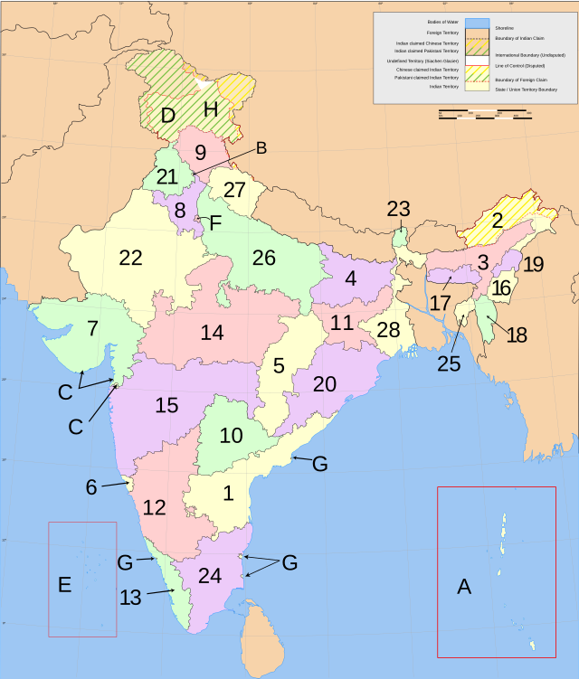
India je apapo isokan awon ipinle[1] to ni awon ipinle mejidinlogbon ati awon agbegbe isokan meje. Bakanna awon ipinle ati awon agbegbe je pinpinsabe pinpinsabe si adugbo.[1]
Akojo awon ipinle ati agbegbe

States:
Union Territories:
 |
Àyọkà yìí tàbí apá rẹ̀ únfẹ́ àtúnṣe sí. Ẹ le fẹ̀ jù báyìí lọ tàbí kí ẹ ṣàtúnṣe rẹ̀ lọ́nà tí yíò mu kúnrẹ́rẹ́. Ẹ ran Wikipedia lọ́wọ́ láti fẹ̀ẹ́ jù báyìí lọ. |
Itokasi
Wikiwand in your browser!
Seamless Wikipedia browsing. On steroids.
Every time you click a link to Wikipedia, Wiktionary or Wikiquote in your browser's search results, it will show the modern Wikiwand interface.
Wikiwand extension is a five stars, simple, with minimum permission required to keep your browsing private, safe and transparent.