فائل:Greater_london_outline_map_bw.png
From Wikipedia, the free encyclopedia
اس سے زیادہ ریزولیوشن دستیاب نہیں۔
Greater_london_outline_map_bw.png (600 × 500 پکسل، فائل کا حجم: 199 کلوبائٹ، MIME قسم: image/png)
یہ فائل ویکی ذخائر کی ہے اور دیگر منصوبوں کے زیر استعمال ہوسکتی ہے۔ فائل کے صفحہ تعارف پر موجود تعارف ذیل میں موجود ہے۔

|
File:Greater London UK location map 2.svg is a vector version of this file. It should be used in place of this PNG file when not inferior.
File:Greater london outline map bw.png → File:Greater London UK location map 2.svg
For more information, see Help:SVG.
|
 |
خلاصہ
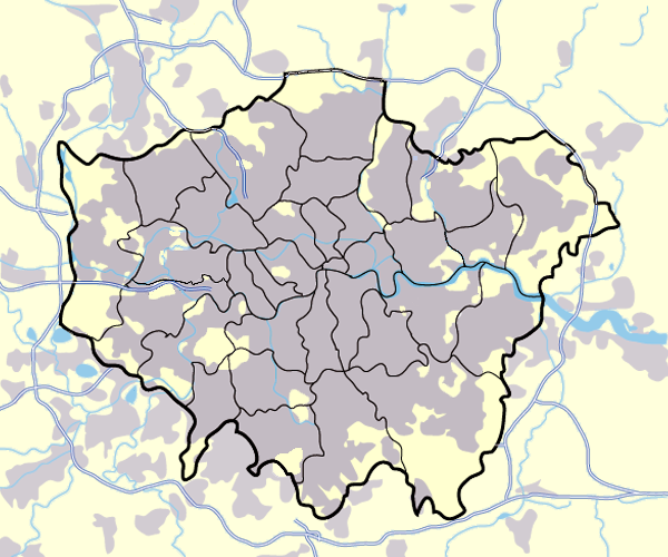
Image:Greater_london_outline_map.png showing built up areas in grey, motorways in blue, water-bodies in light-blue and London borough and county boundaries in black.
Based on a map originally by User:ChrisO.
Revised to correct motorways. DavidCane 19:42, 31 March 2007 (UTC)
اجازہ کاری

|
آپ کو آزاد سافٹ ویئر فاؤنڈیشن کی جانب سے شائع کردہ جی این یو آزاد مسوداتی اجازت نامہ کی شرائط استعمال کے تحت اس دستاویز کو نقل، تقسیم اور/ یا ترمیم کرنے کی اجازت دی جاتی ہے۔ اس اجازت نامہ کی ایک نقل 'جی این یو آزاد مسوداتی اجازت نامہ کے عنوان سے میسر ہے۔http://www.gnu.org/copyleft/fdl.htmlGFDLGNU Free Documentation Licensetruetrue |
| اس ملف کا لائسنس Creative Commons Attribution-Share Alike 3.0 Unported کے تحط ہے۔ | ||
| ||
| This licensing tag was added to this file as part of the GFDL licensing update.http://creativecommons.org/licenses/by-sa/3.0/CC BY-SA 3.0Creative Commons Attribution-Share Alike 3.0truetrue |
| Annotations InfoField | This image is annotated: View the annotations at Commons |
284
237
8
8
600
500
Dort liegt der Covent Garden
Captions
Add a one-line explanation of what this file represents
Items portrayed in this file
عکاسی
فائل کا تاریخچہ
کسی خاص وقت یا تاریخ میں یہ فائل کیسی نظر آتی تھی، اسے دیکھنے کے لیے اس وقت/تاریخ پر کلک کریں۔
| تاریخ/وقت | تھمب نیل | ابعاد | صارف | تبصرہ | |
|---|---|---|---|---|---|
| رائج الوقت | 17:13، 11 مارچ 2008ء | | 600 × 500 (199 کلوبائٹ) | Jza84 | slight alteration making the boundaries clearer between Newham and Barking and Dagenham - Ealing and Hounslow - and City of London and the City of Westminster |
| 19:40، 31 مارچ 2007ء |  | 600 × 500 (217 کلوبائٹ) | DavidCane | ||
| 14:33، 19 مارچ 2007ء |  | 600 × 500 (512 کلوبائٹ) | Jza84 | minor colour correction | |
| 14:30، 19 مارچ 2007ء |  | 600 × 500 (512 کلوبائٹ) | Jza84 | yellowed white backdrop and altered blue of water bodies inline with UK mapping | |
| 11:16، 15 مارچ 2007ء |  | 600 × 500 (552 کلوبائٹ) | Jza84 | Corrected some issues with Motorways and borough boundaries. | |
| 19:22، 25 فروری 2007ء |  | 600 × 500 (476 کلوبائٹ) | Jza84 | Map of Greater London and area. Self made and released to public domain. | |
| 18:09، 18 نومبر 2006ء |  | 600 × 500 (21 کلوبائٹ) | Dtcdthingy~commonswiki | Image:Greater_london_outline_map.png with toned down colour scheme. Originally by User:ChrisO. |
روابط
درج ذیل صفحہ اس فائل کو استعمال کر رہا ہے:
فائل کا عالمی استعمال
مندرجہ ذیل ویکیوں میں یہ فائل زیر استعمال ہے:
- ast.wikipedia.org پر استعمال
- be.wikipedia.org پر استعمال
- bg.wikipedia.org پر استعمال
- ca.wikipedia.org پر استعمال
- da.wikipedia.org پر استعمال
- EFL League Championship
- Brugerdiskussion:Lindberg
- Westminster
- Charing Cross
- Skabelon:Kortpositioner Greater London
- Seven Sisters
- Tottenham
- Premier League
- Chelsea (London)
- Premier League 2013-14
- Premier League 2014-15
- Premier League 2015-16
- Attentatet i Finsbury Park 2017
- Premier League 2016-17
- The Football League 1927-28
- The Football League 1928-29
- The Football League 1929-30
- The Football League 1930-31
- The Football League 1931-32
- The Football League 1932-33
- de.wikipedia.org پر استعمال
- en.wikipedia.org پر استعمال
- en.wikinews.org پر استعمال
- eo.wikipedia.org پر استعمال
- es.wikipedia.org پر استعمال
- eu.wikipedia.org پر استعمال
- fa.wikipedia.org پر استعمال
- fr.wikipedia.org پر استعمال
- gu.wikipedia.org پر استعمال
- hy.wikipedia.org پر استعمال
اس فائل کا مزید عالمی استعمال دیکھیے۔