File:Algeria-Tlemcen.png
From Wikipedia, the free encyclopedia
Xifaniso lexi axikuriseki kuhundza laha.
Algeria-Tlemcen.png (200 × 195 ku anama na leha hi ti phikisele, Vukulu bya fayili: 5 KB, muxaka waMIME: image/png)
Fayili leyi yi suka e Wikimedia Commons naswona swinga endleka leswaku yi tirhisiwa hiti phurojeki tin'wanana. Nhlamuselo ya yona leyi nge ndzeni ka tluka ro hlamusela hi yona leyi kombiweke ehansi.

|
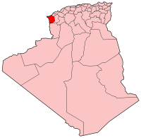
English: This map shows boundaries which are wrong or outdated. Consider using the following updated (as in 2009) map instead : File:Algeria_13_Wilaya_locator_map-2009.svg.
Français : Cette carte montre des frontières erronées ou qui ne sont plus à jour. Veuillez utiliser à la place la carte à jour (telle qu'en 2009) suivante : File:Algeria_13_Wilaya_locator_map-2009.svg.
|

|
| DescriptionAlgeria-Tlemcen.png |
Map of Algeria showing Tlemcen province. Español: Mapa de Algeria con la provincia de Tlemcen resaltada |
| Date | |
| Source | Self-made, traced from public domain UN or CIA maps. |
| Author | User:Golbez |
| Permission (Reusing this file) |
Provide attribution, please. See below. |
| Other versions | See Image:Algeria provinces numbered.png for the numbered map of the provinces. |
I, the copyright holder of this work, hereby publish it under the following licenses:
This file is licensed under the Creative Commons Attribution-Share Alike 2.5 Generic, 2.0 Generic and 1.0 Generic license.
- You are free:
- to share – to copy, distribute and transmit the work
- to remix – to adapt the work
- Under the following conditions:
- attribution – You must give appropriate credit, provide a link to the license, and indicate if changes were made. You may do so in any reasonable manner, but not in any way that suggests the licensor endorses you or your use.
- share alike – If you remix, transform, or build upon the material, you must distribute your contributions under the same or compatible license as the original.

|
Permission is granted to copy, distribute and/or modify this document under the terms of the GNU Free Documentation License, Version 1.2 or any later version published by the Free Software Foundation; with no Invariant Sections, no Front-Cover Texts, and no Back-Cover Texts. A copy of the license is included in the section entitled GNU Free Documentation License.http://www.gnu.org/copyleft/fdl.htmlGFDLGNU Free Documentation Licensetruetrue |
| This file is licensed under the Creative Commons Attribution-Share Alike 3.0 Unported license. | ||
| ||
| This licensing tag was added to this file as part of the GFDL licensing update.http://creativecommons.org/licenses/by-sa/3.0/CC BY-SA 3.0Creative Commons Attribution-Share Alike 3.0truetrue |
You may select the license of your choice.
Captions
Add a one-line explanation of what this file represents
Items portrayed in this file
depicts Xi Nghezi
copyright status Xi Nghezi
copyrighted Xi Nghezi
copyright license Xi Nghezi
inception Xi Nghezi
18 N'wendzamhala 2004
media type Xi Nghezi
image/png
checksum Xi Nghezi
5cc22c88167c8c7afa92f00b934e983b771e09f2
data size Xi Nghezi
5,256 byte
195 pixel
width Xi Nghezi
200 pixel
Matimu ya fayili
thlava eka siku/nkarhi leswaku u vona leswi fayili ayirixiswona hi knarhi walowo
| Siku/Nkarhi | Xifanisonyana | Mpimo | Mutirhisi | Nhlamulo | |
|---|---|---|---|---|---|
| Sweswinyana | 08:24, 26 N'wendzamhala 2004 | | 200 × 195 (5 KB) | Golbez | Map of Algeria showing Tlemcen province. Made by User:Golbez. {{cc-by-sa-2.0}} |
Ntsengo wakutirhisiwa ka fiyili leyi
Kuhava tluka leri khwekelaka eka fayili leyi
Global file usage
The following other wikis use this file:
- Usage on en.wikipedia.org
- Usage on fr.wikipedia.org
- Usage on pt.wikipedia.org
- Usage on sv.wikipedia.org
- Usage on tg.wikipedia.org
- Usage on zh.wikipedia.org