File:Europe_countries_map_ja.png
From Wikipedia, the free encyclopedia
Bu önizlemenin boyutu: 737 × 600 piksel. Diğer çözünürlükler: 295 × 240 piksel | 590 × 480 piksel | 944 × 768 piksel | 1.259 × 1.024 piksel | 1.475 × 1.200 piksel.
Tam çözünürlük ((1.475 × 1.200 piksel, dosya boyutu: 801 KB, MIME tipi: image/png))
Bu dosya Wikimedia Commons'ta bulunmaktadır. Dosyanın açıklaması aşağıda gösterilmiştir. Commons, serbest/özgür telifli medya dosyalarının bulundurulduğu depodur. Siz de yardım edebilirsiniz. |
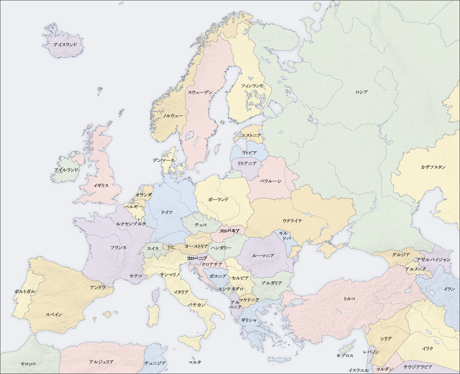
| AçıklamaEurope countries map ja.png |
English: Map of countries in Europe
日本語: ヨーロッパ各国の地図 |
||||||||||
| Tarih | 2009年3月6日(金) | ||||||||||
| Kaynak | own map, based on the Generic Mapping Tools and ETOPO2 | ||||||||||
| Yazar | San Jose (map) and Kiensvay (Japanese Version) | ||||||||||
| İzin (Bu dosyanın tekrar kullanımı) |
|
||||||||||
| Diğer sürümler |
[değiştir]
|


Altyazılar
Bu dosyanın temsil ettiği şeyin tek satırlık açıklamasını ekleyin.
Bu dosyada gösterilen öğeler
betimlenen
Dosya geçmişi
Dosyanın herhangi bir zamandaki hâli için ilgili tarih/saat kısmına tıklayın.
| Tarih/Saat | Küçük resim | Boyutlar | Kullanıcı | Yorum | |
|---|---|---|---|---|---|
| güncel | 00.47, 17 Mayıs 2009 | | 1.475 × 1.200 (801 KB) | Shota y | スロバキアとスロベニア入れ替え修正 |
| 11.44, 6 Mart 2009 |  | 1.475 × 1.200 (367 KB) | Kiensvay | bold texts (太字) | |
| 11.28, 6 Mart 2009 |  | 1.475 × 1.200 (365 KB) | Kiensvay | {{Information |Description={{en|1=Map of countries in Europe}} {{ja|1=ヨーロッパ地図}} |Source=own map, based on the [http://gmt.soest.hawaii.edu/ Generic Mapping Tools] and [http://dss.ucar.edu/datasets/ds759.3/ ETOPO2] |Author=[[User:San Jose|Sa |
Dosya kullanımı
Bu görüntü dosyasına bağlanan sayfa yok.
Küresel dosya kullanımı
"https://tr.wikipedia.org/wiki/Dosya:Europe_countries_map_ja.png" sayfasından alınmıştır