แม่น้ำฮัน (ประเทศเกาหลี)
จากวิกิพีเดีย สารานุกรมเสรี
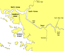
แม่น้ำฮัน เป็นแม่น้ำบนคาบสมุทรเกาหลี, ประเทศเกาหลีใต้ น้ำแม่มีความยาวทั้งสิ้น 497.5 กิโลเมตร มีต้นกำเนิดมาจากภูเขาแทแบ็ก และไหลลงสู่ทะเลเหลือง
| แม่น้ำฮัน | |
|---|---|
 ภาพดาวเทียมของแม่น้ำฮัน | |
 ระบบแม่น้ำฮัน | |
| ที่มาของชื่อ | ฮันจาแบบแพ็กเจ, "Hansu" (漢水)[a][1] |
| ชื่อท้องถิ่น | 한강 (เกาหลี) |
| ที่ตั้ง | |
| ประเทศ | เกาหลีใต้ (KOR), เกาหลีเหนือ (PRK) |
| จังหวัด | คังว็อน (KOR), คย็องกี (KOR), โซล (KOR), ฮวังแฮเหนือ (PRK) |
| ลักษณะทางกายภาพ | |
| ต้นน้ำ | Taebaek Mountains |
| • ตำแหน่ง | Geumdae Peak, Taebaek, จังหวัดคังว็อน ประเทศเกาหลีใต้[b][2] |
| ปากน้ำ | ทะเลเหลือง |
• ตำแหน่ง | จุดตะวันตกเฉียงเหนือของคาบสมุทรคิมโพ ชายแดนเกาหลีเหนือ-ใต้[3] |
| ความยาว | 508 กิโลเมตร (316 ไมล์)[4] |
| พื้นที่ลุ่มน้ำ | 35,770 ตารางกิโลเมตร (13,810 ตารางไมล์)[4] |
| อัตราการไหล | |
| • ตำแหน่ง | สะพานฮันกัง โซล[c][5] |
| • เฉลี่ย | 613 cubic metre per second (21,600 cubic foot per second)[d][5] |
| ลุ่มน้ำ | |
| ลำน้ำสาขา | |
| • ซ้าย | Dalcheon, Cheongmicheon, Bokhacheon, Gyeongancheon, Anyangcheon, คลองอารา † |
| • ขวา | Seom River, Bukhan River, Jungnangcheon, Gongneungcheon, Rimjin River |
| † : ลำน้ำแตกสาขาของแม่น้ำฮัน | |
หมายเหตุ
อ้างอิง
แหล่งข้อมูลอื่น
Wikiwand - on
Seamless Wikipedia browsing. On steroids.
