File:SCO_Map.png
From Wikipedia, the free encyclopedia
మరింత స్పష్టమైన బొమ్మ లేదు.
SCO_Map.png (600 × 600 పిక్సెళ్ళు, ఫైలు పరిమాణం: 139 KB, MIME రకం: image/png)
This is a file from the Wikimedia Commons. Information from its description page there is shown below. Commons is a freely licensed media file repository. You can help. |

|
File:SCO (orthographic projection).svg is a vector version of this file. It should be used in place of this PNG file when not inferior.
File:SCO Map.png → File:SCO (orthographic projection).svg
For more information, see Help:SVG.
|
.svg) |
| వివరణSCO Map.png |
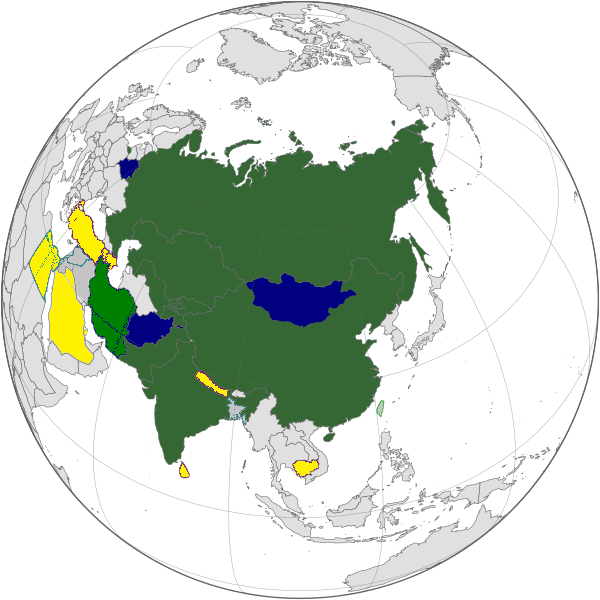
English: Map of the Shanghai Cooperation Organization.
Русский: Карта Шанхайской Организации Сотрудничества. |
||||||||
| తేదీ | 12 ఏప్రిల్ 2005, updated on 20 June 2009 | ||||||||
| మూలం | |||||||||
| కర్త | Aris Katsaris, updated by Emilfaro | ||||||||
| అనుమతి (ఈ దస్త్రాన్ని పునర్వినియోగించుకోవడం) |
|

Captions
Add a one-line explanation of what this file represents
Items portrayed in this file
చిత్రణ
copyright status ఇంగ్లీష్
copyrighted ఇంగ్లీష్
12 ఏప్రిల్ 2005
ఫైలు చరితం
తేదీ/సమయం ను నొక్కి ఆ సమయాన ఫైలు ఎలా ఉండేదో చూడవచ్చు.
| తేదీ/సమయం | నఖచిత్రం | కొలతలు | వాడుకరి | వ్యాఖ్య | |
|---|---|---|---|---|---|
| ప్రస్తుత | 07:22, 20 సెప్టెంబరు 2022 | | 600 × 600 (139 KB) | Yuri V. | correct version, without errors |
| 11:07, 18 సెప్టెంబరు 2017 |  | 600 × 600 (173 KB) | Hwatas | India and Pakistan | |
| 03:28, 20 జూన్ 2009 |  | 1,200 × 1,200 (367 KB) | Emilfaro | Orthographic projection. | |
| 12:48, 16 జూన్ 2009 |  | 1,567 × 692 (177 KB) | Honmingjun | Change the color of Taiwan | |
| 11:41, 8 ఫిబ్రవరి 2009 |  | 1,567 × 692 (218 KB) | Emilfaro | Based on SVG. | |
| 06:25, 25 అక్టోబరు 2008 |  | 1,425 × 625 (34 KB) | KAVO | {{Information |Description= |Source= |Date= |Author= |Permission= |other_versions= }} | |
| 12:37, 22 అక్టోబరు 2008 |  | 1,425 × 625 (58 KB) | Emilfaro | Turkmenistan color changed. | |
| 12:35, 22 అక్టోబరు 2008 |  | 1,425 × 625 (31 KB) | Emilfaro | Sorry, Turkmenistan is still CIS, thus a Guest Attendance. | |
| 18:39, 18 అక్టోబరు 2008 |  | 1,425 × 625 (31 KB) | Emilfaro | Turkmenistan was included by mistake. | |
| 18:15, 18 అక్టోబరు 2008 |  | 1,425 × 625 (31 KB) | Emilfaro | Global map as the alliance is large. |
లింకులు
ఈ ఫైలును వాడుతున్న పేజీలు లేవు.
సార్వత్రిక ఫైలు వాడుక
ఈ దస్త్రాన్ని ఈ క్రింది ఇతర వికీలు ఉపయోగిస్తున్నాయి:
- da.wikipedia.org లో వాడుక
- en.wikipedia.org లో వాడుక
- es.wikipedia.org లో వాడుక
- fr.wikinews.org లో వాడుక
- simple.wikipedia.org లో వాడుక
- zh.wikipedia.org లో వాడుక
మెటాడేటా
ఈ ఫైలులో అదనపు సమాచారం ఉంది, బహుశా దీన్ని సృష్టించడానికి లేదా సాంఖ్యీకరించడానికి వాడిన డిజిటల్ కేమెరా లేదా స్కానర్ ఆ సమాచారాన్ని చేర్చివుండవచ్చు. ఈ ఫైలును అసలు స్థితి నుండి మారిస్తే, ఆ మారిన ఫైలులో కొన్ని వివరాలు పూర్తిగా ప్రతిఫలించకపోవచ్చు.
| క్షితిజసమాంతర స్పష్టత | 37.8 dpc |
|---|---|
| లంబ స్పష్టత | 37.8 dpc |
"https://te.wikipedia.org/wiki/దస్త్రం:SCO_Map.png" నుండి వెలికితీశారు