File:Norwegian_Sea_blank_map.png
From Wikipedia, the free encyclopedia
ఈ మునుజూపు పరిమాణం: 657 × 600 పిక్సెళ్ళు. ఇతర రిజల్యూషన్లు: 263 × 240 పిక్సెళ్ళు | 526 × 480 పిక్సెళ్ళు | 1,000 × 913 పిక్సెళ్ళు.
అసలు దస్త్రం (1,000 × 913 పిక్సెళ్ళు, ఫైలు పరిమాణం: 282 KB, MIME రకం: image/png)
This is a file from the Wikimedia Commons. Information from its description page there is shown below. Commons is a freely licensed media file repository. You can help. |

|
This locator map image could be re-created using vector graphics as an SVG file. This has several advantages; see Commons:Media for cleanup for more information. If an SVG form of this image is available, please upload it and afterwards replace this template with
{{vector version available|new image name}}.
It is recommended to name the SVG file “Norwegian Sea blank map.svg”—then the template Vector version available (or Vva) does not need the new image name parameter. |
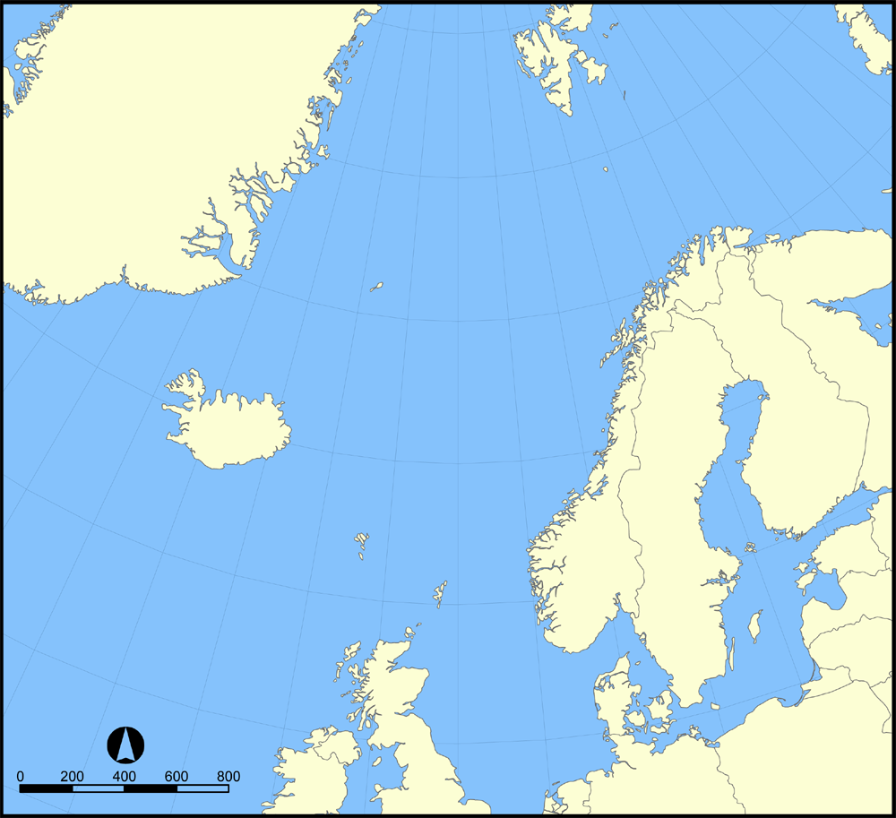
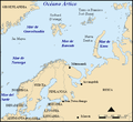
A blank version of the Image:Norwegian Sea map.png map showing the location of the Norwegian Sea in the North Atlantic Ocean.
Feel free to label a copy of this map for use in other language editions of the Wikipedia.
Created by NormanEinstein, October 31, 2005.
నేను, ఈ కృతి యొక్క కాపీహక్కుదారుని, దీన్ని ఇందుమూలముగా ఈ లైసెన్సుల క్రింద ప్రచురిస్తున్నాను:

|
ఈ కృతి యొక్క కర్తనైన నేను, ఇక నుండీ ఈ కృతిని కాపీ చేసుకోవడానికి, పంచి పెట్టడానికి మరియు/లేదా మార్పులు-చేర్పులు చేసుకోవడానికి GFDL, లైసెన్సు వెర్షను 1.2 లేదా దాని తరువాత స్వేచ్చా సాఫ్టువేరు ఫౌండేషను విడుదలచేసే ఏ GFDL లైసెన్సు ద్వారా నయినా అనుమతి ఇస్తున్నాను; ఈ కృతిలో మార్చకూడని బాగాలు లేవు, Front-Cover పాఠం లేదు, Back-Cover పాఠం లేదు. ఈ లైసెన్సు యొక్క పత్రం నకలును "జిఎన్యూ ఉచిత డాక్యుమెంటేషను లైసెన్సు" అని పిలుస్తున్న విభాగంలో ఉంది.http://www.gnu.org/copyleft/fdl.htmlGFDLGNU Free Documentation Licensetruetrue |
| ఈ దస్త్రం క్రియేటివ్ కామన్స్ Attribution-Share Alike 3.0 Unported లైసెన్సు క్రింద లభ్యం. | ||
| ||
| GFDL లైసెన్సు తాజాకరణలో భాగంగా ఈ దస్త్రానికి ఈ లైసెన్సింగు ట్యాగుని చేర్చారు.http://creativecommons.org/licenses/by-sa/3.0/CC BY-SA 3.0Creative Commons Attribution-Share Alike 3.0truetrue |
పైవాటిలో మీకు నచ్చిన లైసెన్సునును ఎంచుకోవచ్చు.
[మార్చు]
- Norwegian Sea
-

-
 bosanski
 -
 čeština
 -
 dansk
dansk -
 Deutsch
 -
 eesti
eesti -
 English
 -
 français
 -
 français (Jan Mayen localisation)
 -
 hrvatski
 -
 italiano
 -
 magyar
 -
 magyar
 -
 norsk
norsk -
 svenska
 -
 македонски
 -
 нохчийн
 -
 русский
 -
 українська
 -
 中文
中文 -
 עברית
עברית


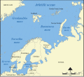
- Barents Sea
-

-
 Deutsch
 -
 English
 -
 español
 -
 hrvatski
 -
 magyar
 -
 Kiswahili
 -
 русский
 -
 Ελληνικά


Captions
Add a one-line explanation of what this file represents
Items portrayed in this file
చిత్రణ
copyright status ఇంగ్లీష్
copyrighted ఇంగ్లీష్
ఫైలు చరితం
తేదీ/సమయం ను నొక్కి ఆ సమయాన ఫైలు ఎలా ఉండేదో చూడవచ్చు.
| తేదీ/సమయం | నఖచిత్రం | కొలతలు | వాడుకరి | వ్యాఖ్య | |
|---|---|---|---|---|---|
| ప్రస్తుత | 16:30, 31 మే 2015 | | 1,000 × 913 (282 KB) | Cmdrjameson | Compressed with pngout. Reduced by 121kB (30% decrease). |
| 15:20, 31 అక్టోబరు 2005 |  | 1,000 × 913 (403 KB) | NormanEinstein | A blank version of the Norwegian Sea map.png map showing the location of the Norwegian Sea in the North Atlantic Ocean. Feel free to label a copy of this map for use in other language editions of the Wikipedia. Created by NormanEinstein, October 31 |
లింకులు
ఈ ఫైలును వాడుతున్న పేజీలు లేవు.
సార్వత్రిక ఫైలు వాడుక
ఈ దస్త్రాన్ని ఈ క్రింది ఇతర వికీలు ఉపయోగిస్తున్నాయి:
- en.wikipedia.org లో వాడుక
- User:Wernher
- User:Chino
- User:Inge
- User:Kasper Holl
- User:MX44
- User:Anjoe
- User:Big Adamsky
- User:SKvalen
- User:Steve Hart
- Wikipedia:Userboxes/Location/Europe
- Template:User Norden
- User:Tamino
- User:NordicStorm
- User:Revontuli~enwiki
- User:Deallus
- User:Islander(Scandinavia)
- User:The monkeyhate
- User:Nv02migu
- User:Sasper
- User:Jannizz
- User:BKfi
- User:Strappado~enwiki
- User:Elpuellodiablo
- User:Tamino/MyUserboxes
- User:Waaaak
- User:Familien.benito
- User:Josso/Userboxes/My Userboxes/
- User:Necz0r
- User:Luredreier
- User:Ikterus
- User:Gsmgm/Userboxes
- User:Hietsu
- User:Ricmik~enwiki
- User:Kilogramm89
- User:MRqtH2
- User:Autioitua
- User:Andber08
- User:Forngrav
- User:K9re11
- User:Finlandestonia
- User:Kaljami
మెటాడేటా
ఈ ఫైలులో అదనపు సమాచారం ఉంది, బహుశా దీన్ని సృష్టించడానికి లేదా సాంఖ్యీకరించడానికి వాడిన డిజిటల్ కేమెరా లేదా స్కానర్ ఆ సమాచారాన్ని చేర్చివుండవచ్చు. ఈ ఫైలును అసలు స్థితి నుండి మారిస్తే, ఆ మారిన ఫైలులో కొన్ని వివరాలు పూర్తిగా ప్రతిఫలించకపోవచ్చు.
| క్షితిజసమాంతర స్పష్టత | 28.35 dpc |
|---|---|
| లంబ స్పష్టత | 28.35 dpc |
"https://te.wikipedia.org/wiki/దస్త్రం:Norwegian_Sea_blank_map.png" నుండి వెలికితీశారు