File:Black_Sea_map_blank.png
From Wikipedia, the free encyclopedia
Madhësia e këtij shikimi: 781 × 600 pixel. Rezolucione të tjera: 313 × 240 pixel | 625 × 480 pixel | 1.000 × 768 pixel | 1.280 × 983 pixel | 2.006 × 1.541 pixel.
Dokument origjinal ((përmasa 2.006 × 1.541 px, madhësia skedës: 574 KB, lloji MIME: image/png))
| Kjo skedë është prej Wikimedia Commons dhe mund të përdoret nga projekte të tjera. Përshkrimi në këtë skedë në këtë faqe nuk është treguar më poshtë. | Shko tek faqja përshkruese në Commons |
Përmbledhje
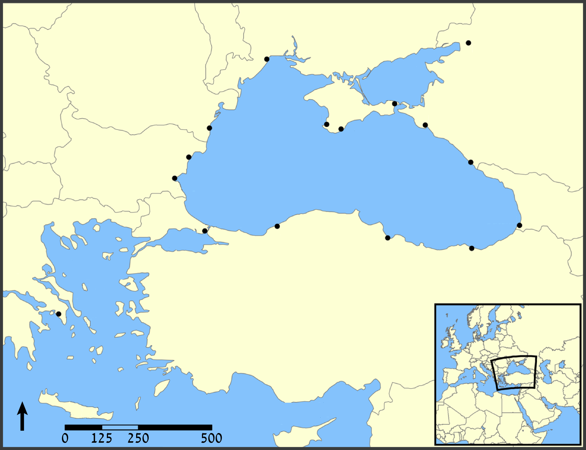
| PërshkrimiBlack Sea map blank.png | A map showing the location of the Black Sea and some of the large or prominent ports around it. The Sea of Azov and Sea of Marmara are also labelled. |
| Data | (UTC) |
| Burimi |
This file was derived from: Black Sea map.png: |
| Autori |
|
| Versione tjera |
[redakto]
|


.png)


| This is a retouched picture, which means that it has been digitally altered from its original version. Modifications: blank. The original can be viewed here: Black Sea map.png:
|
Licencim
Unë, krijuesi i kësaj pune, e publikoj këtu në bazë të licensës në vijim:
| Kjo skedë licencohet sipas Creative Commons Attribution-Share Alike 3.0 Unported. | ||
| ||
| Kjo etiketë licencimi u shtua te kjo skedë si pjesë e përditësimit të lincecimit. GFDL.http://creativecommons.org/licenses/by-sa/3.0/CC BY-SA 3.0Creative Commons Attribution-Share Alike 3.0truetrue |

|
Ju jepet leje për ta kopjuar, shpërndarë dhe/ose ndryshuar këtë dokument sipas kushteve të Licencës GNU për Dokumentim të Lirë, versioni 1.2 ose çfarëdo versioni të mëpasshëm të botuar nga Free Software Foundation; pa Seksione të Pandryshueshme, pa Tekste Kapakësh të Përparmë, dhe pa Tekste Kapakësh të Pasmë. Një kopje e kësaj licence është përfshirë në seksionin e titulluar GNU Free Documentation License.http://www.gnu.org/copyleft/fdl.htmlGFDLGNU Free Documentation Licensetruetrue |
Mundeni të përzgjidhni licencën që doni.
Regjistri origjinal i ngarkimeve
This image is a derivative work of the following images:
- File:Black_Sea_map.png licensed with Cc-by-sa-3.0-migrated, GFDL
- 2007-07-10T18:10:36Z NormanEinstein 1200x915 (382990 Bytes) Updated maps to add Russian city of Sochi.
- 2007-05-07T19:11:11Z NormanEinstein 1200x912 (378400 Bytes) Corrected city name typo.
- 2006-05-29T13:10:42Z NormanEinstein 1200x914 (136455 Bytes) Reduced image size.
- 2005-07-25T14:54:05Z NormanEinstein 1200x916 (487643 Bytes) A map showing the location of the Black Sea and some of the large or prominent ports around it. The Sea of Azov and Sea of Maramara are also labelled. Created by NormanEinstein, July 25, 2005. {{GFDL-self}} [[Category:Maps
Uploaded with derivativeFX
Captions
Add a one-line explanation of what this file represents
Items portrayed in this file
përshkruan
image/png
checksum anglisht
a130d09646d760d87c2e127cd45f4c683223b1b3
data size anglisht
587.727 Bajti
1.541 pixel
2.006 pixel
Historiku skedës
Shtypni mbi një datë/kohë për ta parë skedën siç ishte atëherë.
| Data/Koha | Miniaturë | Përmasat | Përdoruesi | Koment | |
|---|---|---|---|---|---|
| e tanishme | 3 gusht 2012 16:43 | | 2.006 × 1.541 (574 KB) | Amirki | . |
| 3 gusht 2012 16:39 |  | 1.954 × 1.538 (559 KB) | Amirki | == {{int:filedesc}} == {{Information |Description=A map showing the location of the Black Sea and some of the large or prominent ports around it. The Sea of Azov and Sea of Marmara are also labelled. |Source={{Derived from|Black_Sea_map.png|display=50}... |
Lidhje skedash
S’ka faqe që përdorin këtë kartelë.
Metadata
Kjo skedë përmban hollësira të tjera të cilat mund të jenë shtuar nga kamera ose skaneri dixhital që është përdorur për ta krijuar.
Në qoftë se skeda është ndryshuar nga gjendja origjinale, disa hollësira mund të mos pasqyrojnë versionin e tanishëm.
| Madhësia horizontale | 59,06 dpc |
|---|---|
| Madhësia vertikale | 59,06 dpc |
| Softueri i përdorur |
|