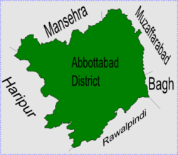
Langra is one of the 51 Union Councils of Abbottabad district in the Khyber Pakhtunkhwa province of Pakistan.[2]
Langra | |
|---|---|
 Langra is in Abbottabad District | |
| Coordinates: 34°4′0″N 73°10′0″E | |
| Country | |
| Province | Khyber Pakhtunkhwa |
| District | Abbottabad |
| Tehsil | Havelian |
| Government | |
| • Nazim | Waqar Ahmed Khan[1] |
| • Naib Nazim | Chaudry Liaqat Ali |
Location
Langra is at 34°4'0N 73°10'0E at a height of 871 metres (2860 feet).[3] It is to the south of Abbottabad city, neighbouring Union councils are, Salhad - which is to the north and forms the approach to Abbottabad city, Rajoya to the east, Havelian to the South and Kokal to the west (which forms the approach to Haripur District).
Subdivisions
The Union Council is subdivided into the following areas: Banda Sahib Khan, Lari and Langra.[1]
References
Wikiwand in your browser!
Seamless Wikipedia browsing. On steroids.
Every time you click a link to Wikipedia, Wiktionary or Wikiquote in your browser's search results, it will show the modern Wikiwand interface.
Wikiwand extension is a five stars, simple, with minimum permission required to keep your browsing private, safe and transparent.
