File:Relief_Map_of_Czech_Republic.png
From Wikipedia, the free encyclopedia
Size of this preview: 800 × 486 pixels. Other resolutions: 320 × 195 pixels | 640 × 389 pixels | 1,000 × 608 pixels.
Original file (1,000 × 608 pixels, file size: 866 KB, MIME type: image/png)
| This is a file from the Wikimedia Commons. Information from its description page there is shown below. Commons is a freely licensed media file repository. You can help. |
Summary
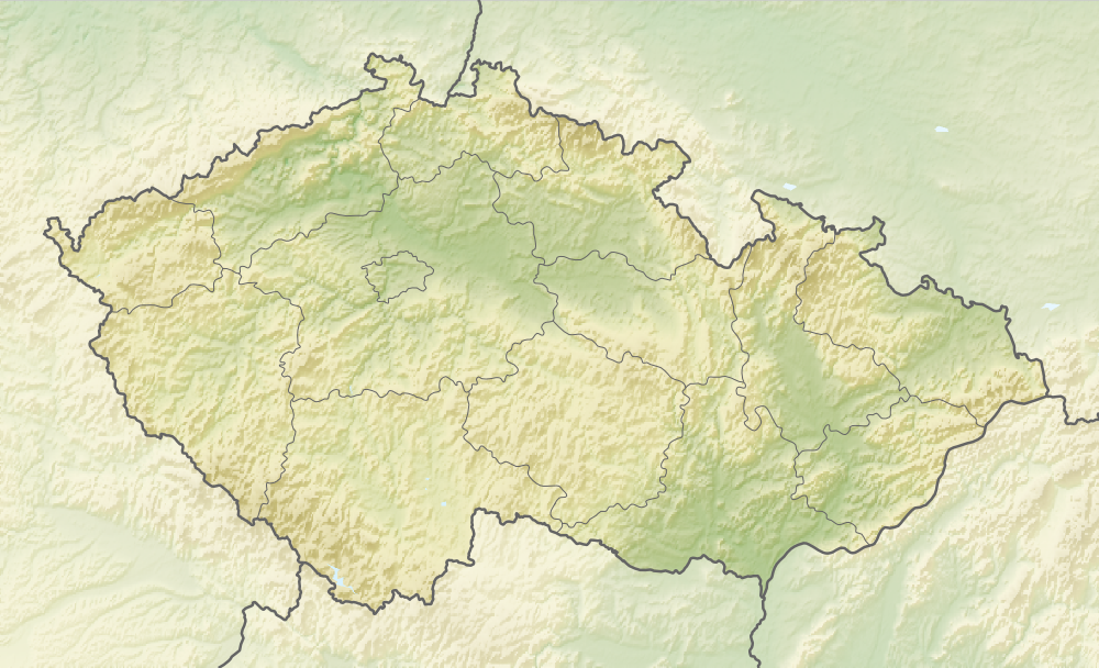
| DescriptionRelief Map of Czech Republic.png |
English: Relief map of the Czech Republic
Equirectangular projection, N/S stretching 150 %. Geographic limits of the map:
|
| Date | |
| Source |
|
| Author | derivative work Виктор_В |
Licensing
This file is licensed under the Creative Commons Attribution-Share Alike 3.0 Unported license.
- You are free:
- to share – to copy, distribute and transmit the work
- to remix – to adapt the work
- Under the following conditions:
- attribution – You must give appropriate credit, provide a link to the license, and indicate if changes were made. You may do so in any reasonable manner, but not in any way that suggests the licensor endorses you or your use.
- share alike – If you remix, transform, or build upon the material, you must distribute your contributions under the same or compatible license as the original.
Captions
Relief map of Czechia
Items portrayed in this file
depicts
28 August 2010
image/png
File history
Click on a date/time to view the file as it appeared at that time.
| Date/Time | Thumbnail | Dimensions | User | Comment | |
|---|---|---|---|---|---|
| current | 08:37, 11 January 2021 | | 1,000 × 608 (866 KB) | ThecentreCZ | Reverted to version as of 11:53, 28 August 2010 (UTC) V Ústavním pořádku České republiky nemají zemské hranice žádné ukotvení a jsou jen přežitkem |
| 22:48, 10 January 2021 |  | 1,000 × 608 (780 KB) | Osidor | přidány zemské hranice (důvod: na mapě jsou užitečné nejméně stejně jako ty krajské [spíše však více]) | |
| 11:53, 28 August 2010 |  | 1,000 × 608 (866 KB) | Виктор В | == {{int:filedesc}} == {{Information |Description={{en|Location map of the Czech Republic}} Equirectangular projection, N/S stretching 150 %. Geographic limits of the map: * N: 51.3° N * S: 48.3° N * W: 11.8° E * O: 19.2° |
File usage
The following 64 pages use this file:
- Bechyně
- Benešov
- Benátky nad Jizerou
- Budyně nad Ohří
- Cheb
- Chodov (Sokolov District)
- Chomutov
- Chrudim
- Doksy
- Dolní Břežany
- Děčín
- Frýdek-Místek
- Frýdlant
- Habry
- Havířov
- Hlučín
- Hradec Králové
- Jablonec nad Nisou
- Jablonné nad Orlicí
- Jeseník
- Jihlava
- Jiříkov
- Kadaň
- Kardašova Řečice
- Karviná
- Kelč
- Kladno
- Klášterec nad Ohří
- Kroměříž
- Liberec
- Libochovice
- Loket
- Louny
- Louňovice pod Blaníkem
- Meziboří
- Mikulov
- Milavče
- Mladá Boleslav
- Most (city)
- Mělník
- Nišovice
- Nová Bystřice
- Nymburk
- Olomouc
- Opava
- Ostrov (Karlovy Vary District)
- Podkovák Nature Reserve
- Poděbrady
- Přerov
- Přibyslav
- Přílepy (Kroměříž District)
- Rozvadov
- Strmilov
- Tábor
- Třeboň
- Valašské Meziříčí
- Veselé, Czech Republic
- Znojmo
- Ústí nad Labem
- Česká Lípa
- Česká Třebová
- České Budějovice
- Module:Location map/data/Czech Republic
- Module:Location map/data/Czech Republic/doc
Global file usage
The following other wikis use this file:
- Usage on als.wikipedia.org
- Usage on arz.wikipedia.org
- Usage on ast.wikipedia.org
- Usage on azb.wikipedia.org
- Usage on az.wikipedia.org
- Usage on bar.wikipedia.org
- Usage on ba.wikipedia.org
- Usage on be-tarask.wikipedia.org
- Usage on be.wikipedia.org
- Usage on bg.wikipedia.org
View more global usage of this file.
Metadata
This file contains additional information, probably added from the digital camera or scanner used to create or digitize it.
If the file has been modified from its original state, some details may not fully reflect the modified file.
| Horizontal resolution | 35.27 dpc |
|---|---|
| Vertical resolution | 35.27 dpc |
| Software used |
|