ගොනුව:Illinois_Locator_Map.PNG
From Wikipedia, the free encyclopedia
මෙයට ඉහල විසර්ජනයක් ලබාගත නොහැක.
Illinois_Locator_Map.PNG (288 × 405 පික්සල, ගොනු විශාලත්වය: 12 කි.බ., MIME ශෛලිය: image/png)
මෙම ගොනුව Wikimedia Commons වෙතින් වන අතර අනෙකුත් ව්යාපෘතීන් විසින්ද භාවිතා කල හැක. එහි ගොනු විස්තර පිටුව තුල අඩංගු විස්තර මෙහි පහත දැක්වෙයි.

|
This locator map image could be re-created using vector graphics as an SVG file. This has several advantages; see Commons:Media for cleanup for more information. If an SVG form of this image is available, please upload it and afterwards replace this template with
{{vector version available|new image name}}.
It is recommended to name the SVG file “Illinois Locator Map.svg”—then the template Vector version available (or Vva) does not need the new image name parameter. |
සාරාංශය
බලපත්රීකරණය
I, Ruhrfisch, මෙම කාර්යයේ ප්රකාශන අයිතිය දරන්නා,පහත බලපත්රය යටතේ එය ප්රකාශයට පත් කරනු ලබයි:

|
Free Software Foundation විසින් ප්රකාශිත GNU Free Documentation License බලපත්රයෙහි 1.2 හෝ ඊට අලුත් පිටපත්වල කොන්දේසිවලට යටත්ව මෙම ගොනුව පිටපත් කෙරුමට, නැවත බෙදාහාරුමට සහ/හෝ වෙනස් කෙරුමට අවසර දී ඇත; ඒ වෙනස් අංශ නොමැතිව, මුල් පිටු පෙළ නොමැතිව, පසු පිටු පෙළ නොමැතිවය. බලපත්රයේ පිටපතක් GNU Free Documentation License නම් අංශයේ දැක්වේ.http://www.gnu.org/copyleft/fdl.htmlGFDLGNU Free Documentation Licensetruetrue |
| මෙම ගොනුව ක්රියේටිව් කොමන්ස් Attribution-Share Alike 3.0 Unported වරපත යටතේ අවසර ලබා ඇත. | ||
| Attribution: I, Ruhrfisch | ||
| ||
| GFDL බලපත්ර යාවත්කාල කෙරුමහි කොටසක් ලෙස මෙම ගොනුවට බලපත්ර ටැගය එක් කෙරිනි.http://creativecommons.org/licenses/by-sa/3.0/CC BY-SA 3.0Creative Commons Attribution-Share Alike 3.0truetrue |
මෙම ගොනුව නිර්මාණශීලී පොදුවූවන් Attribution-Share Alike 2.5 Generic බලපත්රය යටතේ අවසර ලබා ඇත.
Attribution: I, Ruhrfisch
- ඔබ නිදහස්:
- බෙදාහදා ගැනීමට – කාර්යය පිටපත් කිරීමට,බෙදා හැරීමට සහ සම්ප්රේෂණය කිරීමට
- නැවත සංකලනය කිරීමට – කාර්යයට අනුවර්තනය වීමට
- පහත කොන්දේසිවලට යටත්ව:
- attribution – වරපත වෙත බැඳියක්ද සපයමින් ඔබ විසින් සුදුසු කර්තෘභාරය ප්රදානය කල යුතු අතර, කිසියම් වෙනස්වීම් සිදුකලේ නම් එයද සඳහන් කල යුතු වෙයි. ඕනෑම සුදුසු ආකාරයට මෙය ඔබ විසින් සිදුකල හැකි මුත්, වරපත්දායකයා විසින් ඔබ හෝ ඔබගේ භාවිතය හෝ පිටසන් කරන බවට ඇඟවෙන ලෙසින් එය සිදු නොකල යුතු වෙයි.
- share alike – මෙම විෂය කාරණා භාවිතා කොට නැවත සංකලනය, ප්රතියෝජනය හෝ වැඩිදියුණුව කලේ නම්, ඉන්පසු ඔබගේ දායකත්වය ඔබ විසින් බෙදාහැරිය යුත්තේ මුල් වරපත හා සමාන හෝ සංගතික හෝ වරපතක් භාවිතා කරමිනි.
ඔබට අභිමත වරපත තෝරාගත හැක.
| Public domainPublic domainfalsefalse |
This image or file is a work of a United States Census Bureau employee, taken or made as part of that person's official duties. As a work of the U.S. federal government, the image is in the public domain.
English ∙ español ∙ 日本語 ∙ македонски ∙ മലയാളം ∙ português do Brasil ∙ русский ∙ українська ∙ עברית ∙ +/− |
 |
Captions
මෙම ගොනුව නිරූපණය කරන්නෙඑ කුමක්දැයි තනි පේළියේ පැහැදිළි කිරීමක් එක් කරන්න.
Items portrayed in this file
depicts ඉංග්රීසි
copyright status ඉංග්රීසි
copyrighted ඉංග්රීසි
inception ඉංග්රීසි
මාර්තු 2007
media type ඉංග්රීසි
image/png
ගොනු ඉතිහාසය
එම අවස්ථාවෙහිදී ගොනුව පැවැති ආකාරය නැරඹීමට දිනය/වේලාව මත ක්ලික් කරන්න.
| දිනය/වේලාව | කුඩා-රූපය | මාන | පරිශීලක | පරිකථනය | |
|---|---|---|---|---|---|
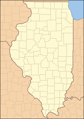
| වත්මන් | 04:02, 25 අප්රේල් 2007 | | 288 × 405 (12 කි.බ.) | Ruhrfisch | {{Information| |Description= Locator Map of Illinois, United States |Source= taken from US Census website [http://factfinder.census.gov/] and modified by User:Ruhrfisch |Date= March 2007 |Author= US Census, Ruhrfisch |Permission= US Census / US Gover |
| 03:45, 28 මාර්තු 2007 |  | 288 × 405 (13 කි.බ.) | Ruhrfisch | {{Information| |Description= Locator Map of Illinois, United States |Source= taken from US Census website [http://factfinder.census.gov/] and modified by User:Ruhrfisch |Date= March 2007 |Author= US Census, Ruhrfisch |Permission= US Census / US Gover | |
| 03:12, 28 මාර්තු 2007 |  | 242 × 412 (11 කි.බ.) | Ruhrfisch | {{Information| |Description= Locator Map of Illinois, United States |Source= taken from US Census website [http://factfinder.census.gov/] and modified by User:Ruhrfisch |Date= March 2007 |Author= US Census, Ruhrfisch |Permission= US Census / US Gover |
ගොනු භාවිතය
පහත දැක්වෙන පිටු 2 ක් විසින් මෙම ගොනුව භාවිතා කෙරෙයි:
ගෝලීය ගොනු භාවිතය
පහත දැක්වෙන අනෙකුත් විකියන් මගින් මෙම ගොනුව භාවිතා කරයි:
- ar.wikipedia.org හි භාවිතය
- bar.wikipedia.org හි භාවිතය
- ceb.wikipedia.org හි භාවිතය
- de.wikipedia.org හි භාවිතය
- en.wikipedia.org හි භාවිතය
- List of counties in Illinois
- List of protected areas of Illinois
- User talk:Kranar drogin/Archive 2
- Template:State parks of Illinois map
- File talk:Illinois Locator Map.PNG
- User talk:Kranar drogin/Archive 3
- Wikipedia talk:WikiProject Illinois/Archive 3
- User:Ruhrfisch
- Template:Illinois County Labelled Map
- Module:Location map/data/USA Illinois inset/doc
- Module:Location map/data/USA Illinois inset
- User:Blåmerke
- fa.wikipedia.org හි භාවිතය
- فهرست شهرستانهای ایلینوی
- الگو:Geobox locator Illinois
- بیردزتاون، ایلینوی
- بلویل، ایلینوی
- بلویدر، ایلینوی
- بلومینگتون، ایلینوی
- بربنک، ایلینوی
- کانتون، ایلینوی
- کاربوندیل، ایلینوی
- کارتج، ایلینوی
- شمپین، ایلینوی
- چنوآ، ایلینوی
- کلینزویل، ایلینوی
- کیوبا، ایلینوی
- فریپورت، ایلینوی
- جلینا، ایلینوی
- گرانیتسیتی، ایلینوی
- گرینویل، ایلینوی
- هاروی، ایلینوی
- لانرک، ایلینوی
- لارنسویل، ایلینوی
- لاوز پارک، ایلینوی
- مارنگو، ایلینوی
- مونتکارول، ایلینوی
- مونتاسترلینگ، ایلینوی
- اورگان، ایلینوی
- پینکنویل، ایلینوی
මෙම ගොනුවේ තවත් ගෝලීය භාවිත බලන්න.
"https://si.wikipedia.org/wiki/ගොනුව:Illinois_Locator_Map.PNG" වෙතින් සම්ප්රවේශනය කෙරිණි