සිතියම්
From Wikipedia, the free encyclopedia
Remove ads
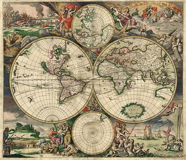
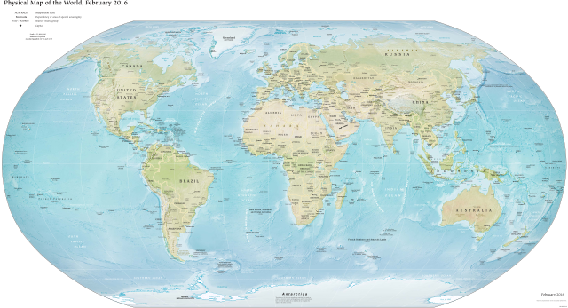
සිතියම් (ඉංග්රීසි: Map) යනු නිශ්චිත පරිමාණයක් සහිත පැතලි තලයක දර්ශනය වන පෘථිවි පෘෂ්ඨයේ පින්තූරයකි. [1] සාම්ප්රදායික මුද්රිත සිතියම්වල සිට පරිගණක තිරයක දිස්වන ඩිජිටල් සිතියම් දක්වා විවිධ ආකාරවලින් සිතියම් ඉදිරිපත් කළ හැක. සිතියම යන පදය පැමිණෙන්නේ ග්රීක වචනයක් වන mappa වලින් වන අතර එහි තේරුම මේස රෙදි හෝ රෙදි යන්නයි. කෙසේ වෙතත්, සාමාන්යයෙන් සිතියමක අර්ථය වන්නේ යම් පරිමාණයකින් අඩු කරන ලද පැතලි තලයක පෘථිවි පෘෂ්ඨයේ සම්පූර්ණ හෝ කොටසක පත්රයකි. සිතියමක් යනු ත්රිමාන අවකාශයක ද්විමාන නිරූපණයකි. සිතියම් සෑදීමේ විද්යාව සිතියම් විද්යාව ලෙස හැඳින්වේ. බොහෝ සිතියම් වල පරිමාණයක් ඇත, එය සිතියමේ ඇති විශාල වස්තූන් කෙතරම් විශාලද යන්න තීරණය කරයි. සිතියම් කිහිපයක එකතුවක් ඇට්ලස් ලෙස හැඳින්වේ.


Remove ads
ආශ්රිත
සමාන්ය
- Counter-mapping
- Map–territory relation
- Censorship of maps
- List of online map services
- Map collection
සිතියම් නිර්මාණය සහ වර්ග
- Automatic label placement
- City map
- Compass rose
- Contour map
- Estate map
- Fantasy map
- Floor plan
- Geologic map
- Hypsometric tints
- Map design
- Orthophotomap—A map created from orthophotography
- Pictorial maps
- Plat
- Road atlas
- Strip map
- Transit map
- Page layout (cartography)
සිතියම් ඉතිහාසය
- Early world maps
- History of cartography
- List of cartographers
ආශ්රිත මාතෘකා
- Aerial landscape art
- Digital geologic mapping
- Economic geography
- Geographic coordinate system
- Index map
- Global Map
- List of online map services
- Map database management
Remove ads
මූලාශ්ර
භාහිර සබැඳි
Wikiwand - on
Seamless Wikipedia browsing. On steroids.
Remove ads
