File:Sulawesi_Locator_Topography.png
From Wikipedia, the free encyclopedia
Size o this luikower: 642 × 599 pixels. Ither resolutions: 257 × 240 pixels | 514 × 480 pixels | 823 × 768 pixels | 1,097 × 1,024 pixels | 1,991 × 1,858 pixels.
Oreeginal file (1,991 × 1,858 pixels, file size: 1.88 MB, MIME type: image/png)
This file is fae Wikimedia Commons n micht be uised bi ither waurks. The descreeption oan its file descreeption page thaur is shawn ablo.
Ootline
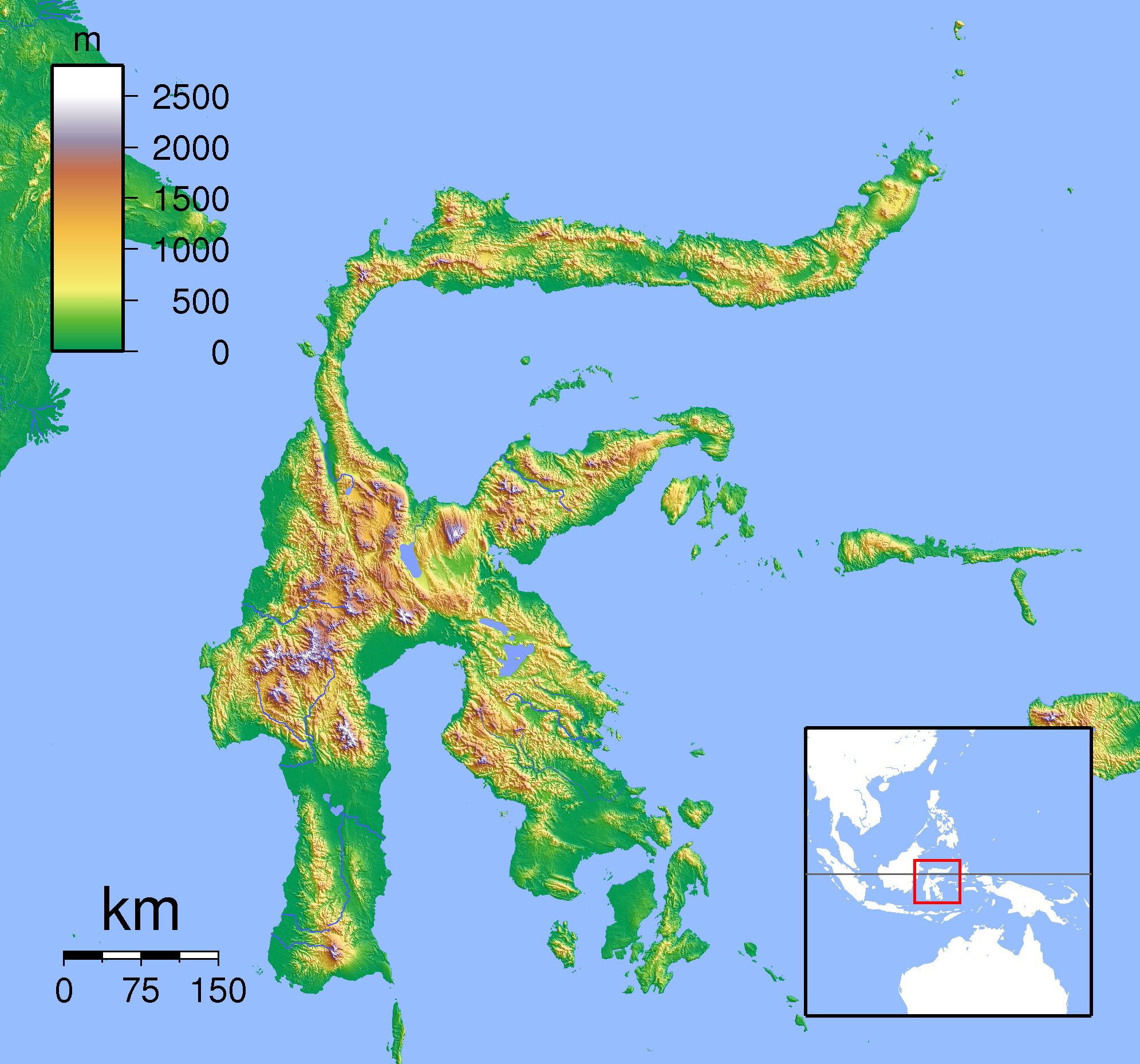
| DescreeptionSulawesi Locator Topography.png | Topographic location map of Sulawesi. Created with SRTM from publicly released SRTM data. For non-locator version, see Image:Sulawesi Topography.png. Left:117 South:-6.333333 Right:127 Top:3 |
| Date | |
| Soorce | Ain wirk |
| Author | Sadalmelik |
Licensin
I, the copyright holder of this work, hereby publish it under the following licenses:

|
Permission is grantit tae copy, distribute an/or modify this document unner the terms o the GNU Free Documentation License, Version 1.2 or ony later version published bi the Free Software Foundation; wi no Invariant Sections, no Front-Cover Texts, an no Back-Cover Texts. A copy o the license is includit in the section enteetled GNU Free Documentation License.http://www.gnu.org/copyleft/fdl.htmlGFDLGNU Free Documentation Licensetruetrue |
This file is licensed under the Creative Commons Attribution-Share Alike 3.0 Unported, 2.5 Generic, 2.0 Generic and 1.0 Generic license.
- Ye are free:
- tae share – tae copy, distribute an transmit the wirk
- tae remix – tae adapt the wirk
- Unner the follaein condeetions:
- attribution – Ye must attribute the wirk in the manner specified bi the author or licensor (but nae in ony way that suggests that thay endorse ye or yer uise o the wirk).
- share alik – If ye alter, transform, or big upon this wirk, ye mey distribute the resultin wirk anly unner the same or seemilar license tae this ane.
Ye mey select the license o yer choice.
Captions
Add a one-line explanation of what this file represents
Items portrayed in this file
depicts
some value
copyright status Inglis
copyrighted Inglis
source of file Inglis
1 September 2007
File history
Clap oan ae date/time fer tae see the file aes it kithed at that time.
| Date/Time | Thummnail | Dimensions | Uiser | Comment | |
|---|---|---|---|---|---|
| current | 19:19, 22 Januar 2011 | | 1,991 × 1,858 (1.88 MB) | Beao | Border. |
| 18:17, 1 September 2007 |  | 2,008 × 1,871 (1.89 MB) | Sadalmelik | {{Information |Description=Topographic location map of Sulawesi. Created with SRTM from publicly released SRTM data. For non-locator version, see Image:Sulawesi Topography.png. Left:117 South:-6.333333 Right:127 Top:3 |Source=self-made |Date=Sep 1, 2 |
Eimage airtins
The follaein pages airts tae this image:
Global file uisage
The follaein ither wikis uise this file:
- Uisage on an.wikipedia.org
- Uisage on ar.wikipedia.org
- Uisage on avk.wikipedia.org
- Uisage on ban.wikipedia.org
- Uisage on ceb.wikipedia.org
- Uisage on en.wikipedia.org
- Uisage on eo.wikipedia.org
- Uisage on es.wikipedia.org
- Uisage on fa.wikipedia.org
- Uisage on fr.wikipedia.org
- Uisage on gl.wikipedia.org
- Uisage on id.wikipedia.org
- Uisage on it.wikipedia.org
- Uisage on it.wikivoyage.org
- Uisage on ka.wikipedia.org
- Uisage on kn.wikipedia.org
- Uisage on min.wikipedia.org
- Uisage on ms.wikipedia.org
- Uisage on nl.wikipedia.org
- Uisage on pnb.wikipedia.org
- Uisage on pt.wikipedia.org
- Uisage on ta.wikipedia.org
- Uisage on th.wikipedia.org
- Uisage on uk.wikipedia.org
- Uisage on ur.wikipedia.org
- Uisage on vi.wikipedia.org
View mair global usage o this file.
Metadata
This file contains addeetional information, likelie eikit fae the deegital camera or scanner uised tae cræft or deegitise it.
Gif the file haes bin modeefied fae its oreeginal state, some details micht na fullie reflect the modeefied file.
| Horizontal resolution | 124.8 dpc |
|---|---|
| Verteecal resolution | 124.8 dpc |
| File chynge date n time | 19:19, 22 Januar 2011 |