Le Bouchaud
Z Wikipedii, wolnej encyklopedii
Z Wikipedii, wolnej encyklopedii
Le Bouchaud – miejscowość i gmina we Francji, w regionie Owernia-Rodan-Alpy, w departamencie Allier.
| gmina | |
.jpg) | |
| Państwo | |
|---|---|
| Region | |
| Departament | |
| Okręg | |
| Kanton |
Le Donjon |
| Kod INSEE |
03035 |
| Mer |
Louis Méret (2008–2020) |
| Powierzchnia |
22,55 km² |
| Wysokość |
269–332 m n.p.m. |
| Populacja (2015 I) • liczba ludności |
|
| • gęstość |
9,31 os./km² |
| Kod pocztowy |
03130 |
Położenie na mapie Allier 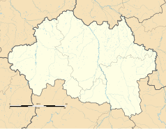 | |
Położenie na mapie Francji  | |
Położenie na mapie regionu Owernia-Rodan-Alpy  | |
| Strona internetowa | |
Według danych na rok 1990 gminę zamieszkiwały 253 osoby, a gęstość zaludnienia wynosiła 11 osób/km². W styczniu 2015 r. Le Bouchaud zamieszkiwało 210 osób, przy gęstości zaludnienia wynoszącej 9,3 osób/km².
Seamless Wikipedia browsing. On steroids.
Every time you click a link to Wikipedia, Wiktionary or Wikiquote in your browser's search results, it will show the modern Wikiwand interface.
Wikiwand extension is a five stars, simple, with minimum permission required to keep your browsing private, safe and transparent.
