Found in articles
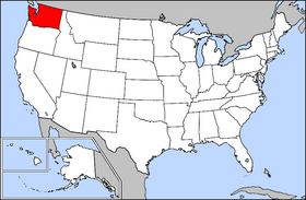
File:Map of USA highlighting Washington.png
280×183× (36228 bytes) Public domain map courtesy of [http://www.lib.utexas.edu/ The General Libraries, The University of Texas at Austin], modified to show
File:Map of Washington highlighting Yakima County.png
Public domain map courtesy of The General Libraries, The University of Texas at Austin, modified to show counties. See Wikipedia:U.S. county maps. The image
File:Pend Oreille-Clark Fork dams.jpg
{{Information |Description={{en|1=Maps of dams, drainage and estuaries along the Columbia River in North America (USA, Canada). Original caption: The Columbia
File:The water, energy, and food security nexus in Asia and the Pacific.pdf
Christian Severin Global Environment Facility (GEF), Washington, DC, USA
Amit Singh Ministry of Waterways and Environment, Suva, Fiji
Clare Stephens Hawkesbury
File:800px-Map of USA highlighting OCA Diocese of Washington and New York.png
I, the copyright holder of this work, hereby publish it under the following licenses: This file is licensed under the Creative Commons Attribution-Share
