File:Southern_Ocean_-_en.png
From Wikipedia, the free encyclopedia
Southern_Ocean_-_en.png (330 × 330 pixel, bogolo ba faele: 10 KB, Mohuta wa MIME: image/png)
Letlakala le letšwa Wikimedia Commons ebile le ka ba ke šumišwa ke di projeke tše dingwe.
Tlhaloso ya [letlakala https://commons.wikimedia.org/wiki/File:Southern_Ocean_-_en.png tlhaloso ya faele] le laetšwa kago latela.

|
This locator map image could be re-created using vector graphics as an SVG file. This has several advantages; see Commons:Media for cleanup for more information. If an SVG form of this image is available, please upload it and afterwards replace this template with
{{vector version available|new image name}}.
It is recommended to name the SVG file “Southern Ocean - en.svg”—then the template Vector version available (or Vva) does not need the new image name parameter. |
Kakaretšo
| DescriptionSouthern Ocean - en.png |
This file has no description, and may be lacking other information.
Please provide a meaningful description of this file. |
| Letšatšikgwedi | |
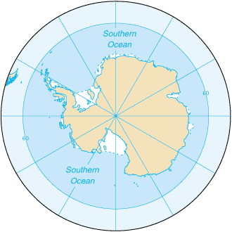
| Mothopo | CIA Factbook 2003: Southern Ocean (picture link is [1]) |
| Mongwadi | CIA |
| Other versions |
|
== Laesense ==
| Public domainPublic domainfalsefalse |
This image is in the public domain because it contains materials that originally came from the United States Central Intelligence Agency's World Factbook.
Bahasa Indonesia ∙ čeština ∙ Deutsch ∙ eesti ∙ English ∙ español ∙ Esperanto ∙ français ∙ galego ∙ hrvatski ∙ italiano ∙ Nederlands ∙ norsk nynorsk ∙ polski ∙ português ∙ sicilianu ∙ slovenščina ∙ suomi ∙ Türkçe ∙ Zazaki ∙ беларуская (тарашкевіца) ∙ македонски ∙ русский ∙ српски / srpski ∙ українська ∙ ქართული ∙ বাংলা ∙ தமிழ் ∙ മലയാളം ∙ 한국어 ∙ 日本語 ∙ 中文 ∙ 中文(简体) ∙ 中文(繁體) ∙ العربية ∙ +/− |
 |
Captions
Items portrayed in this file
depicts English
inception English
2003
Histori ya faele
Pinyeletša go letšatšikgwedi/nako go bona faela ka tsela yeo ebego e le ka gona nakong yeo.
| LetšatšiKgwedi/Nako | Nkgogorupo-Nala | Bogolo | Mošomiši | Comment | |
|---|---|---|---|---|---|
| bjale | 22:23, 22 Phato 2009 | | 330 × 330 (10 KB) | Serg!o | == Summary == Southern_Ocean (from en:) Map from [https://www.cia.gov/library/publications/the-world-factbook/geos/oo.html CIA Factbook 2003: Southern Ocean] (picture link is [https://www.cia.gov/library/publications/the-world-factbook/maps/oo-map.gif]). |
Tirišo ya Faele
Gago matlakala a hlomaganyago faeleng ye.
Global file usage
The following other wikis use this file:
- Usage on en.wikibooks.org
- Usage on en.wikisource.org
- Usage on it.wikipedia.org
- Usage on ko.wikipedia.org
- Usage on lld.wikipedia.org
- Usage on roa-tara.wikipedia.org
Metadata
Faele enale sedi yengwe, yeo ekabago e tšwa go khamera goba scanner tšeo di šumišitšwego go bopa faele ye. Sedi ye itsego ga ego goba gona go faele ye e fetolwago.
| Software used |
|
|---|---|
| File change date and time | 20:19, 14 Moranang 2004 |