File:Orange_watershed_plain.png
From Wikipedia, the free encyclopedia
Size of this preview: 800 × 515 pixels. Other resolutions: 320 × 206 pixels | 640 × 412 pixels | 1,150 × 741 pixels.
''resolution'' ya gofella (1,150 × 741 pixel, bogolo ba faele: 116 KB, Mohuta wa MIME: image/png)
Letlakala le letšwa Wikimedia Commons ebile le ka ba ke šumišwa ke di projeke tše dingwe.
Tlhaloso ya [letlakala https://commons.wikimedia.org/wiki/File:Orange_watershed_plain.png tlhaloso ya faele] le laetšwa kago latela.
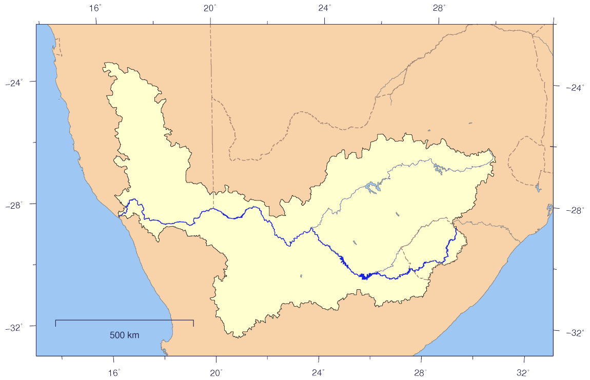
Kakaretšo
| DescriptionOrange watershed plain.png |
English: Course and Watershed of the Orange River with political boundaries.
Deutsch: Verlauf und Einzugsgebiet des Oranje mit Staatsgrenzen. |
| Letšatšikgwedi | |
| Mothopo | The map has been created with the Generic Mapping Tools: http://gmt.soest.hawaii.edu/ using additional public comain data from the VMAP0 data set. |
| Mongwadi | Imagico |
| Permission (Reusing this file) |
This file is licensed under the Creative Commons Attribution-Share Alike 2.5 Generic license.
|
| Other versions | Image:Orange_watershed_topo.png |
Laesense
I, the copyright holder of this work, hereby publish it under the following license:
This file is licensed under the Creative Commons Attribution-Share Alike 2.5 Generic license.
- You are free:
- to share – to copy, distribute and transmit the work
- to remix – to adapt the work
- Under the following conditions:
- attribution – You must give appropriate credit, provide a link to the license, and indicate if changes were made. You may do so in any reasonable manner, but not in any way that suggests the licensor endorses you or your use.
- share alike – If you remix, transform, or build upon the material, you must distribute your contributions under the same or compatible license as the original.
Captions
Add a one-line explanation of what this file represents
Items portrayed in this file
depicts English
creator English
some value
copyright status English
copyrighted English
inception English
25 Dibokwane 2007
media type English
image/png
Histori ya faele
Pinyeletša go letšatšikgwedi/nako go bona faela ka tsela yeo ebego e le ka gona nakong yeo.
| LetšatšiKgwedi/Nako | Nkgogorupo-Nala | Bogolo | Mošomiši | Comment | |
|---|---|---|---|---|---|
| bjale | 17:07, 25 Dibokwane 2007 | | 1,150 × 741 (116 KB) | Imagico | {{Information |Description= {{en|Course and Watershed of the Orange River with political boundaries.}} {{de|Verlauf und Einzugsgebiet des Oranje mit Staatsgrenzen.}} |Source=The map has been created with the [[:en:Generic Mapping Tools|Generic Mapping Too |
Tirišo ya Faele
Gago matlakala a hlomaganyago faeleng ye.
Global file usage
The following other wikis use this file:
- Usage on af.wikipedia.org
- Usage on en.wikipedia.org