File:LocationWesternSahara.png
From Wikipedia, the free encyclopedia
No higher resolution available.
LocationWesternSahara.png (250 × 115 pixels, file size: 5 KB, MIME type: image/png)
This file is from Wikimedia Commons and may be used by other projects. The description on its file description page there is shown below.
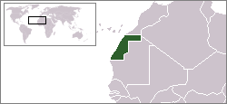
Location map for the Western Sahara.
Originally created for English Wikipedia by Vardion.
| Public domainPublic domainfalsefalse |
| This work has been released into the public domain by its author, Vardion at English Wikipedie. This applies worldwide. In some countries this may not be legally possible; if so: Vardion grants anyone the right to use this work for any purpose, without any conditions, unless such conditions are required by law.Public domainPublic domainfalsefalse |

|
File:LocationWesternSahara.svg is a vector version of this file. It should be used in place of this PNG file when not inferior.
File:LocationWesternSahara.png → File:LocationWesternSahara.svg
For more information, see Help:SVG.
|
 |
Captions
Add a one-line explanation of what this file represents
Items portrayed in this file
depicts English
media type English
image/png
File history
Click on a date/time to view the file as it appeared at that time.
| Date/Time | Thumbnail | Dimensions | Usere | Comment | |
|---|---|---|---|---|---|
| current | 19:11, 24 maye 2018 | | 250 × 115 (5 KB) | Koavf | Reverted to version as of 19:02, 4 December 2007 (UTC) |
| 18:40, 24 maye 2018 |  | 250 × 115 (5 KB) | محمد مدهون | Reverted to version as of 18:17, 15 November 2007 (UTC) | |
| 19:02, 4 desembre 2007 |  | 250 × 115 (5 KB) | Aboyado | is a map of Sahara, no of Marocco. STOP vandalismo in sahara related articles please. help admins | |
| 11:28, 4 desembre 2007 |  | 250 × 115 (5 KB) | Babylone~commonswiki | Reverted to version as of 18:17, 15 November 2007 | |
| 07:02, 19 novembre 2007 |  | 250 × 115 (5 KB) | Gandal el gris | ||
| 18:17, 15 novembre 2007 |  | 250 × 115 (5 KB) | Vispec | ||
| 14:15, 26 june 2006 |  | 250 × 115 (5 KB) | Satesclop | ||
| 12:07, 26 june 2006 |  | 250 × 115 (5 KB) | Satesclop | ||
| 04:58, 24 desembre 2004 |  | 250 × 115 (5 KB) | EugeneZelenko | Location map for the Western Sahara.<br/>Originally created for English Wikipedia by Vardion.<br/>{{PD}}<br/>Category:Country locator maps |
Linkes
The following 2 pages use this file:
Global file usage
The following other wikis use this file:
- Usage on ar.wikipedia.org
- Usage on bo.wikipedia.org
- Usage on bpy.wikipedia.org
- Usage on ca.wikipedia.org
- Usage on ckb.wikipedia.org
- Usage on da.wikipedia.org
- Usage on de.wikinews.org
- Usage on dsb.wikipedia.org
- Usage on en.wikipedia.org
- Usage on en.wikinews.org
- Usage on en.wiktionary.org
- Usage on es.wikipedia.org
- Usage on es.wikinews.org
- Usage on et.wikipedia.org
- Usage on fo.wikipedia.org
- Usage on frp.wikipedia.org
- Usage on gl.wiktionary.org
- Usage on he.wikivoyage.org
- Usage on hr.wikipedia.org
- Usage on incubator.wikimedia.org
- Usage on it.wikinews.org
- Usage on it.wikivoyage.org
- Usage on ja.wikipedia.org
- Usage on jv.wikipedia.org
- Usage on lij.wikipedia.org
- Usage on li.wikipedia.org
- Usage on lt.wiktionary.org
- Usage on lv.wiktionary.org
- Usage on nl.wikivoyage.org
- Usage on nn.wikipedia.org
- Usage on no.wikipedia.org
- Usage on pam.wikipedia.org
- Usage on pt.wikipedia.org
View more global usage of this file.
Retrieved from "https://nov.wikipedia.org/wiki/File:LocationWesternSahara.png"