Remove ads
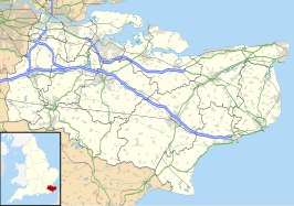
Oare is een civil parish in het bestuurlijke gebied Swale, in het Engelse graafschap Kent.
Geplaatst op:
13-8-2010
13-8-2010
Dit artikel is een beginnetje over landen & volken. U wordt uitgenodigd om op bewerken te klikken om uw kennis aan dit artikel toe te voegen.
| Civil parish in Engeland | |||
|---|---|---|---|
| Situering | |||
| Regio | South East England | ||
| Graafschap | Kent | ||
| District | Swale | ||
| Coördinaten | 51° 19' NB, 0° 53' OL | ||
| Algemeen | |||
| Oppervlakte | 4,6283 km² | ||
| Inwoners (2011) |
513 (111 inw./km²) | ||
| Overig | |||
| ONS-code | E04005066 | ||
| Foto's | |||
 | |||
| Windmolen van Oare | |||
| |||
Wikiwand in your browser!
Seamless Wikipedia browsing. On steroids.
Every time you click a link to Wikipedia, Wiktionary or Wikiquote in your browser's search results, it will show the modern Wikiwand interface.
Wikiwand extension is a five stars, simple, with minimum permission required to keep your browsing private, safe and transparent.
Remove ads
