Hertford is een civil parish in het bestuurlijke gebied East Hertfordshire en vormt de bestuurszetel van het Engelse graafschap Hertfordshire. De plaats ligt aan de rivier de Lea. In 2011 telde Hertford 26.783 inwoners.
 Kasteel van Hertford
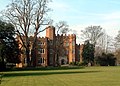
 St Andrew, Hertford


| Civil parish in Engeland | |||
|---|---|---|---|
 | |||
| Situering | |||
| Regio | East of England | ||
| Graafschap | Hertfordshire | ||
| District | East Hertfordshire | ||
| Coördinaten | 51° 48' NB, 0° 5' WL | ||
| Algemeen | |||
| Oppervlakte | 18,1953 km² | ||
| Inwoners (2011) |
26783 (1472 inw./km²) | ||
| Overig | |||
| Postcode(s) | SG14 and SG13 | ||
| Netnummer(s) | 01992 | ||
| Grid code | TL325125 | ||
| Post town | HERTFORD | ||
| ONS-code | E04004734 | ||
| Website | Officiële website | ||
| Foto's | |||
 | |||
| Parliament Square in het centrum van Hertford | |||
| |||
Geboren
- Catharina van Lancaster, koningin-gemalin van Castilië van 1393-1406 en koningin-regentes van 1406-1418
- Dani Filth, zanger en tekstschrijver van de Britse metalband Cradle of Filth
- George Ezra, zanger
Wikiwand in your browser!
Seamless Wikipedia browsing. On steroids.
Every time you click a link to Wikipedia, Wiktionary or Wikiquote in your browser's search results, it will show the modern Wikiwand interface.
Wikiwand extension is a five stars, simple, with minimum permission required to keep your browsing private, safe and transparent.
