File:4516-Oxford-map-1510x1384.jpg
Uit Wikipedia, de vrije encyclopedia
Oorspronkelijk bestand (1.510 × 1.384 pixels, bestandsgrootte: 506 kB, MIME-type: image/jpeg)
Onderstaande beschrijving komt van de beschrijving van het bestand daar.
| Beschrijving4516-Oxford-map-1510x1384.jpg |
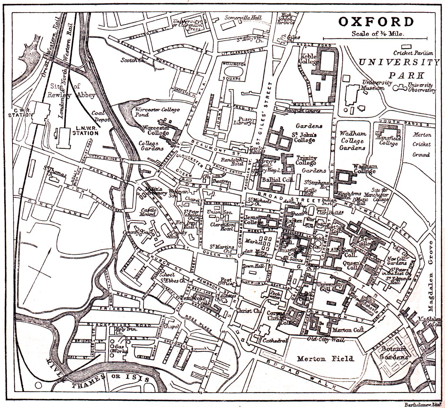
English: public domain image from http://fromoldbooks.org/HarmsworthEncyclopaedia/pages/4516-Oxford-map/1510x1384.html
"Overview map of en:Oxford from 1900 or so, showing the en:River Thames of Isis, giving the names of almost all the streets, marking the colleges of en:Oxford University, the railway and other items." Note that Christ Church College is not shaded as a college, for unknown reasons. |
| Datum | 21 oktober 2005 (originele uploaddatum) |
| Bron | Verplaatst vanaf en.wikipedia naar Commons. |
| Auteur | De originele uploader was Roke op de Engelstalige Wikipedia |
Licentie
| Public domainPublic domainfalsefalse |
|
Dit werk bevindt zich in het publiek domein in landen en gebieden waar de auteursrechttermijn het leven van de auteur plus 70 jaar of minder is.
| |
| Van dit bestand is vastgesteld dat er geen bekende auteursrechtaanspraken op rusten, alle aanverwante en naburige rechten daarbij inbegrepen. | |
https://creativecommons.org/publicdomain/mark/1.0/PDMCreative Commons Public Domain Mark 1.0falsefalse
Oorspronkelijk uploadlogboek
- 2005-10-21 01:32 Roke 1510×1384× (517778 bytes) public domain image from http://fromoldbooks.org/HarmsworthEncyclopaedia/pages/4516-Oxford-map/1510x1384.html
Bijschriften
Items getoond in dit bestand
beeldt af
21 okt 2005
image/jpeg
d3a9d99482c63ed2fde82860bf05985e9d514dc2
517.778 byte
1.384 pixel
1.510 pixel
Bestandsgeschiedenis
Klik op een datum/tijd om het bestand te zien zoals het destijds was.
| Datum/tijd | Miniatuur | Afmetingen | Gebruiker | Opmerking | |
|---|---|---|---|---|---|
| huidige versie | 13 mrt 2009 00:34 | | 1.510 × 1.384 (506 kB) | Kordas | {{Information |Description={{en|public domain image from http://fromoldbooks.org/HarmsworthEncyclopaedia/pages/4516-Oxford-map/1510x1384.html "Overview map of en:Oxford from 1900 or so, showing the en:River Thames of Isis, giving the names of a |
Bestandsgebruik
Dit bestand wordt op de volgende pagina gebruikt:
Globaal bestandsgebruik
De volgende andere wiki's gebruiken dit bestand:
Metadata
Dit bestand bevat metadata met EXIF-informatie, die door een fotocamera, scanner of fotobewerkingsprogramma toegevoegd kan zijn.
| Opmerking bij JPEG-bestand | www.holoweb.net/~liam/pictures/oldbooks/ |
|---|