Bestand:WalesCaerphilly.png
Uit Wikipedia, de vrije encyclopedia
Geen hogere resolutie beschikbaar.
WalesCaerphilly.png (200 × 225 pixels, bestandsgrootte: 22 kB, MIME-type: image/png)
Dit is een bestand van Wikimedia Commons.
Onderstaande beschrijving komt van de beschrijving van het bestand daar.
Onderstaande beschrijving komt van de beschrijving van het bestand daar.
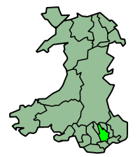
Caerphilly in Wales
Map by en:User:Morwen
Русский: Карта_Кэрфилли

|
Toestemming wordt verleend voor het kopiëren, verspreiden en/of wijzigen van dit document onder de voorwaarden van de GNU-licentie voor vrije documentatie, versie 1.2 of enige latere versie als gepubliceerd door de Free Software Foundation; zonder Invariant Sections, zonder Front-Cover Texts, en zonder Back-Cover Texts. Een kopie van de licentie is opgenomen in de sectie GNU-licentie voor vrije documentatie.http://www.gnu.org/copyleft/fdl.htmlGFDLGNU Free Documentation Licensetruetrue |
| Dit bestand is gelicenseerd onder de Creative Commons-licentie Naamsvermelding-Gelijk delen 3.0 Unported | ||
| ||
| Deze licentietag is toegevoegd aan dit bestand in verband met de GFDL licentie-update.http://creativecommons.org/licenses/by-sa/3.0/CC BY-SA 3.0Creative Commons Attribution-Share Alike 3.0truetrue |
Bijschriften
Beschrijf in één regel wat dit bestand voorstelt
Items getoond in dit bestand
beeldt af
Bestandsgeschiedenis
Klik op een datum/tijd om het bestand te zien zoals het destijds was.
| Datum/tijd | Miniatuur | Afmetingen | Gebruiker | Opmerking | |
|---|---|---|---|---|---|
| huidige versie | 27 jun 2006 01:27 | | 200 × 225 (22 kB) | Nichtbesserwisser | Caerphilly in Wales Map by en:User:Morwen Category:Maps of Wales {{GFDL}} |
Bestandsgebruik
Dit bestand wordt op de volgende 2 pagina's gebruikt:
Globaal bestandsgebruik
De volgende andere wiki's gebruiken dit bestand:
- Gebruikt op be.wikipedia.org
- Gebruikt op bg.wikipedia.org
- Gebruikt op br.wikipedia.org
- Gebruikt op en.wikipedia.org
- Caerphilly
- A465 road
- Taff Trail
- Rhymney line
- Monmouthshire and Brecon Canal
- Ebbw Valley Railway
- Hengoed railway station
- Transport in Wales
- Pengam railway station
- Rhymney railway station
- Bargoed railway station
- Pontlottyn railway station
- Tir-Phil railway station
- Brithdir railway station
- Gilfach Fargoed railway station
- Ystrad Mynach railway station
- Llanbradach railway station
- Aber railway station
- Caerphilly railway station
- Risca and Pontymister railway station
- Crosskeys railway station
- Newbridge railway station (Wales)
- Newport Bus
- Celtic Trail cycle route
- A469 road
- A468 road
- National Cycle Route 4
- Stagecoach South Wales
- Rhymney Valley Ridgeway Walk
- Cistercian Way (Wales)
- Sirhowy Valley Ridgeway Walk
- Energlyn & Churchill Park railway station
- Template:Transport in Caerphilly County Borough
- Trunk roads in Wales
- Blackwood Interchange
- Bargoed Interchange
- Gebruikt op gv.wikipedia.org
- Gebruikt op no.wikipedia.org
- Gebruikt op pt.wikipedia.org
- Gebruikt op ru.wikipedia.org
- Gebruikt op uk.wikipedia.org
Overgenomen van "https://nl.wikipedia.org/wiki/Bestand:WalesCaerphilly.png"