Bestand:Chautauqua_County,_New_York_Divisions.png
Uit Wikipedia, de vrije encyclopedia
Grootte van deze voorvertoning: 478 × 599 pixels. Andere resoluties: 191 × 240 pixels | 596 × 747 pixels.
Oorspronkelijk bestand (596 × 747 pixels, bestandsgrootte: 130 kB, MIME-type: image/png)
Dit is een bestand van Wikimedia Commons.
Onderstaande beschrijving komt van de beschrijving van het bestand daar.
Onderstaande beschrijving komt van de beschrijving van het bestand daar.
Beschrijving
| BeschrijvingChautauqua County, New York Divisions.png |
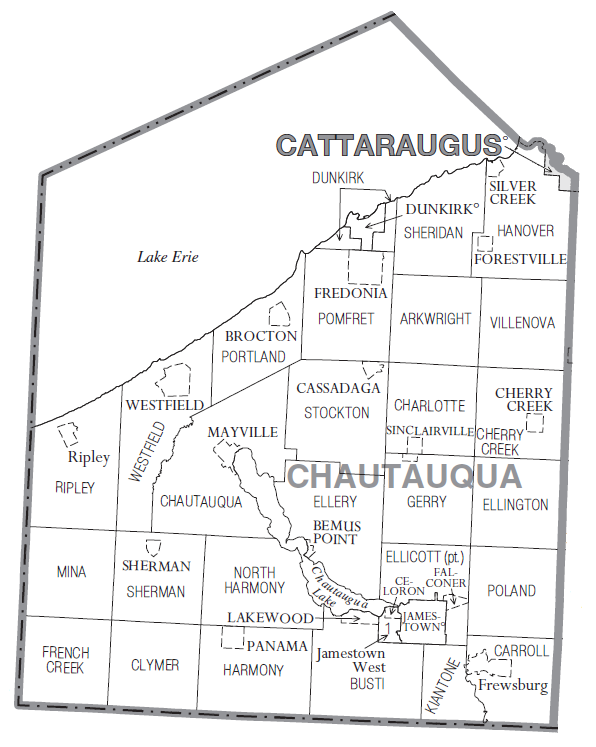
English: Map of Chautauqua County, NY showing cities, towns, villages and CDPs. Taken from U.S. Census Bureau website and modified by Reelcheeper. |
| Datum | |
| Bron | http://www2.census.gov/geo/maps/general_ref/cousub_outline/cen2k_pgsz/ny_cosub.pdf |
| Auteur | U.S. Census Bureau |
Licentie
| Public domainPublic domainfalsefalse |
This image or file is a work of a United States Census Bureau employee, taken or made as part of that person's official duties. As a work of the U.S. federal government, the image is in the public domain.
English ∙ español ∙ 日本語 ∙ македонски ∙ മലയാളം ∙ português do Brasil ∙ русский ∙ українська ∙ עברית ∙ +/− |
 |
Bijschriften
Beschrijf in één regel wat dit bestand voorstelt
Items getoond in dit bestand
beeldt af
20 jul 2011
image/png
86c2c121583ffa1d5de9d41bf69f14bb00a8cc92
133.269 byte
747 pixel
596 pixel
Bestandsgeschiedenis
Klik op een datum/tijd om het bestand te zien zoals het destijds was.
| Datum/tijd | Miniatuur | Afmetingen | Gebruiker | Opmerking | |
|---|---|---|---|---|---|
| huidige versie | 21 jul 2011 17:17 | | 596 × 747 (130 kB) | Reelcheeper | uploaded a narrower version of the image (it will fit better into Wikipedia articles) |
| 21 jul 2011 00:15 |  | 748 × 747 (103 kB) | Reelcheeper |
Bestandsgebruik
Dit bestand wordt op de volgende pagina gebruikt:
Globaal bestandsgebruik
De volgende andere wiki's gebruiken dit bestand:
- Gebruikt op en.wikipedia.org
- Gebruikt op ja.wikipedia.org
- Gebruikt op ku.wikipedia.org
- Gebruikt op pt.wikipedia.org