Template intended to simplify adding a standardized and formatted caption below a map indicating the location of something (e.g. a country), possibly referring to the map's main region and optionally also to a shown subregion. Original use within infoboxes (e.g. see articles on European countries). For a complete set of elements of reasonable length, a width of (minimally) 250px (without extra padding or margins) should be available.
Required parameters shown in bold italics
थप जानकारी Parameter, Description ...
| Parameter | Description | Default |
|---|
| countryprefix |
- Neither linked nor styled prefix e.g. "the" (for articles named e.g. "United Kingdom", "Czech Republic", "Netherlands").
| – |
| country |
- Only if the country name at the map should not be identical to the article name (e.g. "Metropolitan France").
- Template sets [[...]] (if article or redirect exists).
| <ढाँचा:Tsp> |
| location |
- Only if colour is not used and its default is not appropriate: Description identifying country's location (e.g. "circled in inset")
- This parameter must never be empty; "none" suppresses it. If passed, location_color cannot be shown.
| – |
| location_color |
- Only if description is not used: Colour identifying country's location; "none" suppresses the default.
| orange |
| region |
- Name (or equally extremely short description) for approximately the entire area depicted by the map.
- special: "[[Antarctica]]" shown as "on Antarctica",
- special: "[[Middle East]]", "[[Arctic Circle]]" or "[[Pacific Ocean]]" shown as "in the ...",
- special: versus any other: shown as "in ...", e.g. "[[Africa]]" shown as "in Africa"
| – |
| region_color |
- Colour identifying region; "none" suppresses the default.
| white |
| subregion |
- Subregion indicated within region (only if used: aligning both region and subregion lines to the left, else single region line centered as top line)
- Must not occur without parameter region.
- special: "[[EU]]" or "[[European Union]]" shown as "in the European Union",
- special: versus any other: shown as "in ...", e.g. "the [[Caucasus]]" shown as "in the Caucasus"
| – |
| subregion_color |
- Colour identifying subregion; "none" suppresses showing the default.
| tan |
| legend |
- Filename of image providing a map legend.
| – |
बन्द गर्नुहोस्
- Note
If country, region or subregion is exactly the name of a page in article space, the template automatically creates a link to it. You can still put a link here manually, using the usual syntax.
| Code | Raw result (in unformatted box, compare to handling in Infobox) |
{{map caption}} |
|
Map caption/कागजात-अवस्थिति (orange) |
|
{{map caption |region=Europe |legend=European location legend en.png}} |
|
Map caption/कागजात-अवस्थिति (orange) Europe-এ (সাদা) – [व्याख्या] |
|
{{map caption |countryprefix=the |region=Europe |subregion=the [[European Union]] |legend=European location legend en.png}} |
|
the Map caption/कागजात-अवस्थिति (orange) – Europe-এ (তামাটে & সাদা)
– the European Union-এ (তামাটে) – [व्याख्या] |
|
Typical sample for an article on a European Union member that needs no "the" before its name, for otherwise identical output:
{{map caption |region=Europe |subregion=EU |legend=European location legend en.png}} |
|
Map caption/कागजात-अवस्थिति (orange) – Europe-এ (তামাটে & সাদা)
– EU-এ (তামাটে) – [व्याख्या] |
|
थप जानकारी राजधानी, आधिकारिक भाषाहरू ...
| Infobox usage of code (as intended) — in which the alignment, the padding/margins, and font are rendered differently (this template adjusts for that infobox): |
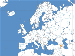
Sample for article named 'Armenia', about a non-European country
{{Infobox Country or territory|

  |common_name             = Armenia

  |image_map               = Europe location ARM.png

  |map_caption             = {{map caption}}

  |(some required infobox parameters omitted from sample)

}}
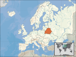
Sample for article named 'Belarus', about a non-member of the EU
{{Infobox Country or territory|

  |common_name             = Belarus

  |image_map               = Europe location BLR.png

  |map_caption             = {{map caption |region=Europe |legend=European location legend en.png}}

  |(some required infobox parameters omitted from sample)

}}
Sample for article named 'Netherlands', about a member of the EU
{{Infobox Country or territory|

  |common_name             = the Netherlands

  |image_map               = EU location NED.png

  |map_caption             = {{map caption |countryprefix=the |region=Europe |subregion=the [[European Union]] |legend=European location legend en.png}}

  |(some required infobox parameters omitted from sample)

}}
|
Net result — The three simplified samples above, shown here side by side
Net result — (called here without country parameter, and with placeholder values for population to prevent error messages): |
 Map caption/कागजात-अवस्थिति (orange) | | राजधानी | x |
|---|
| आधिकारिक भाषाहरू | x |
|---|
| सरकार | x |
|---|
|
• जम्मा | १० किमी२ (३.९ वर्ग माइल) |
|---|
• घनत्व | १० /किमी2 (२५.९ /वर्ग माइल) (0) |
|---|
| मुद्रा | x (x) |
|---|
| समय क्षेत्र | अन्तर्राष्ट्रिय प्रमाणिक समय0 (x) |
|---|
| टेलिफोन कोड | 0 |
|---|
| इन्टरनेट डोमेन | x |
|---|
|
 Map caption/कागजात-अवस्थिति (orange) Europe-এ (সাদা) – [व्याख्या] | | राजधानी | x |
|---|
| आधिकारिक भाषाहरू | x |
|---|
| सरकार | x |
|---|
|
• जम्मा | १० किमी२ (३.९ वर्ग माइल) |
|---|
• घनत्व | १० /किमी2 (२५.९ /वर्ग माइल) (0) |
|---|
| मुद्रा | x (x) |
|---|
| समय क्षेत्र | अन्तर्राष्ट्रिय प्रमाणिक समय0 (x) |
|---|
| टेलिफोन कोड | 0 |
|---|
| इन्टरनेट डोमेन | x |
|---|
|
 the Map caption/कागजात-अवस्थिति (orange) – Europe-এ (তামাটে & সাদা)
– the European Union-এ (তামাটে) – [व्याख्या] | | राजधानी | x |
|---|
| आधिकारिक भाषाहरू | x |
|---|
| सरकार | x |
|---|
|
• जम्मा | १० किमी२ (३.९ वर्ग माइल) |
|---|
• घनत्व | १० /किमी2 (२५.९ /वर्ग माइल) (0) |
|---|
| मुद्रा | x (x) |
|---|
| समय क्षेत्र | अन्तर्राष्ट्रिय प्रमाणिक समय0 (x) |
|---|
| टेलिफोन कोड | 0 |
|---|
| इन्टरनेट डोमेन | x |
|---|
|
|
बन्द गर्नुहोस्


