ഹോഗ്ഗർ മൌണ്ടൻസ്
From Wikipedia, the free encyclopedia
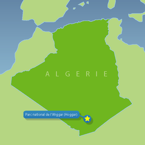
ഹോഗ്ഗർ മൗണ്ടൻസ് (Arabic: جبال هقار, Berber: idurar n Ahaggar, Tuareg: Idurar Uhaggar), തെക്കൻ അൾജീരിയയിലെ മദ്ധ്യ സഹാറയിൽ ഉത്തരായനരേഖയ്ക്കു സമാന്തരമായി സ്ഥിതിചെയ്യുന്ന ഒരു മലയോര പ്രദേശമാണ്. അഹാഗ്ഗർ മൗണ്ടൻസ് എന്നും അറിയപ്പെടുന്നു. ഈ മലനിരകൾ ഏകദേശം 550,000 ചതുരശ്ര കിലോമീറ്റർ (212,000 ചതുരശ്ര മൈൽ) പ്രദേശത്തു വ്യാപിച്ചുകിടക്കുന്നു.[1]
| ഹോഗ്ഗർ മൗണ്ടൻസ് | |
|---|---|
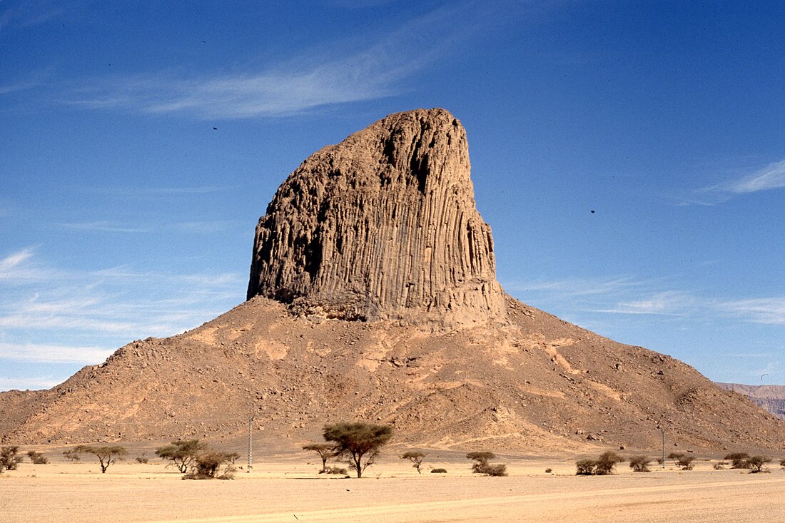
 Landscape of the Assekrem region in the Hoggar | |
| ഉയരം കൂടിയ പർവതം | |
| Peak | Mount Tahat |
| Elevation | 2,908 m (9,541 ft) |
| Coordinates | 23°17′20″N 05°32′01″E |
| മറ്റ് പേരുകൾ | |
| Native name | جبال هقار Idurar Uhaggar Idurar n Ahaggar |
| ഭൂമിശാസ്ത്രപരമായ പ്രത്യേകതകൾ | |
| Country | Algeria |
| Hoggar National Park | |
|---|---|
ഐ.യു.സി.എൻ. ഗണം II (ദേശീയോദ്യാനം) | |
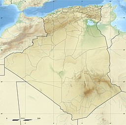
 Locator map | |
| Location | Tamanrasset Province, Algeria |
| Nearest city | Tamanrasset |
| Coordinates | 22°08′N 6°10′E |
| Area | 3,800 km2 (1,500 sq mi) |
| Established | 1987 |

ചരിത്രം
അൾജീരിയൻ തലസ്ഥാനമായ അൾജിയേർസിന് ഏകദേശം 1,500 കി.മീ (930 മൈൽ) തെക്കായിട്ടാണ് ഈ മലയോര മേഖല സ്ഥിതി ചെയ്യുന്നത്. ഭൂരിഭാഗവും പാറക്കെട്ടുകളടങ്ങിയ മരുഭൂമിയായ ഈ പ്രദേശം സമുദ്രനിരപ്പിൽനിന്ന് 900 മീറ്ററിലധികം (3,000 അടി) ഉയരത്തിലാണ് സ്ഥിതിചെയ്യുന്നത്. ഈ പ്രദേശത്തെ ഏറ്റവും ഉയരമുള്ള പർവ്വതമായ മൌണ്ട് തഹാത്ത് 2,908 മീറ്റർ (9,541 അടി) ഉയരമുള്ളതാണ്.[2] ഏകദേശം 2 ബില്ല്യൻ വർഷങ്ങൾവരെ പഴക്കമുള്ള മെറ്റാമോർഫിക് ശിലകൾ അടങ്ങിയതാണ് പർവ്വതനിരകൾ. എന്നിരുന്നാലും അടുത്തകാലത്തെ അഗ്നിപർവ്വത പ്രവർത്തനങ്ങൾ കാരണമായി പുതിയ പാറകളടങ്ങിയ പ്രദേശങ്ങളും കണ്ടുവരുന്നു.[3]
അവലംബം
Wikiwand in your browser!
Seamless Wikipedia browsing. On steroids.
Every time you click a link to Wikipedia, Wiktionary or Wikiquote in your browser's search results, it will show the modern Wikiwand interface.
Wikiwand extension is a five stars, simple, with minimum permission required to keep your browsing private, safe and transparent.


