കോട്സ്വോൾഡ്സ്
From Wikipedia, the free encyclopedia
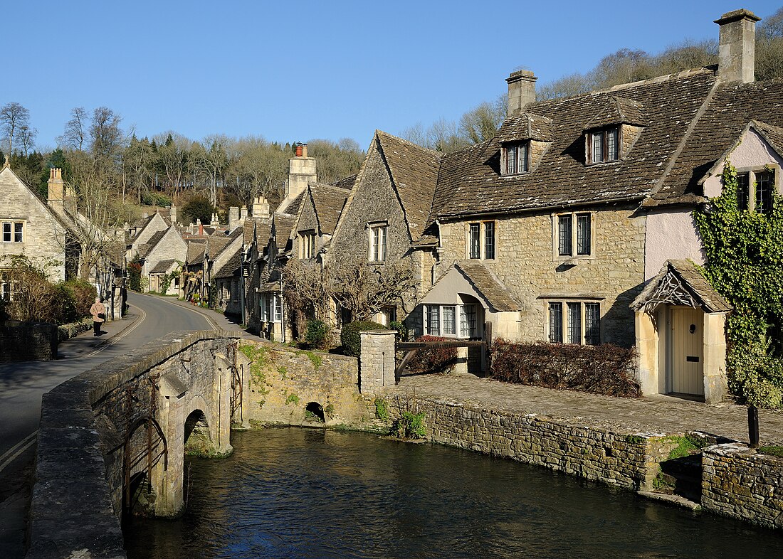
ഇംഗ്ലണ്ടിലെ ഒരു പ്രദേശമാണ് കോട്സ്വോൾഡ്സ്[1] ഇംഗ്ലണ്ടിന്റെ ഹൃദയം എന്നും അറിയപ്പെടുന്നു. തെക്ക് പടിഞ്ഞാറ് മുതൽ വടക്കുകിഴക്ക് വരെ ആറ് കൗണ്ടികൾ ഉൾപ്പെടുന്ന ഒരു മലയോര ഭൂപ്രകൃതിയാണിത്. 1966 ൽ കോട്സ്വോൾഡ് കുന്നുകളെ മികച്ച പ്രകൃതി സൗന്ദര്യ മേഖലയായി തരംതിരിച്ചു. മധ്യകാലഘട്ടത്തിൽ ഈ പ്രദേശം കമ്പിളി കച്ചവടത്തിൽ നിന്ന് വളരെയധികം ലാഭം നേടുകയും ഈ സമ്പത്ത് ഉപയോഗിച്ച് ദേവാലയങ്ങളുടെ നിർമ്മാണം നടത്തി. ഈ പ്രദേശത്തെ കല്ലിന്റെ ചുണ്ണാമ്പുകല്ലു പോലുള്ള സ്വഭാവം മൂലം ഇതുപയോഗിച്ചു നിർമ്മിച്ച ദേവാലയങ്ങളെ കമ്പിളി പള്ളികൾ എന്നു വിളിക്കുന്നു. പല ഗ്രാമങ്ങളിലും ചെറിയ പട്ടണങ്ങളിലും ഈ കല്ലുകൾ നിർമ്മാണ സാമഗ്രികളായി ഉപയോഗിച്ചു. സമ്പന്നരായ ലണ്ടനുകാർക്ക് പലപ്പോഴും ഇവിടെ മറ്റൊരു താമസകേന്ദ്രം ഉള്ളതിനാൽ ഈ പ്രദേശം ഇപ്പോൾ സമ്പന്നമാണ്. ഇവിടുത്തെ ഏറ്റവും ഉയർന്ന പ്രദേശം 1083 അടി ഉയരത്തിലാണ് ഉള്ളത്.
| Cotswolds | |
|---|---|
 Castle Combe, a Cotswolds village with buildings made of Cotswold stone | |
 Location of the Cotswolds within England | |
| Location | England |
| Coordinates | 51°48′N 2°2′W |
| Area | 2,038 കി.m2 (787 ച മൈ) |
| Established | 1966 |
| Named for | cot + wold, 'sheep enclosure in rolling hillsides' |
| Website | www |
അവലംബം
പുറത്തേക്കുള്ള കണ്ണികൾ
Wikiwand in your browser!
Seamless Wikipedia browsing. On steroids.
Every time you click a link to Wikipedia, Wiktionary or Wikiquote in your browser's search results, it will show the modern Wikiwand interface.
Wikiwand extension is a five stars, simple, with minimum permission required to keep your browsing private, safe and transparent.
