Attēls:Lage_der_kreisfreien_Stadt_Münster_in_Deutschland.png
From Wikipedia, the free encyclopedia
Augstāka izšķirtspēja nav pieejama.
Lage_der_kreisfreien_Stadt_Münster_in_Deutschland.png (176 × 234 pikseļi, faila izmērs: 3 KB, MIME tips: image/png)
| Šis fails ir no Vikikrātuves. Tā apraksts no attēla lapas Vikikrātuvē ir parādīts zemāk. Vikikrātuve ir brīvi licencēta failu krātuve. Tu vari tai palīdzēt. |
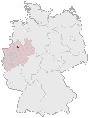
- Beschreibung: Lage der kreisfreien Stadt Münster in Deutschland
- Quelle: de:Bild:Lage der kreisfreien Stadt Münster in Deutschland.GIF (Karte erstellt auf der Grundlage der opengeodb.de-Umrisse - GNU-FDL)
- Zeichner: Geograv
- Datum der Erstellung: unbekannt (hochgeladen um 23:38, 28. Dez 2004, von Geograv (3071 Byte))
- Andere Versionen: keine
- Hinweise: Umwandlung in das PNG-Format durch Blaite
- Lizenz: (gilt im Wortlaut nur für das Quellbild von opengeodb.de)
This image was generated with OpenGeoDB. The information there is placed in the public domain, images generated from OpenGeoDB are derivative works without passing the threshold of creativity, they are therefore also public domain.
| Public domainPublic domainfalsefalse |
| This work is ineligible for copyright and therefore in the public domain because it consists entirely of information that is common property and contains no original authorship. |
Faila hronoloģija
Uzklikšķini uz datums/laiks kolonnā esošās saites, lai apskatītos, kā šis fails izskatījās tad.
| Datums/Laiks | Attēls | Izmēri | Dalībnieks | Komentārs | |
|---|---|---|---|---|---|
| tagadējais | 2005. gada 16. jūlijs, plkst. 08.54 | | 176 × 234 (3 KB) | Holger I. |
Faila lietojums
Šo failu izmanto šajā 1 lapā:
Globālais faila lietojums
Šīs Vikipēdijas izmanto šo failu:
- Izmantojums bar.wikipedia.org
- Izmantojums de.wikinews.org
- Izmantojums fy.wikipedia.org
- Izmantojums is.wikipedia.org
- Izmantojums mn.wikipedia.org
- Izmantojums no.wikipedia.org
- Izmantojums oc.wikipedia.org
- Izmantojums pl.wikivoyage.org
- Izmantojums zh.wikipedia.org