Plaetje:California_map_showing_Kern_County.png
From Wikipedia, the free encyclopedia
Gein hoeger resolutie besjikbaar.
California_map_showing_Kern_County.png ((200 × 231 pixel, besjtandsgruutde: 22 kB, MIME type: image/png))
Dit besjtandj kump van Wikimedia Commons en kin ouch in anger projekte gebroek waere. De pagina mit de besjtandjsbesjrieving wurt hiejónger weergegaeve.
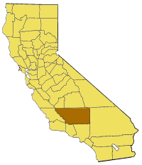
Map of Kern county in California. From en:

|
Toesteumming wert verleend veur t kopiëre, verspreide en/of wiezige van dit document onger de veurwaerd van de GNU-licentie veur vrieje documentatie, versie 1.2 of einige latere versie es gepubliceerd door de Free Software Foundation; zonger Invariant Sections, zonger Front-Cover Texts, en zonger Back-Cover Texts. n kopie van de licentie is opgenomme in de sectie GNU-licentie veur vrieje documentatie.http://www.gnu.org/copyleft/fdl.htmlGFDLGNU Free Documentation Licensetruetrue |
| Dit bestandj steit gelicenseerdj óngere Creative Commons Attribution-Share Alike 3.0 Unported lisensje. | ||
| ||
| Dees licentie-tag woort tougevoeg aon dit bestand in verband mèt de GFDL licentie-update.http://creativecommons.org/licenses/by-sa/3.0/CC BY-SA 3.0Creative Commons Attribution-Share Alike 3.0truetrue |
Bijschriften
Beschrijf in één regel wat dit bestand voorstelt
Items getoond in dit bestand
beeldt af Nederlands
auteursrechtenstatus Nederlands
auteursrechtelijk beschermd Nederlands
MIME-type Nederlands
image/png
checksum Nederlands
410baf5891fe6c726e86f69c3abd8f27b8377e6e
datagrootte Nederlands
22.733 byte
hoogte Nederlands
231 pixel
breedte Nederlands
200 pixel
Besjtandshistorie
Klik op 'ne datum/tied óm 't besjtand te zeen wie 't oetzaog op det tiedsjtip.
| Datum/Tied | Miniatuurplaetje | Aafmaetinge | Gebroeker | Kómmentaar | |
|---|---|---|---|---|---|
| hujig | 1 jul 2005 19:03 | | 200 × 231 (22 kB) | Pyramide~commonswiki | Map of Kern county in California. From en: {{GFDL}} Category:Maps of counties in California |
Plaetjesverwiezinge
Dit plaetje weurt op de volgende pazjena's gebroek:
Globaal besjtandjsgebroek
De volgende anger wiki's gebroeke dit bestandj:
- Gebroek in bg.wikipedia.org
- Gebroek in en.wikipedia.org
- Brown Peak (Kern County, California)
- Wonder Acres, Kern County, California
- Cache Creek (Kern County, California)
- Lost Hills
- Bear Mountain (Kern County, California)
- Edwards, California
- Keyesville, California
- Cantil, California
- Honda Proving Center of California
- Locarno Mine
- El Paso Mountains Wilderness
- Garlock, California
- Indian Wells (Kern County, California)
- Rand Mountains
- Fremont Valley
- Desert Tortoise Natural Area
- El Paso Mountains
- Scodie Mountains
- Greenhorn Mountains
- Jawbone–Butterbredt Area of Critical Environmental Concern
- Willow Springs, Kern County, California
- Famoso, California
- Walker Basin
- Template:KernCountyCA-geo-stub
- White Wolf Fault
- San Emigdio Mountain
- Sawmill Mountain
- Cerro Noroeste
- Grouse Mountain (California)
- Brush Mountain (Kern County, California)
- Cummings Mountain (California)
- Independence dike swarm
- Bealville, California
- Antimony Peak
- Eagle Rest Peak
- Tecuya Mountain
- South Lake, Kern County, California
- Edison, California
- Antelope Hills, California
- Bacon Hills
- Bissell Hills
- Black Hills (Kern County)
- Buena Vista Hills (Kern County)
- Elk Hills
- Horned Toad Hills
- Little Signal Hills
- Pleito Hills
- Rosamond Hills
- Shale Hills
Bekiek wikiwied gebroek van dit bestandj.
Aafkomstig van Wikipedia, de Vriej Encyclopedie. "https://li.wikipedia.org/wiki/Plaetje:California_map_showing_Kern_County.png"