File:Map_Bih_entities-he.png
From Wikipedia, the free encyclopedia
Gruutde van dees veurvertuining: 633 × 599 pixels. Anger resoluties: 254 × 240 pixels | 507 × 480 pixels | 811 × 768 pixels | 1.103 × 1.044 pixels.
Oearsprunkelik bestandj ((1.103 × 1.044 pixel, besjtandsgruutde: 53 kB, MIME type: image/png))
Dit besjtandj kump van Wikimedia Commons en kin ouch in anger projekte gebroek waere. De pagina mit de besjtandjsbesjrieving wurt hiejónger weergegaeve.
| BesjrievingMap Bih entities-he.png |
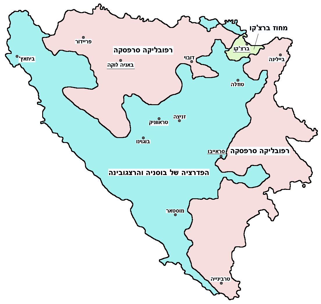
English: Federation of Bosnia and Herzegovina, Republika Srpska and Brčko district.
עברית: הפדרציה של בוסניה והרצגובינה, רפובליקה סרפסקה ומחוז ברצ'קו. |
|||
| Datum | ||||
| Brón | Image:Map Bih entities.png | |||
| Sjriever | User:PANONIAN (translated by User:Gilado) | |||
| Permissie (Hergebroek van dit besjtandj) |
|
Bijschriften
Beschrijf in één regel wat dit bestand voorstelt
Items getoond in dit bestand
beeldt af Nederlands
licentie Nederlands
datum van oprichting of creatie Nederlands
7 sep 2009
Besjtandshistorie
Klik op 'ne datum/tied óm 't besjtand te zeen wie 't oetzaog op det tiedsjtip.
| Datum/Tied | Miniatuurplaetje | Aafmaetinge | Gebroeker | Kómmentaar | |
|---|---|---|---|---|---|
| hujig | 5 okt 2012 16:34 | | 1.103 × 1.044 (53 kB) | PANONIAN | improved version |
| 7 sep 2009 15:02 |  | 700 × 615 (37 kB) | Gilado | {{Information |Description={{en|1=Federation of Bosnia and Herzegovina, Republika Srpska and Brčko district.}} {{he|1=הפדרציה של בוסניה והרצגובינה, רפובליקה סרפסקה ומחוז ברצ'קו.}} |Source=[[:Image:Map Bih |
Plaetjesverwiezinge
Gein inkel pazjena gebroek dit plaetje.
Globaal besjtandjsgebroek
De volgende anger wiki's gebroeke dit bestandj:
Aafkomstig van Wikipedia, de Vriej Encyclopedie. "https://li.wikipedia.org/wiki/Plaetje:Map_Bih_entities-he.png"