File:Francophone_Africa.png
From Wikipedia, the free encyclopedia
Mensura huius perspectionis: 600 × 599 elementa imaginalia. Aliae mensurae: 240 × 240 elementa imaginalia | 480 × 480 elementa imaginalia | 997 × 996 elementa imaginalia.
Sua resolutio (997 × 996 elementa imaginalia, magnitudo fasciculi: 158 chiliocteti, typus MIME: image/png)
Hic fasciculus apud Vicimedia Communia iacet; in aliis inceptis adhiberi potest. Contenta paginae descriptionis fasciculi subter monstrantur.

|
File:Francophone Africa.svg is a vector version of this file. It should be used in place of this PNG file when not inferior.
File:Francophone Africa.png → File:Francophone Africa.svg
For more information, see Help:SVG.
|
 |
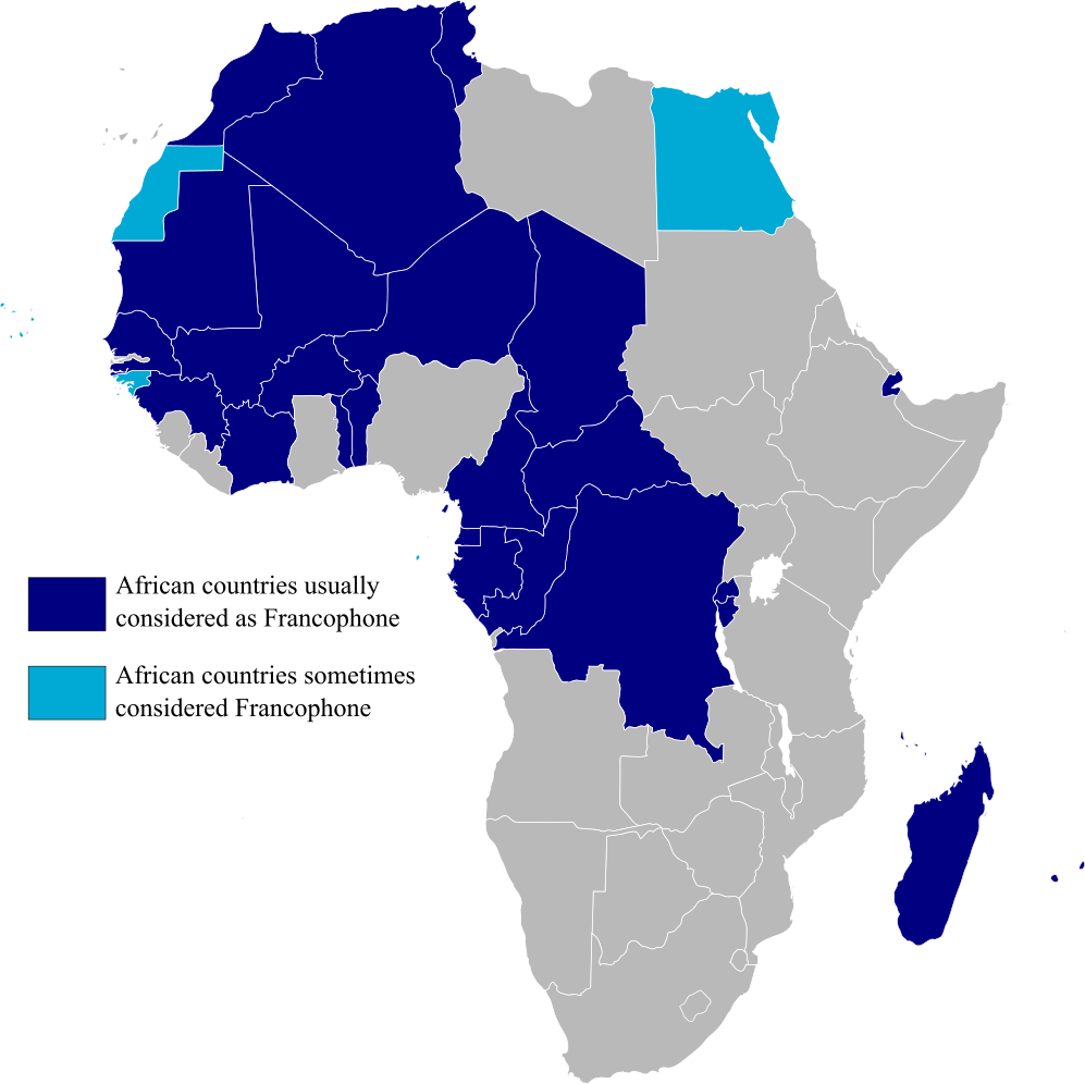
Map highlighting Francophone Africa, made by myself.
| Public domainPublic domainfalsefalse |
| I, the copyright holder of this work, release this work into the public domain. This applies worldwide. In some countries this may not be legally possible; if so: I grant anyone the right to use this work for any purpose, without any conditions, unless such conditions are required by law. |
Captions
Add a one-line explanation of what this file represents
Countries in Africa that are Francophones
Items portrayed in this file
depicts Anglica
media type Anglica
image/png
Historia fasciculi
Presso die vel tempore fasciculum videbis, sicut tunc temporis apparuit.
| Dies/Tempus | Minutio | Dimensiones | Usor | Sententia | |
|---|---|---|---|---|---|
| recentissima | 15:29, 11 Februarii 2023 | | 997 × 996 (158 chiliocteti) | +JMJ+ | rephrased the text |
| 15:21, 11 Februarii 2023 |  | 997 × 996 (157 chiliocteti) | +JMJ+ | Better base map - File:BlankMap-Africa.svg | |
| 21:57, 19 Iulii 2011 |  | 360 × 388 (14 chiliocteti) | Rosss | Added South Sudan | |
| 01:09, 15 Augusti 2007 |  | 360 × 392 (14 chiliocteti) | Rosss | Added Réunion, Mauritius, Seychelles, Comoros, Mayotte, Scattered Islands, Cape Verde, Guinea Bisau, Sao Tome e Principe, and the insular part of Equatorial Guinea. | |
| 17:37, 20 Novembris 2006 |  | 360 × 392 (13 chiliocteti) | Aaker | Map highlighting Francophone Africa. Made by myself. | |
| 17:36, 20 Novembris 2006 |  | 360 × 392 (13 chiliocteti) | Aaker | Map highlighting Francophone Africa, made by myself. | |
| 17:33, 20 Novembris 2006 |  | 360 × 392 (13 chiliocteti) | Aaker | Map highlighting Francophone Africa, made by myself, 2006. Carte marquant l'Afrique francophone. | |
| 17:32, 20 Novembris 2006 |  | 360 × 392 (13 chiliocteti) | Aaker | Map highlighting Francophone Africa, made by myself, 2006. Carte marquant l'Afrique francophone. | |
| 15:46, 11 Novembris 2006 |  | 360 × 392 (13 chiliocteti) | Aaker | Map highlighting Francophone Africa, made by myself. |
Nexus ad fasciculum
Nullae paginae hoc fasciculo utuntur.
Usus fasciculi per inceptus Vicimediorum
Quae incepta Vici fasciculo utuntur:
- Usus in ar.wikipedia.org
- Usus in ast.wikipedia.org
- Usus in de.wikipedia.org
- Usus in en.wikipedia.org
- Usus in es.wikipedia.org
- Usus in fa.wikipedia.org
- Usus in he.wikipedia.org
- Usus in hy.wikipedia.org
- Usus in hyw.wikipedia.org
- Usus in it.wikipedia.org
- Usus in ja.wikipedia.org
- Usus in mr.wikipedia.org
- Usus in pt.wikipedia.org
- Usus in tl.wikipedia.org
- Usus in tr.wiktionary.org
- Usus in ur.wikipedia.org
- Usus in zh.wikipedia.org
Metadata
Hic fasciculus alias res continet, saepius a machina originatore additas, et (si fasciculus postea recensus sit) fortasse corrigendas.
| Short title |
|
|---|---|
| Resolutio horizontalis | 37.79 dpc |
| Resolutio verticalis | 37.79 dpc |
| Software used |
|