File:Ambulante_Kinderhospizdienste_in_Deutschland.PNG
From Wikipedia, the free encyclopedia
Чоңураак нускасы жок.
Ambulante_Kinderhospizdienste_in_Deutschland.PNG (372 × 444 пиксель, файлдын өлчөмү: 44 KB, MIME түрү: image/png)
Бул файл Викиказына долбоорунан. Ошондой эле башка долбоорлордо пайдаланылышы мүмкүн. Төмөндө файлды сыпаттоо барагындагы сыпаттамасы көрсөтүлгөн.

|
This health map image could be re-created using vector graphics as an SVG file. This has several advantages; see Commons:Media for cleanup for more information. If an SVG form of this image is available, please upload it and afterwards replace this template with
{{vector version available|new image name}}.
It is recommended to name the SVG file “Ambulante Kinderhospizdienste in Deutschland.svg”—then the template Vector version available (or Vva) does not need the new image name parameter. |
Жыйынтыгы
| СыпаттамаAmbulante Kinderhospizdienste in Deutschland.PNG |
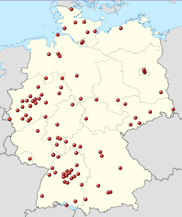
Deutsch: Positionskarte von Deutschland, eingetragen sind die Standorte ambulanter kinderhospizdienste nach DHKV ([1], Stand: März 2012 Quadratische Plattkarte, N-S-Streckung 150 %. Geographische Begrenzung der Karte: * N: 55.1° N * S: 47.2° N * W: 5.5° O * O: 15.5° O English: Location map of Germany Equirectangular projection, N/S stretching 150 %. Geographic limits of the map: * N: 55.1° N * S: 47.2° N * W: 5.5° E * E: 15.5° E Français : Carte de l'Allemagne |
| Дата | (UTC) |
| Булак |
This file was derived from: Germany location map.svg:  |
| Автор |
|
| This is a retouched picture, which means that it has been digitally altered from its original version. Modifications: Ambulante Kinderhospizdienste eingetragen. The original can be viewed here: Germany location map.svg:
|
Лицензиялоо
I, the copyright holder of this work, hereby publish it under the following licenses:
This file is licensed under the Creative Commons Attribution-Share Alike 3.0 Unported license.
- Сиз буларга эркинсиз:
- бөлүшүү – чыгарманы көчүрүү, жайылтуу жана өткөрүп берүү
- ремикс кылуу – чыгарманы ылайыкташтыруу
- Төмөнкү шарттарда:
- атрибуция – Сиз тийиштүү насыя берип, лицензияга шилтеме калтырып жана өзгөртүүлөр болсо көрсөтүшүңүз керек. Сиз муну кандайдыр бир акылга сыярлык жол менен жасай аласыз, бирок лицензиар сизди же сиздин колдонууңузду жактырган кандайдыр бир жол менен эмес.
- Бирдей шарттар боюнча бөлүшүү – If you remix, transform, or build upon the material, you must distribute your contributions under the same or compatible license as the original.

|
Permission is granted to copy, distribute and/or modify this document under the terms of the GNU Free Documentation License, Version 1.2 or any later version published by the Free Software Foundation; with no Invariant Sections, no Front-Cover Texts, and no Back-Cover Texts. A copy of the license is included in the section entitled GNU Free Documentation License.http://www.gnu.org/copyleft/fdl.htmlGFDLGNU Free Documentation Licensetruetrue |
Каалаган лицензияны тандай аласыз.
Original upload log
This image is a derivative work of the following images:
- File:Germany_location_map.svg licensed with Cc-by-sa-3.0, GFDL
- 2010-01-19T10:03:29Z NordNordWest 1073x1272 (502104 Bytes) update
- 2009-07-22T08:33:33Z NordNordWest 1075x1273 (623082 Bytes) c
- 2008-10-13T14:36:44Z NordNordWest 1075x1273 (620685 Bytes)
- 2008-10-09T21:13:47Z NordNordWest 1075x1273 (627868 Bytes) smaller file, data optimized
- 2008-06-30T20:25:05Z NordNordWest 1076x1274 (899543 Bytes) {{Information |Description= {{de|Positionskarte von [[:de:Deutschland|Deutschland]]}} Quadratische Plattkarte, N-S-Streckung 150 %. Geographische Begrenzung der Karte: * N: 55.1° N * S: 47.2° N * W: 5.5° O * O: 15.5° O {{
Uploaded with derivativeFX
Captions
Add a one-line explanation of what this file represents
Items portrayed in this file
depicts англисче
copyright status англисче
copyrighted англисче
19 март 2012
media type англисче
image/png
checksum англисче
c681fda2c24da74787cdbf1ad13cb6144ff91e18
data size англисче
44997 Байт
height англисче
444 пиксель
width англисче
372 пиксель
Файлдын тарыхы
Файлдын мурдагы нускасын көрүү үчүн тийиштүү убакыт/датаны басыңыз
| Убакыт/дата | Миниатюра | Өлчөм | Колдонуучу | Түшүндүрмө | |
|---|---|---|---|---|---|
| учурдагы | 22:19, 19 март 2012 | | 372 × 444 (44 KB) | Gripweed | == {{int:filedesc}} == {{Information |Description={{de|Positionskarte von Deutschland}} Quadratische Plattkarte, N-S-Streckung 150 %. Geographische Begrenzung der Karte: * N: 55.1° N * S: 47.2° N * ... |
Шилтемелер
Бул файлды колдонгон барактар жок.
Файлдын глобалдык колдонулушу
Бул файл төмөнкү викилерде колдонулат:
- de.wikipedia.org сайтындагы колдонулушу