타크나
위키백과, 무료 백과사전
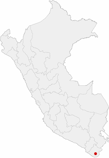
타크나(Tacna)는 페루 남부 칠레 국경 근처에 있는 도시이다. 타크나 주의 주도이다.

인구:331,834
- 시 문장
기후
| 타크나의 기후 | |||||||||||||
|---|---|---|---|---|---|---|---|---|---|---|---|---|---|
| 월 | 1월 | 2월 | 3월 | 4월 | 5월 | 6월 | 7월 | 8월 | 9월 | 10월 | 11월 | 12월 | 연간 |
| 역대 최고 기온 °C (°F) | 33.0 (91.4) |
33.2 (91.8) |
33.8 (92.8) |
31.0 (87.8) |
31.3 (88.3) |
30.1 (86.2) |
31.6 (88.9) |
28.0 (82.4) |
27.8 (82.0) |
29.2 (84.6) |
30.0 (86.0) |
30.0 (86.0) |
33.8 (92.8) |
| 일평균 최고 기온 °C (°F) | 27.8 (82.0) |
28.5 (83.3) |
27.4 (81.3) |
24.8 (76.6) |
22.1 (71.8) |
19.9 (67.8) |
19.0 (66.2) |
19.6 (67.3) |
20.9 (69.6) |
22.9 (73.2) |
24.6 (76.3) |
26.3 (79.3) |
23.7 (74.6) |
| 일일 평균 기온 °C (°F) | 22.5 (72.5) |
23.1 (73.6) |
22.1 (71.8) |
19.9 (67.8) |
17.5 (63.5) |
15.6 (60.1) |
14.7 (58.5) |
15.1 (59.2) |
16.2 (61.2) |
17.8 (64.0) |
19.4 (66.9) |
21.0 (69.8) |
18.7 (65.7) |
| 일평균 최저 기온 °C (°F) | 17.2 (63.0) |
17.7 (63.9) |
16.7 (62.1) |
14.9 (58.8) |
12.9 (55.2) |
11.2 (52.2) |
10.4 (50.7) |
10.6 (51.1) |
11.4 (52.5) |
12.6 (54.7) |
14.1 (57.4) |
15.6 (60.1) |
13.8 (56.8) |
| 역대 최저 기온 °C (°F) | 7.6 (45.7) |
10.0 (50.0) |
6.1 (43.0) |
3.9 (39.0) |
3.9 (39.0) |
0.4 (32.7) |
0.0 (32.0) |
3.9 (39.0) |
3.9 (39.0) |
6.1 (43.0) |
7.2 (45.0) |
7.2 (45.0) |
0.0 (32.0) |
| 평균 강수량 mm (인치) | 3.5 (0.14) |
2.3 (0.09) |
0.8 (0.03) |
0.2 (0.01) |
0.5 (0.02) |
2.0 (0.08) |
3.9 (0.15) |
4.2 (0.17) |
4.0 (0.16) |
1.4 (0.06) |
0.9 (0.04) |
1.3 (0.05) |
25 (1) |
| 평균 강수일수 (≥ 1.0 mm) | 0.0 | 0.2 | 0.0 | 0.0 | 0.0 | 0.3 | 0.9 | 1.2 | 0.3 | 0.4 | 0.0 | 0.0 | 3.4 |
| 평균 상대 습도 (%) | 66 | 65 | 67 | 72 | 76 | 78 | 77 | 78 | 75 | 74 | 71 | 68 | 72 |
| 평균 월간 일조시간 | 217.0 | 197.8 | 229.4 | 222.0 | 176.7 | 162.0 | 173.6 | 189.1 | 147.0 | 232.5 | 243.0 | 248.0 | 2,438.1 |
| 평균 일일 일조시간 | 7.0 | 7.0 | 7.4 | 7.4 | 5.7 | 5.4 | 5.6 | 6.1 | 4.9 | 7.5 | 8.1 | 8.0 | 6.7 |
| 출처 1: 페루 국립기상수문청 (평년값: 1991년~2020년, 극값: 1949년~현재),[1] Meteo Climat (극값 일부)[2] | |||||||||||||
| 출처 2: 독일 기상청 (강수일수: 1970년~1990년, 상대습도: 1951년~1969년, 일조시간: 1930년~1937년)[3] | |||||||||||||
각주
외부 링크
Wikiwand - on
Seamless Wikipedia browsing. On steroids.

