치트랄
위키백과, 무료 백과사전
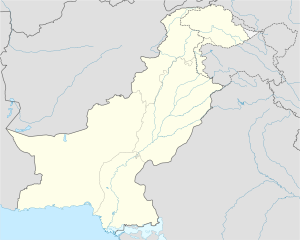
치트랄(우르두어: چترال, 영어: Chitral)은 파키스탄 카이베르파크툰크와주에 위치한 도시로, 치트랄구의 구청 소재지이다. 쿠나르강 서안과 접하며 힌두쿠시산맥에서 가장 높은 티리치미르봉 기슭에 위치한다.
| 치트랄 چترال | |
|---|---|
 치트랄에 있는 시장 풍경 | |
|
| |
| 행정 | |
| 국가 | 파키스탄 |
| 행정 구역 | 카이베르파크툰크와주 |
| 지리 | |
| 면적 | 14,850 km2 |
| 해발 | 1,100 m |
| 시간대 | PST (UTC+5) |
| 인문 | |
| 인구 | 20,000명(2006년) |
기후
| Chitral의 기후 | |||||||||||||
|---|---|---|---|---|---|---|---|---|---|---|---|---|---|
| 월 | 1월 | 2월 | 3월 | 4월 | 5월 | 6월 | 7월 | 8월 | 9월 | 10월 | 11월 | 12월 | 연간 |
| 일평균 최고 기온 °C (°F) | 8.3 (46.9) |
9.5 (49.1) |
14.9 (58.8) |
21.0 (69.8) |
25.6 (78.1) |
31.8 (89.2) |
32.8 (91.0) |
32.0 (89.6) |
28.7 (83.7) |
23.7 (74.7) |
17.4 (63.3) |
10.9 (51.6) |
21.4 (70.5) |
| 일일 평균 기온 °C (°F) | 4.1 (39.4) |
5.0 (41.0) |
9.8 (49.6) |
15.3 (59.5) |
19.4 (66.9) |
24.9 (76.8) |
26.1 (79.0) |
25.4 (77.7) |
21.9 (71.4) |
17.0 (62.6) |
11.5 (52.7) |
6.5 (43.7) |
15.6 (60.0) |
| 일평균 최저 기온 °C (°F) | 0.0 (32.0) |
0.6 (33.1) |
4.8 (40.6) |
9.7 (49.5) |
13.3 (55.9) |
18.0 (64.4) |
19.5 (67.1) |
18.8 (65.8) |
15.2 (59.4) |
10.3 (50.5) |
5.6 (42.1) |
2.1 (35.8) |
11.4 (52.5) |
| 평균 강수량 mm (인치) | 69 (2.7) |
99 (3.9) |
146 (5.7) |
139 (5.5) |
69 (2.7) |
22 (0.9) |
52 (2.0) |
56 (2.2) |
40 (1.6) |
31 (1.2) |
26 (1.0) |
51 (2.0) |
800 (31.4) |
| 출처: Climate-Data.org[1] | |||||||||||||
각주
외부 링크
Wikiwand - on
Seamless Wikipedia browsing. On steroids.

