타만라세트
알제리 남부의 도시 위키백과, 무료 백과사전
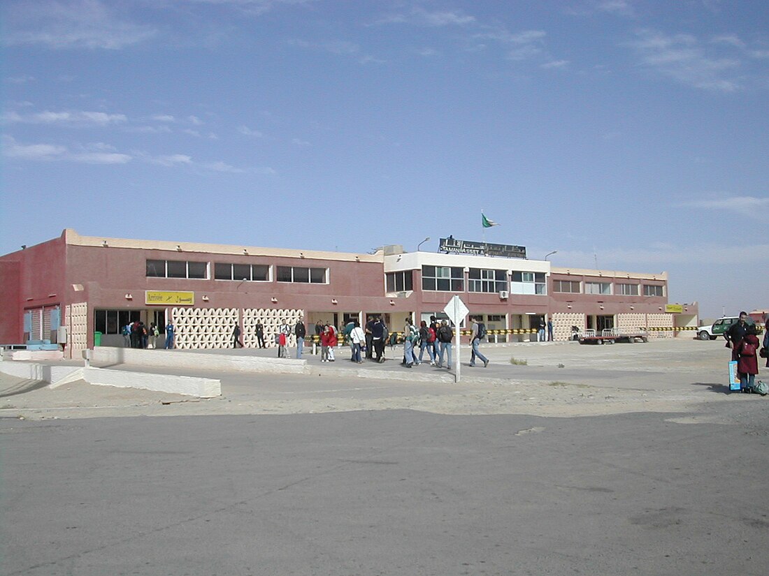
타만라세트(아랍어: تمنراست, 프랑스어: Tamanrasset) 또는 타망가세트(Tamanghasset)는 알제리 남부에 위치한 오아시스 도시로, 타만라세트 주의 주도이며 인구는 76,000명(1998년 기준)이다. 아하가르 산맥과 접하며 해발 1,320m이다. 알제리에 거주하는 투아레그족의 중심 도시이다. 1952년부터 1970년까지 프랑스의 알제리 남부 진출의 군사기지였다.


기후
| Tamanrasset의 기후 | |||||||||||||
|---|---|---|---|---|---|---|---|---|---|---|---|---|---|
| 월 | 1월 | 2월 | 3월 | 4월 | 5월 | 6월 | 7월 | 8월 | 9월 | 10월 | 11월 | 12월 | 연간 |
| 역대 최고 기온 °C (°F) | 24.5 (76.1) |
29.9 (85.8) |
29.8 (85.6) |
35.0 (95.0) |
39.1 (102.4) |
44.7 (112.5) |
47.4 (117.3) |
47.4 (117.3) |
42.5 (108.5) |
34.8 (94.6) |
28.6 (83.5) |
27.2 (81.0) |
47.4 (117.3) |
| 일평균 최고 기온 °C (°F) | 20.1 (68.2) |
22.1 (71.8) |
25.4 (77.7) |
30.1 (86.2) |
33.6 (92.5) |
35.4 (95.7) |
35.3 (95.5) |
34.7 (94.5) |
33.2 (91.8) |
29.5 (85.1) |
24.7 (76.5) |
21.3 (70.3) |
28.8 (83.8) |
| 일일 평균 기온 °C (°F) | 12.7 (54.9) |
14.5 (58.1) |
18.2 (64.8) |
22.7 (72.9) |
26.7 (80.1) |
29.1 (84.4) |
29.2 (84.6) |
28.7 (83.7) |
27.2 (81.0) |
23.0 (73.4) |
17.6 (63.7) |
13.9 (57.0) |
22.0 (71.6) |
| 일평균 최저 기온 °C (°F) | 5.2 (41.4) |
6.9 (44.4) |
10.9 (51.6) |
15.3 (59.5) |
19.7 (67.5) |
22.8 (73.0) |
23.1 (73.6) |
22.6 (72.7) |
21.1 (70.0) |
16.4 (61.5) |
10.4 (50.7) |
6.4 (43.5) |
15.1 (59.2) |
| 역대 최저 기온 °C (°F) | −5.3 (22.5) |
−4.4 (24.1) |
−2.9 (26.8) |
0.4 (32.7) |
4.7 (40.5) |
6.9 (44.4) |
7.2 (45.0) |
7.0 (44.6) |
5.7 (42.3) |
−0.1 (31.8) |
0.0 (32.0) |
−4.6 (23.7) |
−5.3 (22.5) |
| 평균 강수량 mm (인치) | 2.4 (0.09) |
1.5 (0.06) |
5.2 (0.20) |
2.1 (0.08) |
5.1 (0.20) |
7.1 (0.28) |
5.1 (0.20) |
8.1 (0.32) |
7.7 (0.30) |
6.8 (0.27) |
0.8 (0.03) |
1.7 (0.07) |
53.6 (2.11) |
| 평균 강수일수 (≥ 0.1 mm) | 0.6 | 0.7 | 1.1 | 0.8 | 1.5 | 2.8 | 1.6 | 2.9 | 2.8 | 1.5 | 0.4 | 0.6 | 17.3 |
| 평균 상대 습도 (%) | 29 | 31 | 26 | 27 | 29 | 24 | 21 | 25 | 26 | 29 | 32 | 31 | 28 |
| 출처 1: World Meteorological Organization (average temperatures and precipitation, 1976–2005)[1] | |||||||||||||
| 출처 2: Weatherbase (extremes, humidity)[2] | |||||||||||||
각주
Wikiwand in your browser!
Seamless Wikipedia browsing. On steroids.
Every time you click a link to Wikipedia, Wiktionary or Wikiquote in your browser's search results, it will show the modern Wikiwand interface.
Wikiwand extension is a five stars, simple, with minimum permission required to keep your browsing private, safe and transparent.
