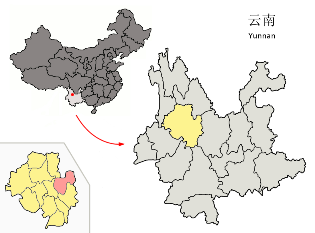
빈촨현(바이어:비프거프, 한국어: 빈천현, 중국어: 宾川县, 병음: Bīnchuān Xiàn)은 중화인민공화국 윈난성 다리 바이족 자치주의 현급 행정구역이다. 넓이는 2627km2이고, 인구는 2007년 기준으로 330,000명이다.

기후
| Binchuan (1981−2010)의 기후 | |||||||||||||
|---|---|---|---|---|---|---|---|---|---|---|---|---|---|
| 월 | 1월 | 2월 | 3월 | 4월 | 5월 | 6월 | 7월 | 8월 | 9월 | 10월 | 11월 | 12월 | 연간 |
| 역대 최고 기온 °C (°F) | 26.8 (80.2) |
29.4 (84.9) |
33.0 (91.4) |
35.4 (95.7) |
37.6 (99.7) |
37.2 (99.0) |
37.5 (99.5) |
34.5 (94.1) |
35.0 (95.0) |
32.4 (90.3) |
29.4 (84.9) |
27.7 (81.9) |
37.6 (99.7) |
| 일평균 최고 기온 °C (°F) | 20.9 (69.6) |
22.9 (73.2) |
26.0 (78.8) |
28.8 (83.8) |
30.4 (86.7) |
30.6 (87.1) |
29.3 (84.7) |
29.0 (84.2) |
28.2 (82.8) |
26.6 (79.9) |
23.4 (74.1) |
20.9 (69.6) |
26.4 (79.5) |
| 일일 평균 기온 °C (°F) | 10.5 (50.9) |
13.0 (55.4) |
16.5 (61.7) |
20.2 (68.4) |
23.3 (73.9) |
24.6 (76.3) |
23.9 (75.0) |
23.1 (73.6) |
21.8 (71.2) |
19.3 (66.7) |
14.3 (57.7) |
10.5 (50.9) |
18.4 (65.1) |
| 일평균 최저 기온 °C (°F) | 1.3 (34.3) |
3.7 (38.7) |
7.4 (45.3) |
11.7 (53.1) |
16.3 (61.3) |
19.4 (66.9) |
19.6 (67.3) |
18.8 (65.8) |
17.2 (63.0) |
13.6 (56.5) |
7.0 (44.6) |
2.0 (35.6) |
11.5 (52.7) |
| 역대 최저 기온 °C (°F) | −4.4 (24.1) |
−3.0 (26.6) |
−0.6 (30.9) |
3.1 (37.6) |
8.1 (46.6) |
11.3 (52.3) |
14.9 (58.8) |
12.2 (54.0) |
7.4 (45.3) |
5.6 (42.1) |
−0.3 (31.5) |
−6.4 (20.5) |
−6.4 (20.5) |
| 평균 강수량 mm (인치) | 3.3 (0.13) |
4.8 (0.19) |
6.4 (0.25) |
9.7 (0.38) |
41.3 (1.63) |
83.0 (3.27) |
140.1 (5.52) |
118.2 (4.65) |
89.8 (3.54) |
50.1 (1.97) |
14.4 (0.57) |
2.7 (0.11) |
563.8 (22.21) |
| 평균 상대 습도 (%) | 56 | 51 | 47 | 47 | 53 | 64 | 73 | 77 | 75 | 70 | 67 | 64 | 62 |
| 출처: China Meteorological Data Service Center | |||||||||||||
행정 구역
8개 진, 2개 민족향을 관할한다.
- 진: 金牛镇, 宾居镇, 州城镇, 大营镇, 鸡足山镇, 力角镇, 平川镇, 乔甸镇.
- 민족향: 钟英傈僳族彝族乡, 拉乌彝族乡.
| 이 글은 중국에 관한 토막글입니다. 여러분의 지식으로 알차게 문서를 완성해 갑시다. | |
| 이 글은 지리에 관한 토막글입니다. 여러분의 지식으로 알차게 문서를 완성해 갑시다. |
Wikiwand in your browser!
Seamless Wikipedia browsing. On steroids.
Every time you click a link to Wikipedia, Wiktionary or Wikiquote in your browser's search results, it will show the modern Wikiwand interface.
Wikiwand extension is a five stars, simple, with minimum permission required to keep your browsing private, safe and transparent.
