ಚಿತ್ರ:Togo_location_map_Topographic.png
From Wikipedia, the free encyclopedia
ಈ ಮುನ್ನೋಟ ಗಾತ್ರ:೪೦೮ × ೬೦೦ ಪಿಕ್ಸೆಲ್ಗಳು. ಇತರ ರೆಸಲ್ಯೂಶನ್ಗಳು: ೧೬೩ × ೨೪೦ ಪಿಕ್ಸೆಲ್ಗಳು | ೩೨೬ × ೪೮೦ ಪಿಕ್ಸೆಲ್ಗಳು | ೭೧೭ × ೧,೦೫೪ ಪಿಕ್ಸೆಲ್ಗಳು.
ಮೂಲ ಕಡತ (೭೧೭ × ೧,೦೫೪ ಚಿತ್ರಬಿಂದು, ಫೈಲಿನ ಗಾತ್ರ: ೧.೧೭ MB, MIME ಪ್ರಕಾರ: image/png)
ಈ ಫೈಲು ವಿಕಿಮೀಡಿಯ ಕಾಮನ್ಸ್ನಲ್ಲಿ ಇರುವುದು. ಅಲ್ಲಿನ ವಿವರಣೆ ಪುಟವನ್ನೇ ಕೆಳಗೆ ತೋರಿಸಲಾಗಿದೆ. ಕಾಮನ್ಸ್ ಕೃತಿಸ್ವಾಮ್ಯತೆಯಿಂದ ಮುಕ್ತ ಫೈಲುಗಳ ಒಂದು ಆಗರ. ಅಲ್ಲಿ ನೀವೂ ಸಹಕರಿಸಬಹುದು. |
ಸಾರಾಂಶ
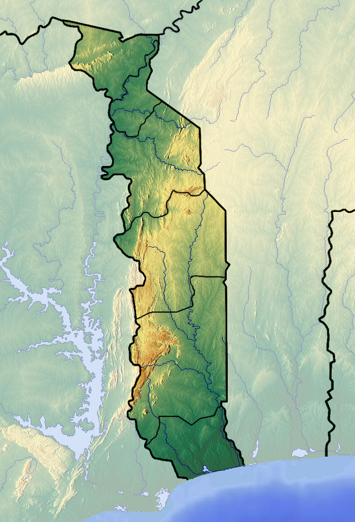
| ವಿವರTogo location map Topographic.png |
Français : Carte topographique du Togo |
| ದಿನಾಂಕ | |
| ಆಕರ | ಸ್ವಂತ ಕೆಲಸ (backgroung : http://www.maps-for-free.com) |
| ಕರ್ತೃ | Dr Brains |
ಪರವಾನಗಿ
I, the copyright holder of this work, hereby publish it under the following licenses:

|
Permission is granted to copy, distribute and/or modify this document under the terms of the GNU Free Documentation License, Version 1.2 only as published by the Free Software Foundation; with no Invariant Sections, no Front-Cover Texts, and no Back-Cover Texts. A copy of the license is included in the section entitled GNU Free Documentation License. | 1.2 onlyhttp://www.gnu.org/licenses/old-licenses/fdl-1.2.htmlGFDL 1.2GNU Free Documentation License 1.2truetrue |
|
|
Permission is granted to copy, distribute and/or modify this document under the terms of the GNU Free Documentation License, Version 1.3 or any later version published by the Free Software Foundation; with no Invariant Sections, no Front-Cover Texts, and no Back-Cover Texts. A copy of the license is included in the section entitled GNU Free Documentation License.
www.gnu.org/licenses/fdl-1.3.htmlGFDL 1.3GNU Free Documentation License 1.3truetrue |
If this file is eligible for relicensing, it may also be used under the Creative Commons Attribution-ShareAlike 3.0 license. The relicensing status of this image needs to be manually reviewed by an experienced user. You can help. العربيَّة | беларуская (тарашкевіца) | English | français | magyar | italiano | 日本語 | 한국어 | македонски | മലയാളം | sicilianu | українська | 中文 | +/− |
ನಿಮ್ಮಿಚ್ಛೆಯ ಪರವಾನಗಿಯನ್ನು ನೀವು ಆರಿಸಿಕೊಳ್ಳಬಹುದು.
Captions
Add a one-line explanation of what this file represents
Items portrayed in this file
depicts ಇಂಗ್ಲಿಷ್
some value
copyright status ಇಂಗ್ಲಿಷ್
copyrighted ಇಂಗ್ಲಿಷ್
೧೧ ಜೂನ್ 2012
source of file ಇಂಗ್ಲಿಷ್
original creation by uploader ಇಂಗ್ಲಿಷ್
media type ಇಂಗ್ಲಿಷ್
image/png
checksum ಇಂಗ್ಲಿಷ್
1c05a199da7f3634cedcb398b1ae2c1c4712309c
data size ಇಂಗ್ಲಿಷ್
೧೨,೨೪,೪೫೧ byte
height ಇಂಗ್ಲಿಷ್
೧,೦೫೪ pixel
width ಇಂಗ್ಲಿಷ್
೭೧೭ pixel
ಕಡತದ ಇತಿಹಾಸ
ದಿನ/ಕಾಲ ಒತ್ತಿದರೆ ಆ ಸಮಯದಲ್ಲಿ ಈ ಕಡತದ ವಸ್ತುಸ್ಥಿತಿ ತೋರುತ್ತದೆ.
| ದಿನ/ಕಾಲ | ಕಿರುನೋಟ | ಆಯಾಮಗಳು | ಬಳಕೆದಾರ | ಟಿಪ್ಪಣಿ | |
|---|---|---|---|---|---|
| ಪ್ರಸಕ್ತ | ೧೯:೩೪, ೨೬ ಜೂನ್ ೨೦೧೨ | | ೭೧೭ × ೧,೦೫೪ (೧.೧೭ MB) | Dark Attsios | pleine résolution (erreur de ma part) |
| ೧೯:೦೮, ೨೬ ಜೂನ್ ೨೦೧೨ |  | ೪೦೮ × ೫೯೯ (೪೧೧ KB) | Dark Attsios | réajustement de la carte pour concorder avec le fichier svg | |
| ೦೨:೫೭, ೧೨ ಜೂನ್ ೨೦೧೨ |  | ೭೨೨ × ೧,೦೫೭ (೧.೧೭ MB) | Dr Brains |
ಕಡತ ಬಳಕೆ
ಈ ಕೆಳಗಿನ ಪುಟವು ಈ ಚಿತ್ರಕ್ಕೆ ಸಂಪರ್ಕ ಹೊಂದಿದೆ:
ಜಾಗತಿಕ ಕಡತ ಉಪಯೋಗ
ಈ ಕಡತವನ್ನು ಕೆಳಗಿನ ಬೇರೆ ವಿಕಿಗಳೂ ಉಪಯೋಗಿಸುತ್ತಿವೆ:
- ar.wikipedia.org ಮೇಲೆ ಬಳಕೆ
- ast.wikipedia.org ಮೇಲೆ ಬಳಕೆ
- az.wikipedia.org ಮೇಲೆ ಬಳಕೆ
- ba.wikipedia.org ಮೇಲೆ ಬಳಕೆ
- bcl.wikipedia.org ಮೇಲೆ ಬಳಕೆ
- be.wikipedia.org ಮೇಲೆ ಬಳಕೆ
- bg.wikipedia.org ಮೇಲೆ ಬಳಕೆ
- bn.wikipedia.org ಮೇಲೆ ಬಳಕೆ
- bs.wikipedia.org ಮೇಲೆ ಬಳಕೆ
- ca.wikipedia.org ಮೇಲೆ ಬಳಕೆ
- ceb.wikipedia.org ಮೇಲೆ ಬಳಕೆ
- cs.wikipedia.org ಮೇಲೆ ಬಳಕೆ
- da.wikipedia.org ಮೇಲೆ ಬಳಕೆ
- de.wikipedia.org ಮೇಲೆ ಬಳಕೆ
- el.wikipedia.org ಮೇಲೆ ಬಳಕೆ
- en.wikipedia.org ಮೇಲೆ ಬಳಕೆ
- Mount Agou
- Kéran National Park
- Fazao Malfakassa National Park
- Abdoulaye Faunal Reserve
- Module:Location map/data/Togo/doc
- 1963 Togolese coup d'état
- Geology of Togo
- Nangbeto Dam
- Fosse aux Lions National Park
- Module:Location map/data/Togo
- List of fossiliferous stratigraphic units in Togo
- 1967 Togolese coup d'état
- 1986 Togolese coup attempt
- eo.wikipedia.org ಮೇಲೆ ಬಳಕೆ
- fa.wikipedia.org ಮೇಲೆ ಬಳಕೆ
ಈ ಫೈಲ್ನ ಹೆಚ್ಚು ಜಾಗತಿಕ ಬಳಕೆಯನ್ನು ವೀಕ್ಷಿಸಿ.
ಮೇಲ್ದರ್ಜೆ ಮಾಹಿತಿ
ಈ ಫೈಲಿನಲ್ಲಿ ಹೆಚ್ಚಿನ ಮಾಹಿತಿ ಇದೆ. ಪ್ರಾಯಶಃ ಫೈಲನ್ನು ಸೃಷ್ಟಿಸಲು ಉಪಯೋಗಿಸಲಾದ ಡಿಜಿಟಲ್ ಕ್ಯಾಮೆರದಿಂದ ಅಥವ ಸ್ಕ್ಯಾನರ್ ಇಂದ ಈ ಮಾಹಿತಿ ಸೇರಿಸಲ್ಪಟ್ಟಿದೆ.
ಮೂಲಪ್ರತಿಯಿಂದ ಈ ಫೈಲು ಮಾರ್ಪಾಟಾಗಿದ್ದಲ್ಲಿ, ಈ ಮಾಹಿತಿ ಮಾರ್ಪಟ್ಟ ಫೈಲಿನ ವಿವರಗಳಿಗೆ ಸರಿಯಾಗಿ ಹೊಂದದೆ ಇರಬಹುದು.
| Horizontal resolution | ೨೮.೩೫ dpc |
|---|---|
| Vertical resolution | ೨೮.೩೫ dpc |
"https://kn.wikipedia.org/wiki/ಚಿತ್ರ:Togo_location_map_Topographic.png" ಇಂದ ಪಡೆಯಲ್ಪಟ್ಟಿದೆ