Իզերնիա (գավառ)
From Wikipedia, the free encyclopedia
From Wikipedia, the free encyclopedia
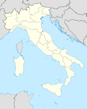
Իզերնիա (իտալ.՝ provincia di Isernia) գավառը գտնվում է Իտալիայի Մոլիզե մարզում։ Գավառի վարչական կենտրոնը Իզերնիա քաղաքն է, գավառի նախագահն է Լուիջի Բռասիելլոն (անգլ.՝ Luigi Brasiello)։ Գավառը զբաղեցնում է 1,535,24 կմ² տարածք, բնակչության թվաքանակը կազմում է 86.828՝ 2015 թվականի դրությամբ, բնակչության խտությունը՝ 56,56 մարդ 1 կմ² վրա[1]։ Գավառը ներառում է 52 կոմունա (իտալ.՝ comuni)՝ նշված Իզերնիա գավառի կոմունաներում[2]։
Իզերնիան հայտնի էր որպես Սամնիտ Ասերնիա (անգլ.՝ Samnite Aesernia)՝ մինչ մ․թ․ա․ 263 թվականը Հռոմեական տիրապետության տակ ընկնելը։ 9-րդ դարի ընթացքում այն բազմիցս թալանվել էր մուսուլմանական արշավների ընթացքում և տուժել էր 847 թվականի երկրաշարժից՝ ավերելով Իզերնիա և Վենաֆրո քաղաքները[3]։ Չնայած դրան, քաղաքը դարձվել է Եպիսկոպոսական աթոռանիստ, և 964 թվականին շնորհվել է կոմսության կարգավիճակ։ 1979 թվականին հնագիտական պեղումների ժամանակ Իզերնիա քաղաքի մոտ գտնվել էր բնակեցման վկայություններ՝ թվագրված պալեոլիթյան ժամանակաշրջանին՝ ավել քան 736,000 տարի առաջ[3]։
476 թվականին՝ Հռոմի անկումից հետո, Բենեդիկտյանները Իզերնիա գավառում հիմնեցին Սան Վինչենցո լա Վոլտուրնո (անգլ.՝ San Vincenzo al Volturno) վանքը։ Երբ տարածք ներխուժեցին մուսուլմանները՝ 500-900 վանականներ գլխատվեցին նրանց կողմից, և շատերը գերեվարվեցին որպես ստրուկներ։ Չնայած դրան, վանքերը շարունակեցին իրենց գործունեությունը և հասան իրենց գագաթնակետին 11-12-րդ դարերի ընթացքում։ Կելեստինոս V պապը ծնվել է Իզերնիայի մոտակայքում և գավառի տոնակատարության օրը՝ Մայիսի 19-ին։ 1805 թվականի երկաշարժը ավերեց Իզերնիայի եկեղեցին, որը վերակառուցվեց 1837 թվականին[3]։

Իզերնիայի գավառը հիմնականում լեռնային տարածք է կենտրոնական Իտալիայում։ Հարավ-արևմուտքից լեռների բարձրությունը նվազում է, և անտառապատ բլուրները ձգվում են դեպի հարթավայրերը, որոնք շրջապատում են Վենաֆրոն։ Հյուսիս-արևելքից Կամպոբասո գավառն է։ Հյուսիսից Լ'Աքվիլա և Կիետի գավառներն են՝ երուսն էլ գտնվում են Աբրուցո մարզում։ Արևմուտքից Ֆրոզինոնե գավառն է Լացիո մարզում, իսկ հարավից՝ Կազերտա գավառը Կամպանիայում[4]։
Գավառում կա չորս լեռնաշղթաներ և Աբրուցոի ազգային պարկը։ Գավառի ամենաբարձր գագաթը Մոնթե Մարեն է (Monte Mare)՝ 2,020 մ։ Գլխավոր գետերն են Վոլտուրնոն և Տրիգնոն, որոնք թափվում են Ադրիատիկ ծով[4]։ Սան Վինչենցոյի եկեղեցու լիճը կառուցված է արհեստական ջրամբարով՝ ուժեղացնելու ՀԷԿ սխեման։
Մարզի տնտեսությունը ավանդաբար հիմնված է գյուղատնտեսության վրա։ Հողատարածությունները շատ փոքր են, և արտադրվում են խաղողի, ձիթենու, բանջարեղենի, մրգերի և կաթնամթերքի արտադրանքներ։ Ավանդական մթերքները աճում են գավառում՝ ներառելով նաև հատիկաընդեղեն (իտալ.՝ Lathyrus sativus) և հացահատիկային (իտալ.՝ Farro) բույսեր։ Թինթիլիա (իտալ.՝ Tintilia) խաղողը աճեցվում է մարզի կարմիր գինու (իտալ.՝ "Tintilia del Molise") արտադրության համար[5]։
Seamless Wikipedia browsing. On steroids.
Every time you click a link to Wikipedia, Wiktionary or Wikiquote in your browser's search results, it will show the modern Wikiwand interface.
Wikiwand extension is a five stars, simple, with minimum permission required to keep your browsing private, safe and transparent.