Fichye:New_York_Locator_Map_with_US.PNG
From Wikipedia, the free encyclopedia
Pa genyen rezolisyon ki pi wo ki disponib.
New_York_Locator_Map_with_US.PNG (425 × 330 piksèl, gwosè fichye a : 20 kio, tip MIME li ye : image/png)
Fichye sa a sòti nan Wikimedia Commons e ka sèvi nan lòt pwojè. Desktripsyon ki sou paj li file description page ekri anba a.
Rezime

|
Cette image (de type locator map) devrait être recréée dans un format vectoriel, en tant que fichier SVG. Cela offrirait plusieurs avantages : voir Commons:Media for cleanup pour plus d'informations. Si une version SVG de cette image est déjà disponible, merci de bien vouloir l'envoyer. Après cela, remplacez ce modèle par {{vector version available|nouveau nom d'image.svg}}.
|
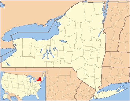
| DeskripsyonNew York Locator Map with US.PNG | Locator Map of New York, United States |
| Dat | |
| Sous | taken from US Census website [1] and modified by User:Ruhrfisch, User:Huebi, and User:Appraiser |
| Kreyatè | US Census, User:Ruhrfisch, User:Huebi, and User:Appraiser |
| Pèmisyon : (Resèvi ak fichye sa a) |
US Census / US Government work is public domain, my modifications licensed under the GNU Free Documentation License |
Kondisyon itlizasyon

|
Ou bay pèmisyon pou kopye, distribye ak/oswa modifye dokiman sa a dapre kondisyon GNU Free Documentation License, Vèsyon. 1.2 oswa nenpòt vèsyon ki pibliye pita pa Free Software Foundation; san okenn Seksyon ki pa ka chanje, pa gen okenn Tèks ak premye paj kouvèti, epi pa gen okenn Tèks Denyè-Kouvèti. Gen yon kopi lisans lan nan seksyon ki rele GNU Free Documentation License.http://www.gnu.org/copyleft/fdl.htmlGFDLGNU Free Documentation Licensetruetrue |
| Fichye sa a distribiye selon lisans Creative Commons. | ||
| Rekonèt avèk non otè: We, Ruhrfisch and Appraiser | ||
| ||
| Ce bandeau de licence a été ajouté à ce fichier dans le cadre de la procédure de mise à jour des licences des images sous GFDL.http://creativecommons.org/licenses/by-sa/3.0/CC BY-SA 3.0Creative Commons Attribution-Share Alike 3.0truetrue |
Ce fichier est disponible selon les termes de la licence Creative Commons Attribution – Partage dans les Mêmes Conditions 2.5 Générique
- Ou gen dwa:
- pou pataje – pou kopye, distribiye epi difize ouvraj la
- pou remiks – pou adapte ouvraj la
- Selon kondisyon sa a yo:
- Rekonèt avèk non otè – Ou dwe bay enfòmasyon apwopriye sou otè a, bay yon lyen pou lisans lan, epi endike si te gen chanjman ki fèt. Ou ka fè sa nan nenpòt fason rezonab, men okenn fason ki sijere ke otè a soutni oswa apwouve itilizasyon ou an.
- Enfòmasyon sa yo ka pataje – Si ou fè rekopye, transfòme, oswa baze sou materyèl sa, ou dwe distribye kontribisyon ou anba menm oswa yon lisans konpatib avèk orijinal la.
Chwazi lisans ou vle a.
and
| Public domainPublic domainfalsefalse |
This image or file is a work of a United States Census Bureau employee, taken or made as part of that person's official duties. As a work of the U.S. federal government, the image is in the public domain.
English ∙ español ∙ 日本語 ∙ македонски ∙ മലയാളം ∙ português do Brasil ∙ русский ∙ українська ∙ עברית ∙ +/− |
 |
made by kasey klase
Légendes
Ajoutez en une ligne la description de ce que représente ce fichier
Éléments décrits dans ce fichier
dépeint français
statut des droits d'auteur français
sous droit d'auteur français
Istorik fichye a
Klike sou yon dat/yon lè pou wè fichye a jan li te ye nan moman sa a.
| Dat ak lè | Minyati | Grandè yo | Itilizatè | Komantè | |
|---|---|---|---|---|---|
| Kounye a | 26 jen 2013 à 05:50 | | 425 × 330 (20 kio) | Zyxw | Same width & height as File:New York Locator Map.PNG for use with mapping templates. Inset is File:Map of USA NY.svg. Smaller file size. |
| 14 mas 2008 à 15:35 |  | 429 × 334 (27 kio) | Appraiser | {{Information| |Description= Locator Map of New York, United States |Source= taken from US Census website [http://factfinder.census.gov/] and modified by User:Ruhrfisch, User:Huebi, and User:Appraiser |Date= March 2008 |Author= US Census, [[U |
Itilizasyon fichye sa a
paj sa a itilize fichye sa a:
Itilizasyon global fichye a
Wiki sa a yo sèvi ak fichye sa a:
- Itilizasyon sou ar.wikipedia.org
- Itilizasyon sou azb.wikipedia.org
- Itilizasyon sou be-tarask.wikipedia.org
- Itilizasyon sou bs.wikipedia.org
- Itilizasyon sou ca.wikipedia.org
- Itilizasyon sou ceb.wikipedia.org
- Itilizasyon sou cy.wikipedia.org
- Itilizasyon sou de.wikipedia.org
- Itilizasyon sou en.wikipedia.org
- Fleischmanns, New York
- Margaretville, New York
- Andover, New York
- Angelica, New York
- Lisle, New York
- Ellicottville, New York
- Little Valley, New York
- Big Flats, New York
- Horseheads, New York
- Andes, New York
- Delhi, New York
- Franklin, Delaware County, New York
- Fishkill, New York
- Mayfield, New York
- Lowville, New York
- Leicester, New York
- Lima, New York
- Livonia, New York
- Cherry Valley, New York
- Lodi, New York
- Edwards, New York
- Hermon, New York
- Avoca, New York
- Candor, New York
- Castile, New York
- West Valley Demonstration Project
- Cuylerville, New York
Gade plis itilizasyon global fichye sa a.
Rekipere depi « https://ht.wikipedia.org/wiki/Fichye:New_York_Locator_Map_with_US.PNG »