File:Fuller_projection_with_largest_islands.svg
From Wikipedia, the free encyclopedia

पूर्वावलोकन PNG का आकार SVG फ़ाइल: 512 × 288 पिक्सेल दूसरे रेसोल्यूशन्स: 320 × 180 पिक्सेल | 640 × 360 पिक्सेल | 1,024 × 576 पिक्सेल | 1,280 × 720 पिक्सेल | 2,560 × 1,440 पिक्सेल।
मूल चित्र (SVG फ़ाइल, साधारणतः 512 × 288 पिक्सेल, फ़ाइल का आकार: 554 KB)
|
|
यह फ़ाइल विकिमेडिया कॉमन्स से है। वहाँ पर इसका विवरण पृष्ठ निम्नोक्त है। कॉमन्स मुक्त लाइसेंसों के अंतर्गत उपलब्ध मीडिया फ़ाइलों का संग्रह है। आप भी इसमें मदद कर सकते हैं। |
सारांश
| विवरणFuller projection with largest islands.svg |
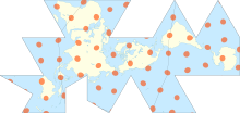
English: Dymaxion map of the world with the continental landmasses (Roman numerals) and 30 largest islands (Hindu-Arabic numerals) highlighted. (The list stops at 30 as the next few islands are north of Canada, and space is insufficient for their labels.) |
|||
| दिनांक | ||||
| स्रोत |
|
|||
| लेखक | cmglee, Justin Kunimune | |||
| दूसरे संस्करण |
|


लाइसेंस
इस फ़ाइल को क्रिएटिव कॉमन्स श्रेय-समानसांझा 4.0 अंतर्राष्ट्रीय लाइसेंस के अंतर्गत लाइसेंस किया गया है।
- आप खुलकर:
- बाँट सकते हैं – रचना की प्रतिलिपि बना सकते हैं, बाँँट सकते हैं और संचारित कर सकते हैं
- रीमिक्स कर सकते हैं – कार्य को अनुकूलित कर सकते हैं
- निम्नलिखित शर्तों के अंतर्गत:
- श्रेय – यह अनिवार्य है कि आप यथोचित श्रेय प्रदान करें, लाइसेंस की कड़ी प्रदान करें, और अगर कोई बदलाव हुए हों तो उन्हें इंगित करें। आप ऐसा किसी भी उचित तरीके से कर सकते हैं, लेकिन किसी भी तरह उससे यह नहीं संकेत नहीं किया जाना चाहिए कि लाइसेंसधारी द्वारा आपको अथवा आपके इस प्रयोग का समर्थन किया जा रहा हो।
- समानसांझा – अगर आप इस रचना में कोई बदलाव करते हैं या इसपर आधारित कुछ रचित करते हैं तो आप अपने योगदान को सिर्फ इसी या इसके सामान किसी लाइसेंस के अंतर्गत बाँट सकते हैं।
Captions
Add a one-line explanation of what this file represents
Dymaxion Map of the world with the continental landmasses (Roman numerals) and 30 largest islands (Hindu-Arabic numerals) highlighted.
१५ फ़रवरी 2018
media type अंग्रेज़ी
image/svg+xml
चित्र का इतिहास
फ़ाइलका पुराना अवतरण देखने के लिये दिनांक/समय पर क्लिक करें।
| दिनांक/समय | थंबनेल | आकार | सदस्य | प्रतिक्रिया | |
|---|---|---|---|---|---|
| वर्तमान | 00:15, 25 अक्टूबर 2020 | | 512 × 288 (554 KB) | Cmglee | Uploaded a work by cmglee, Justin Kunimune from {{source thumb|Dymaxion_with_Tissot's_Indicatrices_of_Distortion.svg}} with UploadWizard |
चित्र का उपयोग
निम्नलिखित पन्ने इस चित्र से जुडते हैं :
चित्र का वैश्विक उपयोग
इस चित्र का उपयोग इन दूसरे विकियों में किया जाता है:
- en.wikipedia.org पर उपयोग
- fa.wikipedia.org पर उपयोग
- kk.wikipedia.org पर उपयोग
- nn.wikipedia.org पर उपयोग
- si.wikipedia.org पर उपयोग
- th.wikipedia.org पर उपयोग
- zh.wikipedia.org पर उपयोग
मेटाडेटा
इस फ़ाइल में अतिरिक्त जानकारी मौजूद है, जो शायद इसे बनाने या डिजिटाइज़ करने के लिए उपयुक्त डिजिटल कैमरा या फिर स्कैनर द्वारा जोड़ा गया हो।
अगर चित्र को इसके मूल रूप से बदला गया है, शायद कुछ जानकारी इसके वर्तमान स्थिति से संबंधित न हो।
| लघु शीर्षक | Dymaxion map of the world with the continental landmasses (Roman numerals) and 30 largest islands (Arabic numerals) highlighted. |
|---|---|
| चित्र शीर्षक | A map of the world, showing all landmasses with 10° graticule and Tissot's indicatrices of diameter 1,000 km and spacing 30°. Coastlines precise to 110 km. |
| चौड़ाई | 100% |
| ऊँचाई | 100% |