Waihona:Claiborne_Pell_Newport_Bridge.jpg
From Wikipedia, the free encyclopedia
Waihona kumu (3,872 x 2,592 pikela, nui waihona: 5.22 MB, ʻano MIME: image/jpeg)
ʻO kēia waihona mai Wikimedia Commons a hiki paha ke hana ʻia mai nā papahana ʻē aʻe. Aia i lalo ka hōʻike ʻano [mai ka ʻaoʻao hōʻike ʻano waihona https://commons.wikimedia.org/wiki/File:Claiborne_Pell_Newport_Bridge.jpg].
Hōʻuluʻulu manaʻo
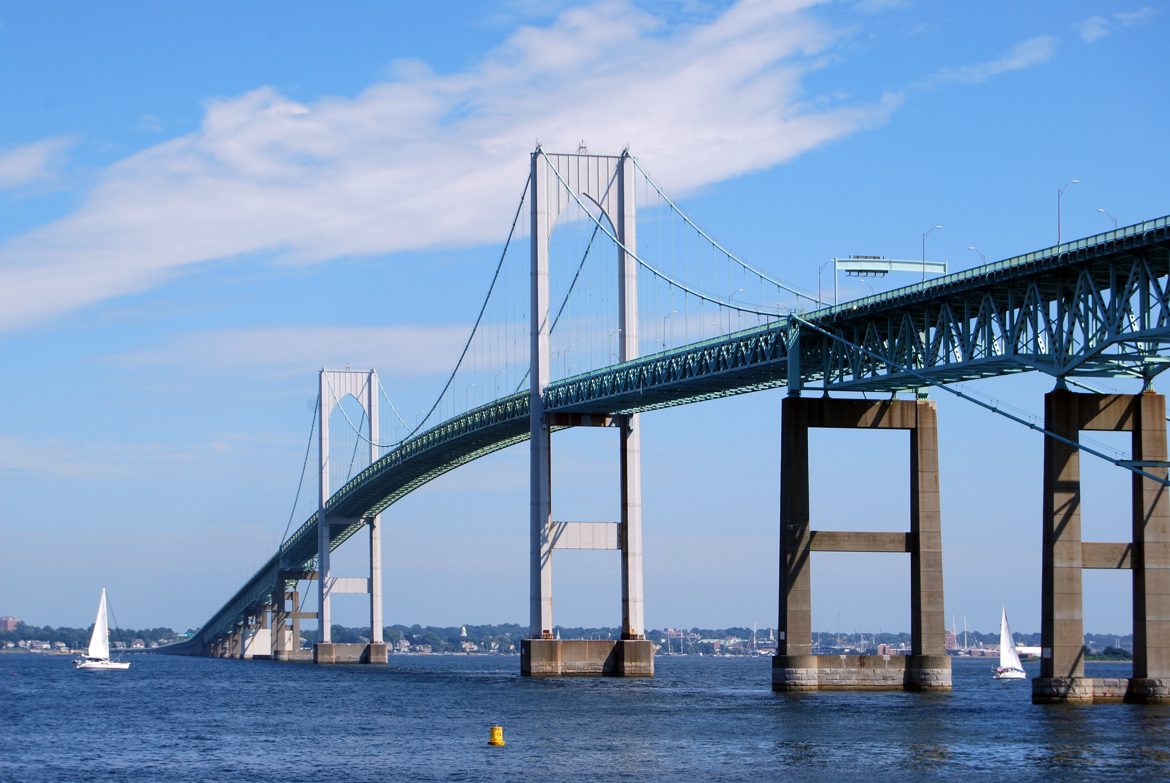
| DescriptionClaiborne Pell Newport Bridge.jpg |
English: The Claiborne Pell Newport Bridge in Newport, Rhode Island, United States, a suspension bridge that connects Newport and Jamestown, crossing the Narragansett Bay. It was built in 1969 and is featured on the reverse of the Rhode Island quarter. |
| Date | |
| Source | Own work |
| Author | UpstateNYer |
| Camera location | 41° 30′ 29.63″ N, 71° 21′ 28.83″ W | View this and other nearby images on: OpenStreetMap |
|---|
 |
This image or media was taken or created by Matt H. Wade. To see his entire portfolio, click here. @thatmattwade
|
Laikini
- You are free:
- to share – to copy, distribute and transmit the work
- to remix – to adapt the work
- Under the following conditions:
- attribution – You must give appropriate credit, provide a link to the license, and indicate if changes were made. You may do so in any reasonable manner, but not in any way that suggests the licensor endorses you or your use.
- share alike – If you remix, transform, or build upon the material, you must distribute your contributions under the same or compatible license as the original.
Captions
Items portrayed in this file
depicts Pelekānia
some value
copyright status Pelekānia
copyrighted Pelekānia
copyright license Pelekānia
inception Pelekānia
10 ‘Aukake 2009
source of file Pelekānia
original creation by uploader Pelekānia
coordinates of the point of view Pelekānia
41°30'29.632"N, 71°21'28.829"W
captured with Pelekānia
Nikon D60 Pelekānia
media type Pelekānia
image/jpeg
checksum Pelekānia
ec9f754025c9e7d6e3bf600a0b34d910a1799c20
data size Pelekānia
5,471,185 byte
2,592 pixel
3,872 pixel
Mōʻaukala waihona
Kāomi ma ka lā/hola no ka nānā ʻana i ka waihona ma kēlā manawa.
| Lā/Hola | Kiʻiliʻi | Nā Nui | Mea ho‘ohana | Kaumanaʻo | |
|---|---|---|---|---|---|
| okamanawa | 03:28, 13 'Aukake 2009 | | 3,872 × 2,592 (5.22 MB) | MattWade | {{Information |Description={{en|1=The en:Claiborne Pell Newport Bridge in Newport, en:Rhode Island, en:United States, a en:suspension bridge that connects Newport and [[:en:Jamestown, Rhode Island|Jame |
Nā Hana waihona
Loulou kekahi ‘ao‘ao i kēia waihona:
Global file usage
The following other wikis use this file:
- Usage on an.wikipedia.org
- Usage on arz.wikipedia.org
- Usage on bat-smg.wikipedia.org
- Usage on be.wikipedia.org
- Usage on br.wikipedia.org
- Usage on cy.wikipedia.org
- Usage on de.wikipedia.org
- Usage on el.wikipedia.org
- Usage on en.wikipedia.org
- Newport, Rhode Island
- East Greenwich, Rhode Island
- Warwick, Rhode Island
- Jamestown, Rhode Island
- Little Compton, Rhode Island
- Middletown, Rhode Island
- Portsmouth, Rhode Island
- Cranston, Rhode Island
- Narragansett, Rhode Island
- North Kingstown, Rhode Island
- Bristol, Rhode Island
- Tiverton, Rhode Island
- Narragansett Bay
- Point Judith, Rhode Island
- Aquidneck Island
- Conanicut Island
- Prudence Island
- Blackstone River
- Taunton River
- Quonset Point
- Naval Station Newport
- Mount Hope Bridge
- Sakonnet River
- Claiborne Pell Newport Bridge
- Point Judith Light
- Rose Island Light
- Stone Bridge (Rhode Island)
- Rhode Island Route 138
- Jamestown Verrazzano Bridge
- Jamestown Bridge
- Sakonnet River Bridge
- Seekonk River
- Pawtuxet River
- Hope Island (Rhode Island)
- Davisville, Rhode Island
- Newport Harbor Light
- Goat Island (Rhode Island)
- Patience Island
- Dutch Island (Rhode Island)
- Gould Island (Rhode Island)
- Dyer Island (Rhode Island)
View more global usage of this file.
ʻIkepiliMeta
Loaʻa i kēia waihona nā ʻike ʻē aʻe i hoʻohui ʻia paha mai kekahi pahupaʻakiʻi aiʻole kekahi mīkinikopekiʻi i hana ʻia no ka haku ʻana aiʻole ka hoʻokamepiuila ʻana o ia.
Inā ua kāloli ʻia ka waihona mai kona ʻano kumu, hōʻike piha ʻole i kekahi o nā kikoʻī o ka waihona i kāloli ʻia.
| Camera manufacturer | NIKON CORPORATION |
|---|---|
| Camera model | NIKON D60 |
| Orientation | Normal |
| Horizontal resolution | 300 dpi |
| Vertical resolution | 300 dpi |
| Software used | Adobe Photoshop CS4 Macintosh |
| File change date and time | 23:23, 12 'Aukake 2009 |
| Y and C positioning | Co-sited |
| Exposure time | 1/250 sec (0.004) |
| F Number | f/10 |
| Exposure Program | Not defined |
| ISO speed rating | 110 |
| Exif version | 2.21 |
| Date and time of data generation | 13:52, 10 'Aukake 2009 |
| Date and time of digitizing | 13:52, 10 'Aukake 2009 |
| Image compression mode | 4 |
| APEX exposure bias | 0 |
| Maximum land aperture | 5 APEX (f/5.66) |
| Metering mode | Pattern |
| Light source | Unknown |
| Flash | Flash did not fire, compulsory flash suppression |
| Lens focal length | 55 mm |
| DateTime subseconds | 30 |
| DateTimeOriginal subseconds | 30 |
| DateTimeDigitized subseconds | 30 |
| Color space | sRGB |
| Sensing method | One-chip color area sensor |
| Custom image processing | Normal process |
| Exposure mode | Auto exposure |
| White balance | Auto white balance |
| Digital zoom ratio | 1 |
| Focal length in 35 mm film | 82 mm |
| Scene capture type | Landscape |
| Contrast | Hard |
| Saturation | Normal |
| Sharpness | Hard |
| Subject distance range | Unknown |