Tetãvore Perũ retame From Wikipedia, the free encyclopedia
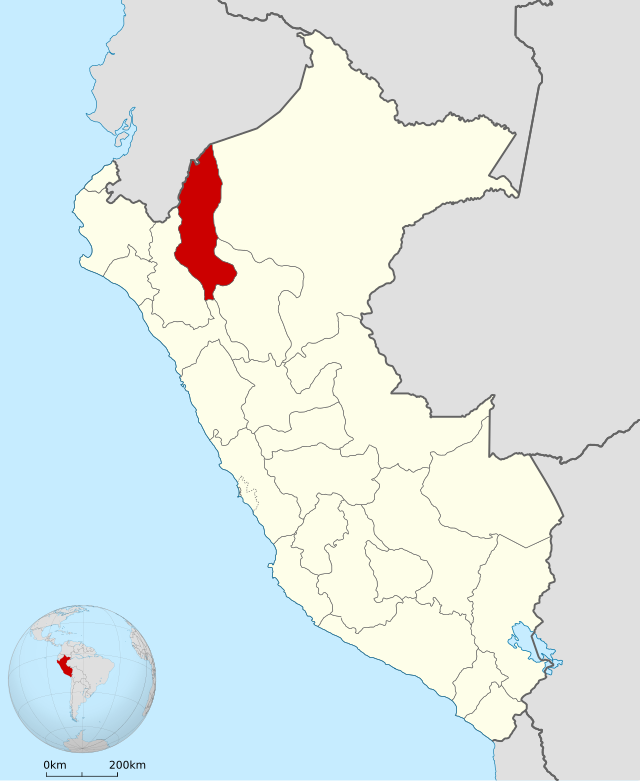
Tetãvore Amasóna (karaiñe'ẽme Departemento del Amazonas), ha'e peteĩ tetãvore umi 24 tetãvore ha pe tavusu Líma ojapo Perũ retame. Iatavusu ha'e Chachapoyas ha itáva tuichaveva katu ha'e Vagua Guasu. Oguereko peteĩ yvy tuichakue 39 200 km², pe censo 2017-gua he'i oguerekoha 379 384 tapicha.
| Amasóna | |||||||||
|---|---|---|---|---|---|---|---|---|---|
| Perũ retãvorekuéra | |||||||||
De arriba abajo y de derecha a izquierda: Las ruinas de Kuélap, la catarata de Gocta, el río Utcubamba a su paso por el distrito de Tingo, calle en Leimebamba, la plaza Mayor de Bagua Grande y la plaza Mayor de Chachapoyas. | |||||||||
| |||||||||
 Ojejuhuhápe Amasóna | |||||||||
| Tavusu | Chachapoyas | ||||||||
| Táva ava hetakuevéva | Bagua Grande | ||||||||
| Ñe'ẽ tee | Karaiñe'ẽ | ||||||||
| Tetãkue | Perũ retãvorekuéra | ||||||||
| • Tetã |
{{Geodatos | ||||||||
| Apekue | Puesto 9.º | ||||||||
| • Opa | 39,249,13 km² | ||||||||
| Altitud | |||||||||
| • Máxima | n/d msnm | ||||||||
| • Mínima | n/d msnm | ||||||||
| Ava hetakue (2023)[1] | |||||||||
| • Total |
433 717 hab. • 223 299 hombres • 210 418 mujeres | ||||||||
| • Ava hetakue yvy rendáre | Error en la expresión: no se reconoce el carácter de puntuación «,». hab/km² | ||||||||
| Hetãgua | amazonense | ||||||||
| PIB (nominal) | Puesto 21.º | ||||||||
| • Total |
| ||||||||
| • PIB per cápita |
| ||||||||
| IDH (2019) | 0,685[4] (23.º) – Medio | ||||||||
| Yvy arapehẽ | UTC-5 | ||||||||
| Prefijo telefónico | +51-41 | ||||||||
| ISO 3166-2 | AMA | ||||||||
| Ubigeo | 01 | ||||||||
| Sitio web oficial | |||||||||
| [editar datos en Wikidata] | |||||||||
Seamless Wikipedia browsing. On steroids.
Every time you click a link to Wikipedia, Wiktionary or Wikiquote in your browser's search results, it will show the modern Wikiwand interface.
Wikiwand extension is a five stars, simple, with minimum permission required to keep your browsing private, safe and transparent.