Ofbyld:MSH80_mailboxes_along_cowlitz_river_1980.jpg
From Wikipedia, the free encyclopedia
Grutte fan dit proefbyld: 800 × 522 piksels. Oare resolúsjes: 320 × 209 piksels | 640 × 418 piksels | 1.024 × 668 piksels | 1.280 × 835 piksels | 2.919 × 1.905 piksels.
Oarspronklik bestân (2.919 × 1.905 pixels, bestânsgrutte: 1,78 MB, MIME-type: image/jpeg)
Dit bestân komt fan Wikimedia Commons, en kin ek troch oare projekten brûkt wurde. De beskriuwing op syn bestânsside dêre wurdt hjirûnder werjûn.
Gearfetting
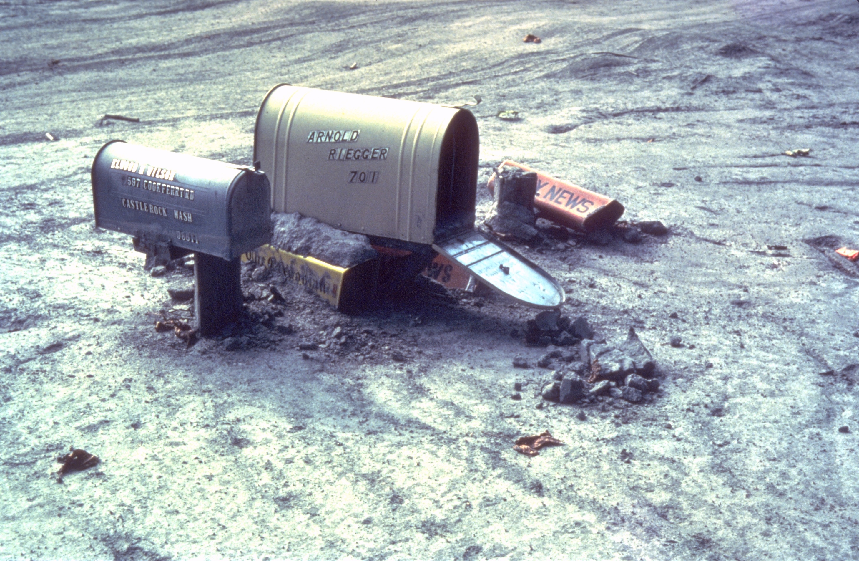
| BeskriuwingMSH80 mailboxes along cowlitz river 1980.jpg | Mailboxes sticking out of a mudflow along the Cowlitz River in Castle Rock, Washington after the May 18, 1980 explosion of Mount St. Helens |
| Datum |
Summer 1980 date QS:P,+1980-00-00T00:00:00Z/9,P4241,Q40720564 |
| Boarne | Archived source link |
| Auteur | Lyn Topinka, USGS |
| Camera location | 46° 15′ 18,72″ N, 122° 53′ 52,08″ W | View this and other nearby images on: OpenStreetMap |
|---|
Lisinsje
| Public domainPublic domainfalsefalse |
This image is in the public domain in the United States because it only contains materials that originally came from the United States Geological Survey, an agency of the United States Department of the Interior. For more information, see the official USGS copyright policy.
Bahasa Indonesia ∙ català ∙ čeština ∙ Deutsch ∙ eesti ∙ English ∙ español ∙ français ∙ galego ∙ italiano ∙ Nederlands ∙ português ∙ polski ∙ sicilianu ∙ suomi ∙ Tiếng Việt ∙ Türkçe ∙ български ∙ македонски ∙ русский ∙ മലയാളം ∙ 한국어 ∙ 日本語 ∙ 中文 ∙ 中文(简体) ∙ 中文(繁體) ∙ العربية ∙ فارسی ∙ +/− |
Captions
Add a one-line explanation of what this file represents
mailboxes sticking out of a mudflow along the Cowlitz River in Castle Rock, Washington after the May 18, 1980 explosion of Mount St. Helens
Briefkästen in einem Schlammstrom entlang des Cowlitz Rivers, der durch die Eruption des Mount St. Helens am 18. Mai 1980 geschaffen wurde.
Items portrayed in this file
depicts Ingelsk
coordinates of the point of view Ingelsk
46°15'18.7"N, 122°53'52.1"W
Triemskiednis
Klik op in datum/tiid om it bestân te besjen sa't it op dat stuit wie.
| Datum/Tiid | Miniatuer | ôfmjittings | Meidogger | Opmerking | |
|---|---|---|---|---|---|
| lêste | 31 mrt 2006, 19.28 | | 2.919 × 1.905 (1,78 MB) | Mnh | ==English== {{Information| |Description=Mailboxes in the mudflow along the Cowlitz River created by the May 18th, 1980 eruption of the Mount St. Helens. |Source=[http://vulcan.wr.usgs.gov/Volcanoes/MSH/Images/mudflow_images.html USGS Cascades Volcano Obse |
Bestânsgebrûk
De neikommende side brûkt dit bestân:
Globaal bestânsgebrûk
De neikommende oare wiki's brûke dit bestân:
- Gebrûk op ar.wikipedia.org
- Gebrûk op de.wikipedia.org
- Gebrûk op en.wikipedia.org
- Gebrûk op eo.wikipedia.org
- Gebrûk op es.wikipedia.org
- Gebrûk op fr.wikipedia.org
- Gebrûk op id.wikipedia.org
- Gebrûk op ig.wikipedia.org
- Gebrûk op ka.wikipedia.org
- Gebrûk op ko.wikipedia.org
- Gebrûk op la.wikipedia.org
- Gebrûk op lt.wikipedia.org
- Gebrûk op ms.wikipedia.org
- Gebrûk op nl.wikipedia.org
- Gebrûk op nn.wikipedia.org
- Gebrûk op no.wikipedia.org
- Gebrûk op pt.wikipedia.org
- Gebrûk op simple.wikipedia.org
- Gebrûk op sv.wikipedia.org
- Gebrûk op uk.wikipedia.org
- Gebrûk op uz.wikipedia.org
- Gebrûk op zh-yue.wikipedia.org