Ofbyld:Baton_Rouge_Louisiana_waterfront_aerial_view.jpg
From Wikipedia, the free encyclopedia
Oarspronklik bestân (1.500 × 1.200 pixels, bestânsgrutte: 1,04 MB, MIME-type: image/jpeg)
Dit bestân komt fan Wikimedia Commons, en kin ek troch oare projekten brûkt wurde. De beskriuwing op syn bestânsside dêre wurdt hjirûnder werjûn.
| BeskriuwingBaton Rouge Louisiana waterfront aerial view.jpg |
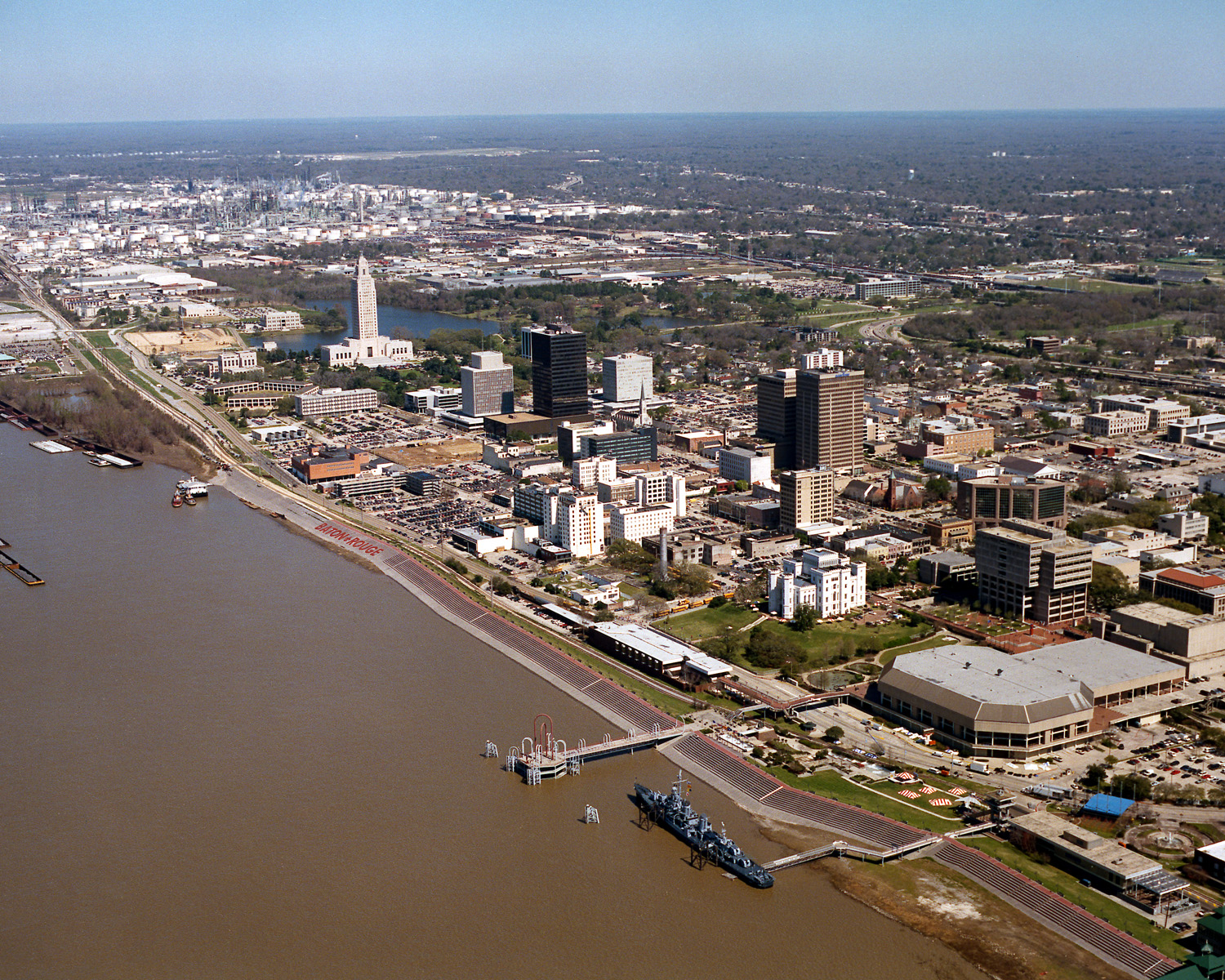
English: Aerial view of the riverfront area of Baton Rouge, Louisiana, USA. The city fronts on the Mississippi River in the center of Louisiana. The tall state capitol tower can be seen at center left. The historic destroyer USS Kidd is moored in the river at the bottom of the picture. View is to the north-northeast. |
||||
| Datum | |||||
| Boarne |
U.S. Army Corps of Engineers Digital Visual Library Image page Image description page Digital Visual Library home page |
||||
| Auteur | Michael Maples, U.S. Army Corps of Engineers | ||||
| Tastimming (Reusing this file) |
|
||||
| Location InfoField | Baton Rouge, Louisiana, USA |
| Camera location | 30° 26′ 56,27″ N, 91° 11′ 23,67″ W | View this and other nearby images on: OpenStreetMap |
|---|
Captions
Items portrayed in this file
depicts Ingelsk
inception Ingelsk
5 mai 1990
coordinates of the point of view Ingelsk
30°26'56.270"N, 91°11'23.669"W
media type Ingelsk
image/jpeg
checksum Ingelsk
f3810733327c1f43060c33b63964aa2defaccee2
data size Ingelsk
1.086.037 byte
height Ingelsk
1.200 pixel
width Ingelsk
1.500 pixel
Triemskiednis
Klik op in datum/tiid om it bestân te besjen sa't it op dat stuit wie.
| Datum/Tiid | Miniatuer | ôfmjittings | Meidogger | Opmerking | |
|---|---|---|---|---|---|
| lêste | 6 apr 2007, 05.05 | | 1.500 × 1.200 (1,04 MB) | DanMS | {{Information | Description = {{en|Aerial view of the riverfront area of Baton Rouge, Louisiana, USA. The ctiy fronts on the Mississippi River in the center of Louisiana. The tall state capital tower can be seen at center left. The historic destroyer U |
Bestânsgebrûk
De neikommende side brûkt dit bestân:
Globaal bestânsgebrûk
De neikommende oare wiki's brûke dit bestân:
- Gebrûk op af.wikipedia.org
- Gebrûk op an.wikipedia.org
- Gebrûk op ar.wikipedia.org
- Gebrûk op ast.wikipedia.org
- Gebrûk op az.wikipedia.org
- Gebrûk op bar.wikipedia.org
- Gebrûk op bat-smg.wikipedia.org
- Gebrûk op be-tarask.wikipedia.org
- Gebrûk op be.wikipedia.org
- Gebrûk op bg.wikipedia.org
- Gebrûk op br.wikipedia.org
- Gebrûk op ca.wikipedia.org
- Gebrûk op ceb.wikipedia.org
- Gebrûk op ce.wikipedia.org
- Gebrûk op cy.wikipedia.org
- Gebrûk op dag.wikipedia.org
- Gebrûk op da.wikipedia.org
- Gebrûk op de.wikipedia.org
- Gebrûk op de.wikivoyage.org
- Gebrûk op diq.wikipedia.org
- Gebrûk op el.wikipedia.org
- Gebrûk op en.wikipedia.org
- Gebrûk op en.wikinews.org
- Gebrûk op en.wikivoyage.org
- Gebrûk op en.wiktionary.org
- Gebrûk op es.wikipedia.org
- Gebrûk op et.wikipedia.org
- Gebrûk op eu.wikipedia.org
- Gebrûk op fi.wikipedia.org
- Gebrûk op fr.wikipedia.org
- Gebrûk op fr.wikivoyage.org
- Gebrûk op ga.wikipedia.org
- Gebrûk op gl.wikipedia.org
- Gebrûk op he.wikipedia.org
- Gebrûk op he.wikivoyage.org
- Gebrûk op hsb.wikipedia.org
- Gebrûk op ht.wikipedia.org
- Gebrûk op hu.wikipedia.org
- Gebrûk op hy.wikipedia.org
- Gebrûk op ia.wikipedia.org
Mear globaal gebrûk fan dit bestân besjen.
Metadata
Dit bestân befettet oanfoljende ynformaasje, dy't troch in fotokamera, scanner of fotobewurkingsprogramma tafoege wêze kin. As it bestân oanpast is, komme de details mûglik net folslein oerien mei de feroare ôfbylding.
| JPEG file comment | File written by Adobe Photoshop¨ 5.0 |
|---|