File:Ilgora_Emankorraren_mapa.png
From Wikipedia, the free encyclopedia
Grutte fan dit proefbyld: 488 × 599 piksels. Oare resolúsjes: 195 × 240 piksels | 391 × 480 piksels | 625 × 768 piksels | 833 × 1.024 piksels | 1.996 × 2.452 piksels.
Oarspronklik bestân (1.996 × 2.452 pixels, bestânsgrutte: 725 KB, MIME-type: image/png)
Dit bestân komt fan Wikimedia Commons, en kin ek troch oare projekten brûkt wurde. De beskriuwing op syn bestânsside dêre wurdt hjirûnder werjûn.
| BeskriuwingIlgora Emankorraren mapa.png |
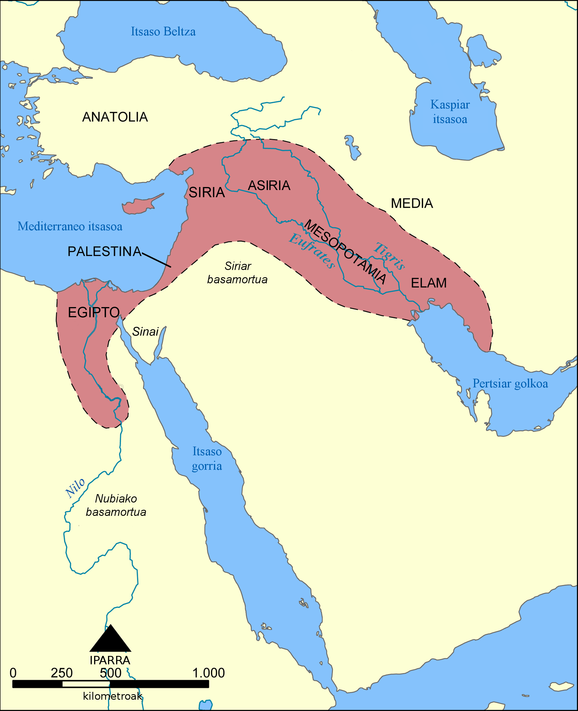
Euskara: Ilgora Emankorra deritzon eskualdearen kokalekua eta hedadura erakusten du mapa honek. |
| Datum | (UTC) |
| Boarne | |
| Auteur |
|
| Oare ferzjes |
[bewurkje]
See also:
|


| This is a retouched picture, which means that it has been digitally altered from its original version. Modifications: Translation into Basque language. The original can be viewed here: Mapa del Creciente Fértil.png:
|
I, the copyright holder of this work, hereby publish it under the following licenses:
| This file is licensed under the Creative Commons Attribution-Share Alike 3.0 Unported license. | ||
| ||
| This licensing tag was added to this file as part of the GFDL licensing update.http://creativecommons.org/licenses/by-sa/3.0/CC BY-SA 3.0Creative Commons Attribution-Share Alike 3.0truetrue |

|
Der wurdt tastimming jûn ta kopiearjen, fersprieden en/of wizigjen fan dit dokumint ûnder de betinksten fan de GNU-lisinsje foar iepen dokumintaasje, ferzje 1.2, as eltse lettere ferzje útjûn troch de Free Software Foundation; sûnder Ynfariante Seksjes, sûnder Omkaftteksten foar de Foarkante en sûnder Omkaftteksten foar de Efterkante. In kopy fan de lisinsje is opnaam yn de seksje "Text of the GNU Free Documentation License".http://www.gnu.org/copyleft/fdl.htmlGFDLGNU Free Documentation Licensetruetrue |
You may select the license of your choice.
Original upload log
This image is a derivative work of the following images:
- File:Mapa_del_Creciente_Fértil.png licensed with Cc-by-sa-3.0-migrated, GFDL
- 2006-04-22T11:54:46Z Locutus Borg 1996x2452 (687847 Bytes) Este mapa muestra la localización y extensión del '''Creciente Fértil''', una región de Oriente Medio que abarcaba el Aniguo Egipto, el Levante mediterráneo, Meospotamia y otras civilizaciones. Creado por NormanEinstein
- 2006-04-22T00:19:58Z Locutus Borg 1996x2452 (683529 Bytes) Este mapa muestra la localización y extensión del '''Creciente Fértil''', una región de orient Medio que abarcaba el Aniguo Egipto, el Levante mediterráneo, Meospotamia y otras cibilizaciones. Creado por NormanEinstein,
Uploaded with derivativeFX
Captions
Add a one-line explanation of what this file represents
Items portrayed in this file
depicts Ingelsk
copyright status Ingelsk
copyrighted Ingelsk
inception Ingelsk
21 jun 2010
Triemskiednis
Klik op in datum/tiid om it bestân te besjen sa't it op dat stuit wie.
| Datum/Tiid | Miniatuer | ôfmjittings | Meidogger | Opmerking | |
|---|---|---|---|---|---|
| lêste | 21 jun 2010, 20.04 | | 1.996 × 2.452 (725 KB) | Xabier Armendaritz | Translation of untranslated text at the bottom |
| 21 jun 2010, 16.06 |  | 1.996 × 2.452 (735 KB) | Xabier Armendaritz | {{Information |Description={{es|Este mapa muestra la localización y extensión del '''Creciente Fértil''', una región de Oriente Medio que abarcaba el Aniguo Egipto, el Levante mediterráneo, Meospotamia y otras civilizaciones.}} |Source=*[[:File:Mapa_ |
Bestânsgebrûk
Der binne gjin siden dy't dit bestân brûke.
Globaal bestânsgebrûk
De neikommende oare wiki's brûke dit bestân:
- Gebrûk op eu.wikipedia.org