File:Aeolian_Islands_blank_map.png
From Wikipedia, the free encyclopedia

Gjin hegere resolúsje beskikber.
Aeolian_Islands_blank_map.png (800 × 588 pixels, bestânsgrutte: 54 KB, MIME-type: image/png)
Dit bestân komt fan Wikimedia Commons, en kin ek troch oare projekten brûkt wurde. De beskriuwing op syn bestânsside dêre wurdt hjirûnder werjûn.
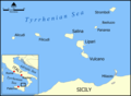
Blank version of Image:Aeolian Islands map.png.
Created by NormanEinstein.
I, the copyright holder of this work, hereby publish it under the following license:

|
Der wurdt tastimming jûn ta kopiearjen, fersprieden en/of wizigjen fan dit dokumint ûnder de betinksten fan de GNU-lisinsje foar iepen dokumintaasje, ferzje 1.2, as eltse lettere ferzje útjûn troch de Free Software Foundation; sûnder Ynfariante Seksjes, sûnder Omkaftteksten foar de Foarkante en sûnder Omkaftteksten foar de Efterkante. In kopy fan de lisinsje is opnaam yn de seksje "Text of the GNU Free Documentation License".http://www.gnu.org/copyleft/fdl.htmlGFDLGNU Free Documentation Licensetruetrue |
| This file is licensed under the Creative Commons Attribution-Share Alike 3.0 Unported license. | ||
| ||
| This licensing tag was added to this file as part of the GFDL licensing update.http://creativecommons.org/licenses/by-sa/3.0/CC BY-SA 3.0Creative Commons Attribution-Share Alike 3.0truetrue |
[bewurkje]
-

-
 Deutsch
 -
 eesti
eesti -
 English
 -
 español
 -
 français
 -
 hrvatski
 -
 italiano
 -
 magyar
 -
 Ελληνικά
 -
 македонски
 -
 עברית
עברית


| Camera location | 38° 28′ 16,79″ N, 14° 46′ 44,18″ E | View this and other nearby images on: OpenStreetMap |
|---|
Captions
Add a one-line explanation of what this file represents
Items portrayed in this file
depicts Ingelsk
copyright status Ingelsk
copyrighted Ingelsk
coordinates of the point of view Ingelsk
38°28'16.79"N, 14°46'44.18"E
media type Ingelsk
image/png
checksum Ingelsk
0b7fe410003bca10b0c6eebdf40db6936ed4a460
data size Ingelsk
54.928 byte
height Ingelsk
588 pixel
width Ingelsk
800 pixel
Triemskiednis
Klik op in datum/tiid om it bestân te besjen sa't it op dat stuit wie.
| Datum/Tiid | Miniatuer | ôfmjittings | Meidogger | Opmerking | |
|---|---|---|---|---|---|
| lêste | 20 nov 2006, 06.52 | | 800 × 588 (54 KB) | Falcorian | Lossless compression. |
| 3 apr 2006, 17.58 |  | 800 × 588 (79 KB) | NormanEinstein | Blank version of Image:Aeolian Islands map.png. Created by NormanEinstein. {{GFDL-self}} Category:Maps of Italy |
Bestânsgebrûk
Der binne gjin siden dy't dit bestân brûke.
Globaal bestânsgebrûk
De neikommende oare wiki's brûke dit bestân:
- Gebrûk op pl.wikivoyage.org