Pjatyh’atky
kaupunki Ukrainan Dnipropetrovskin alueella From Wikipedia, the free encyclopedia
kaupunki Ukrainan Dnipropetrovskin alueella From Wikipedia, the free encyclopedia
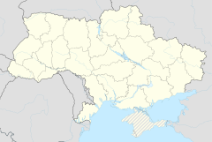
Pjatyh’atky (ukr. П’ятихатки, kirjaimellisesti "viisi taloa"; ven. Пятихатки, Pjatihatki[2]) on kaupunki Ukrainan Dnipropetrovskin alueen luoteisosassa Kamjansken piirissä.[1][3][4] Pjatyh’atky sijaitsee noin 88 kilometriä piirikeskus Kamjansken keskustasta ja 110 kilometriä aluekeskus Dniprosta länteen. Kaupunki on rautateiden risteyspaikkakunta ja sijaitsee eurooppatien E 50 (muun muassa valtatieyhteys Donetsk–Dnipro–Kiova) varrella.[2]
| Pjatyh’atky П’ятихатки |
|
|---|---|
 Pjatyh’atkyn nimikyltti ja muistoveturi eurooppatie E50:n ja rautatien varrella. |
|
 lippu |
 vaakuna |
 Pjatyh’atky |
|
|
Koordinaatit: |
|
| Valtio | Ukraina |
| Alue | Dnipropetrovskin alue |
| Piiri | Kamjansken piiri |
| Perustettu (rautatieasema) | 1886 |
| Kaupungiksi | 1938 |
| Väkiluku (2021) ([1]) | 18 457 |
Ukrainan tilastokeskus arvioi Pjatyh’atkyn väkiluvuksi 18 457 asukasta vuoden 2021 alussa.[1] Pjatyh’atky on Ukrainan vuonna 2020 tehdyn aluehallintouudistuksen jälkeen kuulunut Kamjansken piiriin;[3] tätä ennen se oli Pjatyh’atkyn piirin hallintokeskus.[4]
Paikkakunnan kehitys sai vauhtia noin vuonna 1886, kun sinne valmistui rautateiden risteys ja sittemmin rautatieasema (1898). Kaupungin aseman Pjatyh’atky sai 1938. Siellä on esimerkiksi vaatetehdas, elintarviketeollisuutta ja rautatiealan yrityksiä.[4]


Seamless Wikipedia browsing. On steroids.
Every time you click a link to Wikipedia, Wiktionary or Wikiquote in your browser's search results, it will show the modern Wikiwand interface.
Wikiwand extension is a five stars, simple, with minimum permission required to keep your browsing private, safe and transparent.
