پرونده:Location_map_Los_Angeles.png
From Wikipedia, the free encyclopedia
اندازهٔ این پیشنمایش: ۶۲۵ × ۶۰۰ پیکسل. کیفیتهای دیگر: ۲۵۰ × ۲۴۰ پیکسل | ۵۰۰ × ۴۸۰ پیکسل | ۷۹۵ × ۷۶۳ پیکسل.
پروندهٔ اصلی (۷۹۵ × ۷۶۳ پیکسل، اندازهٔ پرونده: ۷۵۶ کیلوبایت، نوع MIME پرونده: image/png)
این پرونده در ویکیانبار موجود است. محتویات صفحهٔ توصیف آن در زیر نمایش داده میشود. |
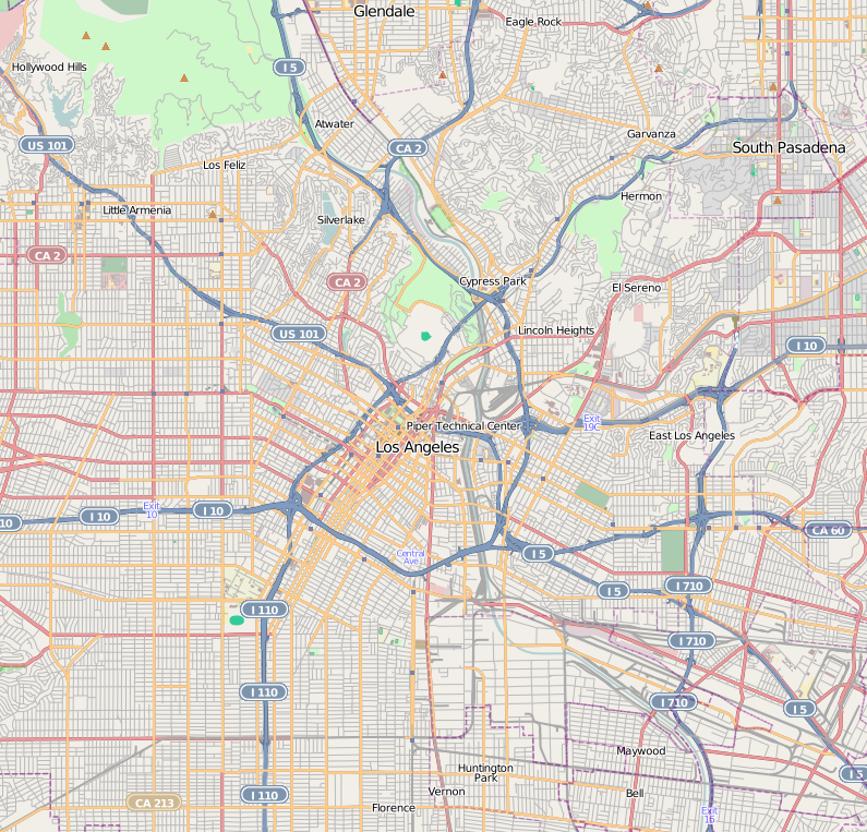
| DescriptionLocation map Los Angeles.png |
This map of Downtown Los Angeles and immediate area was created from OpenStreetMap project data, collected by the community. This map may be incomplete, and may contain errors. Don't rely solely on it for navigation. |
|||||||||
| تاریخ | (see file history) | |||||||||
| منبع | openstreetmap.org | |||||||||
| پدیدآورنده |
OpenStreetMap contributors |
|||||||||
| اجازهنامه (استفادهٔ مجدد از این پرونده) |
OpenStreetMap data and maps are licensed under the Creative Commons Attribution-ShareAlike 2.0 license (CC-BY-SA 2.0). این پرونده با اجازهنامهٔ کریتیو کامانز Attribution-Share Alike 2.0 عمومی منتشر شده است.
|
|||||||||
| Geotemporal data | ||||||||||
| Bounding box |
|
|||||||||
| Georeferencing | Georeference the map in Wikimaps Warper If inappropriate please set warp_status = skip to hide. | |||||||||
| برچسبها InfoField | این نگاره برچسپگذاری شدهاست: برچسپها را در ویکیانبار مشاهده کنید |
145
394
71
51
795
763
West Pico Boulevard positioned N-E-S-W between
St. Olympic Blvd, Elden Ave, Venice Blvd, and S. Oxford Ave.:
West Pico Boulevard--OpenStreetMap lat 34.04798 lon -118.29831 16x.png
عنوان
شرحی یکخطی از محتوای این فایل اضافه کنید
آیتمهایی که در این پرونده نمایش داده شدهاند
توصیفها
تاریخچهٔ پرونده
روی تاریخ/زمانها کلیک کنید تا نسخهٔ مربوط به آن هنگام را ببینید.
| تاریخ/زمان | بندانگشتی | ابعاد | کاربر | توضیح | |
|---|---|---|---|---|---|
| کنونی | ۱۸ مهٔ ۲۰۱۰، ساعت ۱۸:۳۰ | | ۷۹۵ در ۷۶۳ (۷۵۶ کیلوبایت) | Dr. Blofeld~commonswiki | {{Information |Description={{en|1=s}} |Source=s |Author=s |Date=s |Permission= |other_versions= }} |
کاربرد پرونده
صفحههای زیر از این تصویر استفاده میکنند:
- الیزین پارک (لس آنجلس)
- اکو پارک، لس آنجلس
- تپه ملرز (لس آنجلس)
- رصدخانه گریفیتس
- سیلور لیک، لس آنجلس
- لارچمانت (لس آنجلس)
- لیتل آرمنیا، لس آنجلس
- لیتل توکیو
- مونتسیتو هایتس (لس آنجلس)
- ناحیه تاریخی آلواردو ترس
- هاید پارک، لوسآنجلس
- هنکاک پارک (لس آنجلس)
- پیادهروی مشاهیر هالیوود
- گلاسل پارک (لس آنجلس)
- الگو:Location map United States Los Angeles Central
کاربرد سراسری پرونده
ویکیهای دیگر زیر از این پرونده استفاده میکنند:
- کاربرد در ar.wikipedia.org
- کاربرد در azb.wikipedia.org
- کاربرد در bh.wikipedia.org
- کاربرد در bn.wikipedia.org
- کاربرد در ceb.wikipedia.org
- کاربرد در en.wikipedia.org
- Hollywood, Los Angeles
- East Los Angeles, California
- U.S. Bank Tower (Los Angeles)
- Boyle Heights, Los Angeles
- Hancock Park, Los Angeles
- Echo Park
- Eagle Rock, Los Angeles
- Los Feliz, Los Angeles
- Mount Washington, Los Angeles
- Koreatown, Los Angeles
- Lincoln Heights, Los Angeles
- Silver Lake, Los Angeles
- Griffith Observatory
- Highland Park, Los Angeles
- Hollywood Hills
- Thai Town, Los Angeles
- Atwater Village, Los Angeles
- Pico-Union, Los Angeles
- Leimert Park, Los Angeles
- Little Tokyo, Los Angeles
- West Adams, Los Angeles
- Country Club Park, Los Angeles
- Westlake, Los Angeles
- Westin Bonaventure Hotel
- Little Armenia, Los Angeles
- North University Park, Los Angeles
- Larchmont, Los Angeles
- Harvard Heights, Los Angeles
- Jefferson Park, Los Angeles
- East Hollywood, Los Angeles
- Glassell Park, Los Angeles
- University Hills, Los Angeles
- Angelino Heights, Los Angeles
- Historic Filipinotown, Los Angeles
- Applied Scholastics
- Association for Better Living and Education
- Elysian Park, Los Angeles
- El Sereno, Los Angeles
نمایش استفادههای سراسری از این پرونده.