Yukon–Charley Rivers National Preserve
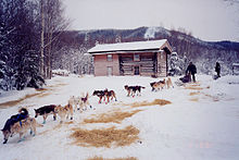
United States national preserve in AlaskaYukon–Charley Rivers National Preserve is a United States national preserve located in east central Alaska along the border with Canada. Managed by the National Park Service, the preserve encompasses 130 miles (208 km) of the 1,800-mile (3,000 km) Yukon River and the entire Charley River basin. The preserve protects the undeveloped Charley River and a significant portion of the upper Yukon. The interior Alaskan region experiences extremes of weather, with temperatures that can vary from −50 °F (−46 °C) in winter to 97 °F (36 °C) in summertime. The Yukon provided a means of access to the region, which is entirely roadless, during the late 19th century and early 20th centuries. Gold rushes in Alaska brought prospectors, who operated gold dredges to recover significant quantities of placer gold from area creeks. Today the preserve includes part of the route of the annual Yukon Quest dogsled race, which runs every February. During the summer float trips are popular on the Yukon and Charley Rivers.


