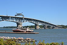
York River (Virginia)
River in Virginia, United StatesThe York River is a navigable estuary, approximately 34 miles (55 km) long, in eastern Virginia in the United States. It ranges in width from 1 mile (1.6 km) at its head to 2.5 miles (4.0 km) near its mouth on the west side of Chesapeake Bay. Its watershed drains an area of the coastal plain of Virginia north and east of Richmond.
Read article
Top Questions
AI generatedMore questions
Nearby Places

York County, Virginia
County in Virginia, United States

Tue Marshes Light
Lighthouse in Virginia, United States

Perrin River
River in the United States
Maryus, Virginia
Unincorporated community in Virginia, United States
Severn, Virginia
Unincorporated community in Virginia, United States

Perrin, Virginia
Unincorporated community in Virginia, United States

Dandy, Virginia
Unincorporated community in Virginia, US

Goodwin Islands
Virginian group of islands


